Routeyst
Opening your next page…
Routeyst
Opening your next page…
Your next day out
Finding your places to explore…
Loading your city’s local sights and outing ideas.
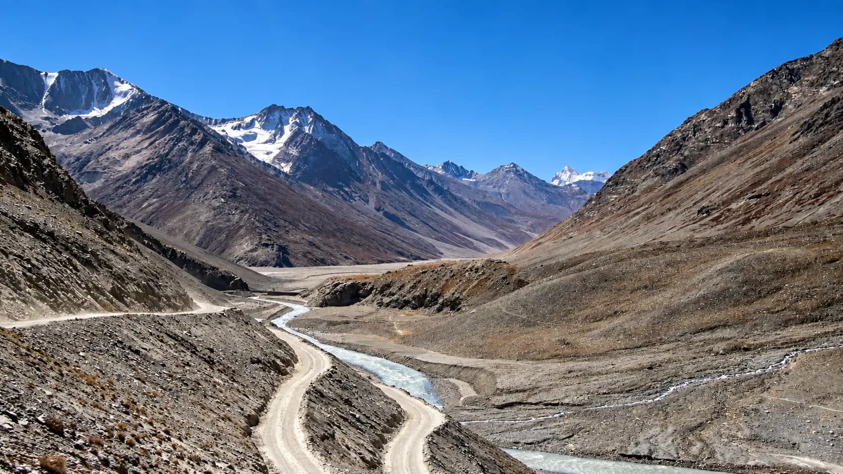
Choose a starting point, find local sights or an out-of-town idea within a stated 200 km road distance.
Make it your kind of day
Choose a starting point and your ideas appear automatically. Switch to Out of town whenever you fancy going further.
Maharashtra · Local sights
Dynamic, kinetic, and endlessly multifaceted, Mumbai is India’s financial titan and cultural melting pot.
Dynamic, kinetic, and endlessly multifaceted, Mumbai is India’s financial titan and cultural melting pot. Built on the historic reclamation of seven marshy islands into a unified maritime peninsula, Mumbai offers travelers a unique urban density where Victorian Gothic and Art Deco architectural ensembles coexist with ancient 2,000-year-old rock-cut Buddhist sanctuaries, sacred tidal Sufi shrines, sprawling mangrove wetlands, and a 104-square-kilometer wilderness national park harboring wild leopards. Because the city stretches over 45 kilometers from the southern tip of Colaba to its northern suburban perimeter, deciding on an outing depends greatly on whether you wish to explore the historic pedestrian core of South Mumbai, venture into the bohemian and nature-filled suburbs, or escape along radiating road corridors into the Sahyadri mountains and coastal forts:
Explore local sights and the nearby visitor area. Maps opens a place search; check the visitor entrance and current access.
3 of 3 places · Open details without losing your list
Not sure? Pick 2–3 places to compare.
Planning your day
To visit Elephanta Caves, board an authorized luxury passenger ferry from Jetty No. 5 directly at the Gateway of India in South Mumbai. Ferries depart every 30 minutes between 9:00 AM and 2:00 PM, taking approximately 50 to 60 minutes across the harbour. Remember that Elephanta Caves and ferry services are strictly closed on Mondays, and private boat transport across the sea is suspended during rough monsoon weather.
Both Haji Ali Dargah (in Worli) and Kolaba Fort (in Alibaug) rely entirely on daily ocean tide cycles. The 1-km causeway to Haji Ali and the 1-km seabed path to Kolaba Fort can only be walked during low tide, when the sea recedes. During high tide, both pathways are submerged under water. Always check the daily Mumbai and Alibaug naval tide schedules online before departing to align your arrival with low tide.
Matheran is declared an Eco-Sensitive Zone by the Government of India, legally prohibiting all motorized vehicular traffic within town limits to protect its fragile Western Ghats ecology. All private cars, taxis, and buses must park at Dasturi Naka (the entrance barrier 3 km east of town). From Dasturi, visitors can walk along the shaded red-laterite path (30 to 40 minutes), ride horseback, take an electric rickshaw, or board the 15-minute Central Railway shuttle toy train from Aman Lodge station into Matheran town.
Yes, dramatically so. While driving the highway route (via Atal Setu and NH 66) covers 100 km and typically takes 2.5 to 3 hours through Pen traffic, taking the M2M Ro-Ro ferry from Bhaucha Dhakka (Ferry Wharf) in South Mumbai to Mandwa Jetty takes just 55 minutes (with your car loaded on board), followed by an easy 30-minute drive (18 km) from Mandwa to Alibaug, saving over an hour of driving stress.
Your friend receives the same starting point, outing type and filters. No sign-in needed.
Make room for a longer journey
Hubs and guides from our wider collection, ordered with local and geographically closer places first. These are not limited to 200 km and are not road-distance estimates.
Open a place for its researched visitor notes. Confirm current charges and access before travelling.
Check the current visiting hours and permitted access with the site operator before departure; ceremonies, closures and visitor sessions can affect access.
CSMT is the primary railway terminus in South Mumbai and serves as the central distance anchor for all Mumbai road measurements (0 km). It is directly connected to suburban lines (Central and Harbour lines) and long-distance express trains from across India. Churchgate railway station on the Western line is only 1.5 km west (a 5-minute taxi ride). Numerous BEST bus routes terminate at the CSMT bus depot directly outside the terminus. Given the dense traffic and restricted parking in the Fort heritage zone, visitors are strongly urged to arrive by train, metro, or black-and-yellow taxi.
Fees, visiting hours and entry rules may change. Confirm the latest details with the official operator or local authority before travelling.
Crawford Market is managed by the Market Department of the Brihanmumbai Municipal Corporation (BMC).
Crawford Market is located 800 meters north of CSMT in Mumbai City district. Walking from CSMT takes just 8 to 10 minutes straight up Dr. Dadabhai Naoroji Road, while a metered black-and-yellow taxi takes under 5 minutes. The closest suburban railway stations are CSMT (Central and Harbour lines, 800 meters south) and Marine Lines (Western line, 1 km west). Dozens of BEST bus lines stop directly outside at the "Chhatrapati Shivaji Maharaj Mandai / Crawford Market" stop. Traffic around the junction is notoriously congested and car parking is practically non-existent; arriving on foot from CSMT or via taxi is strongly recommended.
Fees, visiting hours and entry rules may change. Confirm the latest details with the official operator or local authority before travelling.
The museum is governed by an autonomous Board of Trustees.
CSMVS is situated on Mahatma Gandhi Road at the junction of Kala Ghoda and Colaba, 1.5 km south of CSMT and 1 km east of Churchgate railway station. Walking from Churchgate takes approximately 12 to 15 minutes through the historic Fort district, while a taxi from CSMT takes under 10 minutes. Numerous BEST buses stop directly outside at the "Museum" bus station (one of South Mumbai's major bus transit hubs). While paid street parking is available along Kala Ghoda, spaces are extremely limited during business hours; public transit or taxis are strongly recommended.
Fees, visiting hours and entry rules may change. Confirm the latest details with the official operator or local authority before travelling.
Check the current visiting hours and permitted access with the site operator before departure; ceremonies, closures and visitor sessions can affect access.
The Gateway of India is located at Apollo Bunder at the northern end of Colaba in South Mumbai, approximately 2.5 km south of Chhatrapati Shivaji Maharaj Terminus (CSMT). It is an easy 10-to-15-minute taxi ride from CSMT or Churchgate railway stations. Numerous BEST city buses (including routes 111, 112, 124, and 137) terminate at the adjacent Electric House and Gateway bus depots. Marine parking near Apollo Bunder is extremely scarce; arriving by taxi or rideshare is strongly recommended.
Fees, visiting hours and entry rules may change. Confirm the latest details with the official operator or local authority before travelling.
Check the current visiting hours and permitted access with the site operator before departure; ceremonies, closures and visitor sessions can affect access.
Marine Drive is situated 2.5 km west of CSMT in South Mumbai. It runs parallel to the Western railway line, easily accessed on foot from several major suburban stations: Churchgate (5 minutes walk to Nariman Point end), Marine Lines (2 minutes walk to the central promenade via flyovers), and Charni Road (direct footbridge access straight onto Girgaon Chowpatty beach). Taxis are abundant along the entire length of the boulevard. Street parking along the sea-facing road is strictly regulated and generally reserved for local residents; taking suburban trains or taxis is the most practical choice.
Fees, visiting hours and entry rules may change. Confirm the latest details with the official operator or local authority before travelling.
Mani Bhavan is administered by the Mani Bhavan Gandhi Sangrahalaya Trust.
Mani Bhavan is situated at 19 Laburnum Road in Gamdevi, South Mumbai, approximately 5 km southwest of CSMT and 1.5 km northeast of Girgaon Chowpatty beach. The nearest suburban railway station is Grant Road (Western line), located roughly 1 km away (a 12-to-15-minute walk or a quick 5-minute taxi ride); Charni Road station is also within 1.5 km. Taxis readily navigate Laburnum Road. Street parking along the narrow leafy lane is severely constrained by residential cars; visitors are strongly advised to arrive by taxi, auto-rickshaw (from central suburbs), or suburban rail.
Fees, visiting hours and entry rules may change. Confirm the latest details with the official operator or local authority before travelling.
Both Hanging Gardens and Kamala Nehru Park are maintained by the Brihanmumbai Municipal Corporation (BMC).
Located atop Malabar Hill in Mumbai City district, the gardens lie 6.5 km southwest of CSMT. The drive takes approximately 20 to 25 minutes by taxi via Marine Drive and Walkeshwar Road or Pedder Road. The nearest suburban railway stations are Charni Road (Western line, 3 km southeast) and Grant Road (3.5 km east), from where black-and-yellow taxis are readily available. Several BEST bus routes (including routes 106 and 108) climb Malabar Hill to terminate near the park gates. Street parking along Ridge Road is extremely limited; visitors are advised to arrive by taxi.
Fees, visiting hours and entry rules may change. Confirm the latest details with the official operator or local authority before travelling.
Banganga Tank and its public ghats are free of charge and open to the public 24 hours daily.
Banganga Tank is located in the Walkeshwar neighborhood of Malabar Hill in Mumbai City district, 7.5 km southwest of CSMT and 2 km south of Hanging Gardens. The drive by taxi takes approximately 25 to 30 minutes via Marine Drive and Walkeshwar Road. The nearest suburban railway stations are Charni Road (Western line, 3.5 km east) and Grant Road (4 km northeast), from where black-and-yellow taxis are readily available. Vehicles cannot enter the narrow heritage lanes surrounding the tank; taxis must drop visitors on Walkeshwar Road or Teen Batti junction, from where a marked 200-meter pedestrian lane leads down to the ghats.
Fees, visiting hours and entry rules may change. Confirm the latest details with the official operator or local authority before travelling.
The museum is managed as a public-private partnership between the Municipal Corporation of Greater Mumbai (BMC) and the Jamnalal Bajaj Foundation.
The museum is located within the Jijamata Udyan complex on Dr. Babasaheb Ambedkar Road in Byculla East, Mumbai City district, approximately 6 km north of CSMT. The journey by taxi takes 15 to 20 minutes from CSMT. The nearest suburban railway station is Byculla (Central line), located just 400 meters west (a 5-minute walk from the station exit to the museum gate). Taxis and BEST buses running along Ambedkar Road are abundant. Organized paid vehicle parking is available inside the Jijamata Udyan zoo parking complex.
Fees, visiting hours and entry rules may change. Confirm the latest details with the official operator or local authority before travelling.
The shrine is administered by the Haji Ali Dargah Trust.
Haji Ali Dargah is located on Lala Lajpat Rai Marg (Hornby Vellard) in Mahalaxmi, Mumbai City district, approximately 8 km northwest of CSMT. By taxi, the journey takes 20 to 25 minutes via Pedder Road or the Coastal Road promenade. The nearest suburban railway station is Mahalaxmi (Western line, 1.2 km southeast), from where shared or regular taxis take 5 minutes to the causeway entrance. Numerous BEST buses terminate at the adjacent Haji Ali bus junction. Parking on the mainland along Lala Lajpat Rai Marg is limited; using taxis or the suburban railway is strongly recommended.
Fees, visiting hours and entry rules may change. Confirm the latest details with the official operator or local authority before travelling.
The temple is administered by the Shree Mahalakshmi Temple Trust.
Mahalakshmi Temple is located on Bhulabhai Desai Road (Warden Road) in Mahalaxmi, Mumbai City district, approximately 7.5 km northwest of CSMT and 1 km south of Haji Ali Dargah. By taxi, it takes approximately 20 minutes from CSMT via Pedder Road or the newly opened Coastal Road. The nearest suburban railway station is Mahalaxmi (Western line, 1 km east), from where shared or regular metered taxis reach the temple entrance in under 5 minutes. Numerous BEST buses serve the Warden Road and Mahalaxmi Temple bus stops. Municipal and private vehicle parking near the temple steps is severely restricted; visitors are strongly advised to arrive by taxi or suburban train.
Fees, visiting hours and entry rules may change. Confirm the latest details with the official operator or local authority before travelling.
The centre is operated under the National Council of Science Museums (Ministry of Culture, Government of India).
The Nehru Science Centre is situated on Dr. E. Moses Road in Worli, Mumbai City district, approximately 9 km north-northwest of CSMT. Driving by taxi takes around 20 to 25 minutes via Dr. Annie Besant Road or Senapati Bapat Marg. The nearest suburban railway stations are Mahalaxmi (Western line, 1.5 km south) and Chinchpokli / Currey Road (Central line, 1.8 km east), from where metered black-and-yellow taxis or auto-rickshaws take under 10 minutes to reach the gate. Several BEST bus lines stop right outside at the "Nehru Science Centre" bus stop. Dedicated on-site surface parking for cars, two-wheelers, and school tourist coaches is available inside the campus.
Fees, visiting hours and entry rules may change. Confirm the latest details with the official operator or local authority before travelling.
The temple is governed by the statutory Shree Siddhivinayak Ganapati Temple Trust.
siddhivinayak.org) or at on-site trust pass counters.
Mobile phone photography and videography are strictly prohibited inside the inner temple hall and sanctum.Siddhivinayak Temple is situated on SK Bole Marg in Prabhadevi, Mumbai City district, 12 km north of CSMT. The drive by taxi takes approximately 25 to 35 minutes via Senapati Bapat Marg or Dr. Babasaheb Ambedkar Road. The nearest suburban railway stations are Dadar (Central and Western interchange, 1.5 km northeast) and Prabhadevi (Western line, 1 km east), from where metered taxis and share-cabs reach the temple in 5 to 10 minutes. The newly constructed Mumbai Metro Line 3 (Aqua Line) also serves nearby underground stations at Siddhivinayak / Dadar. Private vehicle parking is virtually impossible in the congested lanes of Prabhadevi; arriving via public transit or taxi is strongly advised.
Fees, visiting hours and entry rules may change. Confirm the latest details with the official operator or local authority before travelling.
Worli Fort is protected by the Directorate of Archaeology and Museums, Government of Maharashtra.
Worli Fort is located at the northernmost tip of Worli Koliwada in Mumbai City district, approximately 14 km north of CSMT and 4 km north of Haji Ali. By taxi, it takes approximately 30 minutes via Dr. Annie Besant Road and Worli Village Road. The nearest suburban railway stations are Prabhadevi and Parel (3.5 km east) and Dadar (4 km east), from where metered taxis take 15 to 20 minutes to reach the Worli Koliwada entrance. BEST bus routes 83 and 88 terminate right at the Worli Village bus depot. Since the narrow lanes inside the village cannot accommodate four-wheelers, cars and taxis must park near the village entrance or at Worli Seaface, from where visitors proceed on foot.
Fees, visiting hours and entry rules may change. Confirm the latest details with the official operator or local authority before travelling.
Sewri Fort and the adjoining public mudflats are managed by the Directorate of Archaeology and Museums, Government of Maharashtra, and the Forest Department.
Sewri Fort is situated in Sewri East along the eastern seafront in Mumbai City district, approximately 8 km north of CSMT. The drive by taxi takes approximately 20 to 25 minutes via Eastern Freeway (exiting at Sewri) or Dr. Babasaheb Ambedkar Road. The nearest suburban railway station is Sewri (Harbour line, 1 km west), from where black-and-yellow taxis or a 15-minute walk through the timber market lane leads straight to the fort entrance. Taxis and private cars can park in the open clearing along the fort access road near the jetty.
Fees, visiting hours and entry rules may change. Confirm the latest details with the official operator or local authority before travelling.
Bandra Fort and the Land's End garden amphitheatre are maintained by the Archaeological Survey of India (ASI) in collaboration with the Bandra Bandstand Residents Trust.
Bandra Fort is located at the southern tip of Byramji Jeejeebhoy Road (Bandstand) in Bandra West, Mumbai Suburban district, approximately 17 km north of CSMT. The journey takes 30 to 45 minutes by taxi via the Bandra-Worli Sea Link or Western Express Highway. The nearest suburban railway station is Bandra (Western and Harbour lines, 3 km east), from where metered auto-rickshaws and black-and-yellow taxis take 10 to 15 minutes to reach Land's End. Several BEST bus routes (notably route 211) connect Bandra railway station directly to Land's End. Dedicated public car parking is available along Byramji Jeejeebhoy Road near the Taj Lands End hotel and amphitheatre entrance.
Fees, visiting hours and entry rules may change. Confirm the latest details with the official operator or local authority before travelling.
The shrine is administered by the Archdiocese of Bombay.
Mount Mary Basilica is situated on Mount Mary Hill in Bandra West, Mumbai Suburban district, approximately 18 km north of CSMT and 1 km northeast of Bandra Fort. The journey by taxi takes 30 to 45 minutes via the Bandra-Worli Sea Link or Western Express Highway. The nearest suburban railway station is Bandra (Western and Harbour lines, 2.5 km east), from where metered auto-rickshaws or taxis take 10 to 12 minutes to reach the hill. Several BEST bus routes (including routes 211 and 214) stop at the foot of the hill. Vehicle parking directly outside the church gate is extremely limited; visitors are advised to arrive by auto-rickshaw or taxi.
Fees, visiting hours and entry rules may change. Confirm the latest details with the official operator or local authority before travelling.
Check the current visiting hours and permitted access with the site operator before departure; ceremonies, closures and visitor sessions can affect access.
Juhu Beach is located in Juhu in the Mumbai Suburban district, approximately 25 km north of CSMT and 10 km north of Bandra. The drive takes 45 to 60 minutes via the Western Express Highway (WEH) or SV Road. The nearest suburban railway stations on the Western line are Vile Parle (3 km east) and Santacruz (3.5 km southeast), from where metered auto-rickshaws take 10 to 15 minutes to reach the beach entrance. The Mumbai Metro Line 1 (Versova - Andheri - Ghatkopar) serves DN Nagar station (3 km north). Pay-and-park facilities are available near the main beach entrance, but become severely congested on weekend evenings; taking an auto-rickshaw or taxi is strongly recommended.
Fees, visiting hours and entry rules may change. Confirm the latest details with the official operator or local authority before travelling.
The park is administered by the Maharashtra Forest Department (Wildlife Wing).
The main entrance gate of SGNP is located on the Western Express Highway (NH 48) in Borivali East, Mumbai Suburban district, approximately 38 km north of CSMT and 20 km north of Mumbai International Airport. Driving takes 60 to 90 minutes via the Western Express Highway. The nearest suburban railway station is Borivali (Western line, 1 km west), an easy 10-minute walk or a quick auto-rickshaw ride from the eastern exit of the station. The Mumbai Metro Line 7 (Red Line) also serves the nearby Rashtriya Udyan metro station, situated right across from the park entrance gate. A large organized pay-and-park facility is available inside the main entrance for cars, two-wheelers, and tourist buses.
Fees, visiting hours and entry rules may change. Confirm the latest details with the official operator or local authority before travelling.
Kanheri Caves is a protected monument of national importance administered by the Archaeological Survey of India (ASI).
Kanheri Caves is located 6 km inside Sanjay Gandhi National Park, accessible via the main SGNP gate on the Western Express Highway in Borivali East, Mumbai Suburban district (44 km north of CSMT). From the main Borivali gate, visitors can reach the caves by:
Fees, visiting hours and entry rules may change. Confirm the latest details with the official operator or local authority before travelling.
The pagoda is managed by the Global Vipassana Foundation.
The Global Vipassana Pagoda is situated on the Gorai peninsula in the Mumbai Suburban district, northwest of Mumbai. There are two primary transit options: Confirm the current charge and what it includes with the operator or service provider. Visitor admission, vehicles, parking, activities and accommodation can have separate charges. From the island jetty, it is an easy 5-minute walk straight into the pagoda entrance. 2. Direct Road Route: Drive north via the Western Express Highway (NH 48) past Dahisar toll gate to Bhayander West, then follow the scenic Bhayander - Uttan - Gorai coastal road for 22 km directly to the pagoda entrance (total 48 km from CSMT, approx. 1.5 to 2 hours drive). A large, organized free vehicle parking lot is located directly outside the main pagoda gates.
Fees, visiting hours and entry rules may change. Confirm the latest details with the official operator or local authority before travelling.
Browse cities by state · 85 starting points
Open a state, then choose your starting city. Local sights load automatically.
Out-of-town ideas vary in distance. Check your outward and return journey, time at the destination and breaks before deciding whether you need a stay.
Maps may identify a landscape rather than its visitor entrance. Check parking, walks, boat transfers and entry permission with the local operator.
Use the guide for practical context and visit weather for the available three-day forecast. Neither is a live opening or safety confirmation.