Mirjan Fort
Comprehensive visitor guide to Mirjan Fort in Uttara Kannada near Gokarna. Discover the history of the Pepper Queen, Bijapur architecture, timings, entry, and travel tips.
Location
Gokarna & Murudeshwar, Karnataka
A closer look
Your visit, at a glance.
Gokarna Murudeshwar, Karnataka
GET TO KNOW THE PLACE
Rising above the tidal mangrove creeks and coconut groves of the Aghanashini River estuary in coastal Uttara Kannada, Mirjan Fort is one of the most enigmatic and visually…
The story of Mirjan Fort
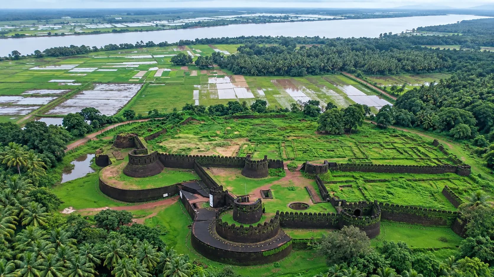
Rising above the tidal mangrove creeks and coconut groves of the Aghanashini River estuary in coastal Uttara Kannada, Mirjan Fort is one of the most enigmatic and visually captivating military fortifications in Karnataka. Built predominantly from massive, dressed blocks of locally quarried dark red laterite stone, this sprawling 11.5-acre coastal citadel stands as an enduring monument to the maritime trade, dynastic clashes, and geopolitical intrigue that defined peninsular India's Konkan coastline during the 16th and 17th centuries. Known colloquially as the stronghold of Queen Chennabhairadevi - the celebrated 16th-century Jain monarch whom Portuguese chroniclers titled Raina da Pimenta or the "Pepper Queen" - the fort later served as a vital administrative capital (Mahal) and customs bastion for the Bijapur Sultanate under Governor Sharif-ul-Mulk of Ponda.
Encircled by a broad defensive moat, towering double-layered ramparts, circular watchtowers, and an ingenious internal hydraulic network of nine interconnected wells, Mirjan Fort displays an architectural fusion of indigenous Vijayanagara stonecraft and Deccan-Islamic military engineering. Yet beyond its formidable defensive pedigree, what captivates contemporary travelers is its astonishing natural transformation across the seasons. During and immediately following the Southwest Monsoon, the dark porous laterite stone absorbs the maritime moisture, causing every rampart, bastion, and stone staircase to become completely carpeted in a lush, velvety coat of vivid emerald-green moss and delicate ferns. Nestled just off National Highway 66 between Kumta and Gokarna, Mirjan Fort offers heritage enthusiasts, photographers, and curious travelers an evocative portal into the forgotten spice empires that once commanded the Indian Ocean trade.
Start here. Open a tile for the full details.
Why goRead details
Mirjan Fort provides a rich, multi-layered travel experience that distinguishes it from the typical hill fortresses and coastal bastions of western India:
When to visitRead details
Selecting the ideal time to explore Mirjan Fort depends largely on whether your primary objective is comfortable heritage walking, historical photography, or witnessing the famous monsoon moss phenomenon:
Entry & permissionsRead details
Fees, visiting hours and entry rules may change. Confirm the latest details with the official operator or local authority before travelling.
A complete guide to visiting regulations, ticketing, and monument preservation policies at Mirjan Fort:
Operating Parameter | Policy / Schedule | Specific Visitor Notes |
|---|---|---|
Opening Hours | 08:00 to 17:30 Daily | Open seven days a week from 08:00 AM until 17:30 PM (or sunset). Gates are locked at dusk; visitors must exit the ramparts before closing. |
Admission Tariff | Completely Free (₹0) | As a Category-C protected monument under the Archaeological Survey of India (ASI) Dharwad Circle, there is no entrance fee for any visitors. |
Vehicle Parking | Free On-Site Parking | An open gravel-and-grass parking area outside the main northern entrance accommodates cars, motorbikes, and tourist coaches free of charge. |
Photography & Drones | Stills Allowed; Drones Banned | Handheld still photography and smartphone videography are permitted free. Unmanned aerial vehicles (drones) and commercial shoots are strictly forbidden without prior written ASI permit. |
Monument Conservation and Safety Guidelines
As an ancient monument protected under the Ancient Monuments and Archaeological Sites and Remains Act (AMASR), visitors are required to uphold strict preservation and behavioral standards:
- Structural Integrity: Climbing over fragile ruined parapets, leaning against degraded laterite walls, or attempting to enter barricaded subterranean tunnels is strictly forbidden. The laterite stone, while durable, is susceptible to mechanical chipping and surface erosion.
- Litter and Plastic Prohibition: Mirjan Fort is a designated zero-plastic heritage zone. Visitors must carry all personal waste, plastic water bottles, and food wrappings back to vehicle disposal bins.
- Open Water Hazards: The nine historic wells located within the fort grounds are deep and contain standing water. While low safety walls and perimeter railings border several wells, visitors - particularly parents accompanied by children - must exercise vigilant supervision and refrain from leaning over the copings.
Plan your visitRead details
Mirjan Fort is exceptionally accessible, located directly adjacent to Karnataka's premier coastal transport artery, National Highway 66 (NH-66), in Kumta Taluk of Uttara Kannada District.
Rampart Edge and Well Safety Caution
Families traveling with young children must exercise strict vigilance along the high curtain walls and around the nine historic stepped wells, ensuring children remain on established gravel paths and never climb or sit upon the low, unfenced laterite parapet edges.
Explore the full guide - choose a topic below.
Why visit?
Mirjan Fort provides a rich, multi-layered travel experience that distinguishes it from the typical hill…Explore detailsClose details
Mirjan Fort provides a rich, multi-layered travel experience that distinguishes it from the typical hill fortresses and coastal bastions of western India:
- The Remarkable Legacy of the Pepper Queen: Foremost among its historical narratives is its association with Queen Chennabhairadevi of Gerusoppa (Gersoppa). Ruling for fifty-four remarkable years (circa 1552 to 1606 CE) - one of the longest documented reigns by any female monarch in Indian history - she deftly managed trade relations and military alliances under the aegis of the Vijayanagara Empire, fiercely resisting Portuguese naval subjugation and monopolizing the lucrative global export of Malabar black pepper, cinnamon, nutmeg, and ginger.
- Mastery of Coastal Laterite Military Architecture: Unlike granite hill fortresses, Mirjan is constructed entirely from porous, iron-rich laterite rock. The citadel showcases exceptional masonry skills: soaring double walls, arched subterranean gateways, curved bastions with gun embrasures, and elevated sentry parapets engineered specifically to withstand maritime saline dampness and coastal artillery bombardment.
- Ingenious Hydraulic Engineering and Nine Historic Wells: An extraordinary feature documented by the Archaeological Survey of India (ASI) is the fort's sophisticated self-sustaining water security infrastructure. Inside the central compound lie nine deep, stone-stepped freshwater wells interconnected by covered masonry conduits, ensuring that a garrison could survive extended maritime sieges and prolonged coastal blockades without relying on external river supplies.
- Secret Escape Tunnels and Multi-Tiered Gateways: The citadel features four major gateways approached by broad, ceremonial laterite steps, alongside arched subterranean escape tunnels (secret outlets) carved into the laterite bedrock that once allowed defending forces to slip discreetly down to waiting river craft on the Aghanashini estuary during emergency retreats.
- The Fabled Post-Monsoon Emerald Transformation: Between July and October, the fortress undergoes one of the most stunning aesthetic metamorphoses in southern India. The dark red and charcoal-toned laterite surfaces become smothered in vibrant green moss, giving the entire complex the appearance of an ancient overgrown castle lifted from a fantasy epic, making it a dream destination for architectural and landscape photographers.
- Central Location on the Uttara Kannada Coastal Circuit: Situated just 22 km south of the sacred temple town and beaches of Gokarna, 12 km north of Kumta, and within easy striking distance of Yana Caves and Murudeshwar, Mirjan Fort serves as an effortless, high-reward cultural excursion along National Highway 66.
What to expect
Visiting Mirjan Fort is an atmospheric journey through coastal history, botanical resurgence, and defensive…Explore detailsClose details
Visiting Mirjan Fort is an atmospheric journey through coastal history, botanical resurgence, and defensive military engineering. Approaching the fort via the quiet link road from Mirjan village on NH-66, the surrounding landscape is peaceful and pastoral: emerald paddy fields, swaying betel nut and coconut palms, and the tidal reaches of the Aghanashini River creek.
At the entrance, visitors cross a stone bridge spanning the wide outer moat - which historically drew tidal seawater from the river to deter sappers, war elephants, and siege ladders - before arriving at the monumental northern portal. Here, a broad flight of wide laterite stone steps ascends between two colossal semi-circular bastions pierced with arrow slits and musket loops. Passing beneath the deep arched portal (dwarashala), the interior of the fort reveals itself: an expansive, undulating greensward dotted with manicured lawns, mature shade trees, archaeological ruins, and perimeter ramparts that encircle the entire 11.5-acre compound.
[ Outer Defensive Moat & Tidal Creek ]
                 │
                 ▼
[ Main Northern Gateway & Flanking Bastions ]
                 │
                 ▼
[ Central Citadel Green & Darbar Hall Ruins ]
      ├── Nine Interconnected Water Wells
      ├── Subterranean Secret Escape Passage
      ├── Marketplace & Barrack Foundations
      └── Dargah of Peer Syad Ahmad Shah Qadri
                 │
                 ▼
[ High Perimeter Ramparts & Sentry Lookouts ]
Queen Chennabhairadevi and the Maritime Spice Empire
The soul of Mirjan Fort is inextricably bound to Queen Chennabhairadevi, one of the most visionary and resilient monarchs of medieval India. Born into the Saluva dynasty of Gerusoppa (situated upstream along the Sharavathi River near modern Honnavar), Chennabhairadevi belonged to the Jain faith and adhered to the matrilineal system of succession (Aliyasantana). Ascending the throne in 1552 CE as a feudatory of the mighty Vijayanagara Empire, her coastal realm encompassed a rich, fertile strip extending from southern Goa down through Karwar, Ankola, Mirjan, Kumta, Honnavar, and Bhatkal.
This coastal territory was universally acknowledged as the global epicentre of the highest-grade black pepper, often called "black gold." Under her astute commercial administration, the ports of Mirjan, Honnavar, and Bhatkal bustled with Arab, Persian, Turkish, and European merchant vessels. Recognizing the strategic value of Mirjan as a fortified customs post and river-mouth transshipment harbour, she reinforced the fortification to protect inbound caravans descending the Western Ghats from highland spice plantations.
The Portuguese, newly entrenched at Goa, sought desperately to establish a monopoly over her spice trade, demanding exorbitant concessions and attempting to force her into vassalage. Demonstrating extraordinary diplomatic acumen and military fortitude, Chennabhairadevi rebuffed their advances, repelling Portuguese naval incursions in 1559 and 1570 by forging tactical alliances with the neighbouring rulers of Bilgi and Keladi. Portuguese viceroys and chroniclers, frustrated by her unyielding independence yet in awe of her immense wealth and trading power, christened her in their official dispatches as Raina da Pimenta - the "Pepper Queen." She maintained freedom of religion throughout her kingdom, patronizing Jain basadis, Shaivite temples, and Islamic merchant guilds with equal magnanimity, until the twilight of her reign in the early 1600s when internal dynastic rivalries coincided with the southward expansion of the Bijapur Sultanate.
Bijapur Renovation and Military Strategic Evolution
Following the catastrophic fall of the Vijayanagara Empire at the Battle of Talikota (1565 CE) and the eventual collapse of the Gerusoppa kingdom in the opening decade of the 17th century, the Kanara coast was annexed by the Adil Shahi dynasty of the Bijapur Sultanate. Historical and epigraphical records preserved by the Archaeological Survey of India (ASI) establish that around 1608 - 1610 CE, Sharif-ul-Mulk, the Bijapur governor stationed at Ponda (Goa), undertook a massive, comprehensive reconstruction and expansion of Mirjan Fort.
Sharif-ul-Mulk transformed the regional citadel into the military and administrative headquarters (Mahal) of the northern Kanara coastal province. The governor introduced sophisticated Deccan-Islamic fortification techniques, grafting high crenellated battlements, defensive machicolations for dropping boiling oil or projectiles, and circular cannon bastions onto the preexisting Vijayanagara laterite foundations. Under Bijapur rule, the fort housed a permanent military garrison, a central administrative court (Darbar Hall), treasury vaults, and customs tax houses that monitored all riverine cargo traversing the Aghanashini estuary toward the Arabian Sea.
Within the fort's inner perimeter stands a venerable Islamic shrine: the Dargah of Peer Syad Ahmad Shah Qadri. Constructed during the Adil Shahi period to honour a respected Sufi saint associated with the governor's court, this quiet, whitewashed masonry structure reflects the pluralistic cultural layers that accumulated within the fortress over centuries. Following the decline of Bijapur, the citadel changed hands repeatedly - held briefly by the Keladi Nayakas of Ikkeri, garrisoned by the naval forces of the Maratha Empire under Chhatrapati Shivaji Maharaj during his Konkan coastal campaigns, and finally occupied by the British East India Company in the late 18th century following their victory over the Kingdom of Mysore, before being decommissioned as a military post.
Architectural Anatomy and Hydraulic Engineering
The architectural design of Mirjan Fort reflects a masterclass in military defense adapted to coastal topography. Constructed entirely from dense, iron-bearing laterite stone quarried directly from the surrounding ridges, the masonry blocks were cut with remarkable precision, interlocking without excessive mortar and hardening steadily over centuries through exposure to air and monsoon moisture.
- Concentric Double Walls and Ramparts: The fortress is defended by a system of double concentric walls. The outer wall, rising from the moat bed, presents a sheer, vertical face designed to thwart escalade attacks. Behind it, separated by an open defensive berm (chemin de ronde), rises an inner curtain wall crowned by a continuous parapet walkway with musket loops (embrasures) allowing defenders to maintain overlapping fields of fire across the approaches.
- The Four Gateways: The fort incorporates four principal entrances, each oriented to a cardinal direction and accessed via wide, ceremonial stone staircases. Unlike European castles that employed portcullises, the gateways of Mirjan utilize the classic Indian defensive principle of indirect, bent-axis access: approaching forces were forced to navigate a series of sharp right-angle turns flanked by high bastions, preventing battering rams from gaining momentum and exposing attackers' unshielded right flanks to archers and musketeers positioned on the parapets above.
- The Hydraulic Marvel of Nine Wells: Among the most remarkable features documented during archaeological studies is the fort's sophisticated water conservation network. Across the central lawns lie nine large, stone-lined circular and rectangular freshwater wells. Sunk deep into the laterite aquifer, several of these wells feature internal masonry steps (stepwells) descending to the summer water level. Subterranean stone-lined conduits connected the wells, allowing water to be systematically balanced and harvested from monsoon runoff across the 11.5-acre compound. This self-contained reservoir system ensured an inexhaustible supply of potable drinking water during coastal sieges when river access was cut off.
- Secret Escape Outlets and Subterranean Chambers: Along the southern and western perimeters, visitors can observe arched masonry portals leading downward into subterranean stone passages. Known as secret outlets, these concealed tunnels burrowed beneath the thick laterite ramparts, terminating near the concealed banks of the Aghanashini creek. In times of catastrophic siege, these passages permitted commanders to dispatch covert couriers or execute an emergency maritime evacuation by boat under the cover of coastal darkness.
- Archaeological Discoveries: Extensive excavations conducted by the Archaeological Survey of India (ASI) in 2000 and 2001 unearthed a wealth of material culture that corroborates the fort's cosmopolitan history. Excavators recovered hundreds of historic copper and bronze coins minted by the Vijayanagara kings and the Bijapur Sultanate, iron cannonballs, bronze cannon barrels, shards of imported Ming-dynasty Chinese porcelain, glazed Islamic ceramics, iron sword blades, and clay smoking pipes - physical proof of Mirjan's vibrant integration into early modern Eurasian trade routes.
The Monsoon Emerald Phenomenon and Heritage Atmosphere
While Mirjan Fort possesses profound architectural and martial merit, its visual fame among modern travelers is crowned by the extraordinary seasonal phenomenon known as the Monsoon Emerald Transformation.
The Konkan coast experiences immense precipitation during the Southwest Monsoon, receiving upwards of 3,500 mm of torrential rain between June and September. The porous laterite stone acts as a natural sponge, absorbing immense volumes of moisture. By mid-July, microscopic spores of moss, algae, and delicate ferns germinate across the dark, textured surfaces of the stone. Within weeks, the entire citadel undergoes a breathtaking metamorphosis: every crenellated parapet, circular bastion, stone staircase, and ruined doorway becomes completely enveloped in a dense, plush carpet of luminescent emerald-green moss.
Walking through the fortress on an overcast monsoon morning - with mist rising from the nearby Aghanashini backwaters, gentle sea breezes rustling the coconut fronds, and droplets of rain glistening across the velvet-green masonry - feels like entering an enchanted, forgotten kingdom untouched by the modern world. Even into the late autumn months of October and November, as the rains subside and the skies turn azure, the emerald mantle lingers, creating a visual contrast between the vivid green walls, manicured inner lawns, and clear blue coastal skies.
Best time to visit
Selecting the ideal time to explore Mirjan Fort depends largely on whether your primary objective is comfortable…Explore detailsClose details
Selecting the ideal time to explore Mirjan Fort depends largely on whether your primary objective is comfortable heritage walking, historical photography, or witnessing the famous monsoon moss phenomenon:
[ October to February: Peak Heritage Season ]
Pleasant coastal weather (20°C - 32°C), dry stone steps, sunny skies.
Optimal for exploring all ramparts, wells, and combining with Gokarna beaches.
                │
                ▼
[ March to May: Summer Season ]
Intense heat (up to 36°C) and strong humidity.
Early morning (08:00 - 10:00) or late afternoon (16:00 - 17:30) visits essential.
                │
                ▼
[ June to September: Southwest Monsoon ]
Heavy rains, lush emerald velvet moss covering all walls.
Photographically magical; requires non-slip footwear and umbrella protection.
Post-Monsoon and Winter Season (October to February)
This period is universally considered the most comfortable and rewarding window for visiting Mirjan Fort. By October, the torrential monsoon rains begin to abate, leaving the atmosphere clear, crisp, and invigorated. Daytime temperatures hover comfortably between 20°C and 32°C, accompanied by refreshing coastal sea breezes and bright, sunny skies.
During October and November, visitors enjoy the best of both worlds: the laterite walls still retain their spectacular blanket of vibrant green moss from the monsoon, while the ground and stone staircases have dried sufficiently to allow safe, slip-free walking along the elevated ramparts and parapet walkways. Exploring the entire 11.5-acre compound, peering down into the nine historic wells, and photographing the bastions against the backdrop of the Aghanashini River can be accomplished without the taxing discomfort of summer heat. This is also the ideal season for pairing a morning tour of Mirjan Fort with an afternoon dip at Om Beach or a sunset visit to Gokarna.
Summer Season (March to May)
Summer along the Konkan coastal plain brings intense heat and escalating humidity. Daytime temperatures regularly climb to between 32°C and 36°C, with the humid marine air elevating the heat index considerably. Check the current visiting hours and permitted access with the site operator before departure; ceremonies, closures and visitor sessions can affect access.
Check the current visiting hours and permitted access with the site operator before departure; ceremonies, closures and visitor sessions can affect access. The moss dries out and turns a pale golden-brown during the summer, revealing the raw, rugged texture of the dark laterite stonework. Sun hats, polarized sunglasses, broad-spectrum sunscreen, and ample bottled drinking water are mandatory requirements for summer visits.
Southwest Monsoon (June to September)
For landscape photographers, nature lovers, and romantic wanderers, the monsoon season is an irresistible time to experience Mirjan Fort. Although Uttara Kannada receives continuous, heavy downpours that can occasionally disrupt road travel, the aesthetic payoff is unmatched. The entire fort is transformed into a living botanical sculpture, wrapped in vivid green velvet, surrounded by swelling tidal waters in the moat, and framed by overcast pewter skies.
Visiting during the monsoon requires careful preparation:
- Wear sturdy, closed-toe walking shoes or trekking sandals equipped with deep rubber tread; wet laterite stone and moss-covered steps become exceptionally slippery.
- Carry a reliable, windproof golf umbrella and waterproof dry-bags to protect cameras, smartphones, and electronic equipment from sudden tropical squalls.
- Avoid walking too close to unfenced outer rampart edges, where sudden gusts of wind from the river can destabilize footing on slick stones.
How to reach
Mirjan Fort is exceptionally accessible, located directly adjacent to Karnataka's premier coastal transport…Explore detailsClose details
Mirjan Fort is exceptionally accessible, located directly adjacent to Karnataka's premier coastal transport artery, National Highway 66 (NH-66), in Kumta Taluk of Uttara Kannada District.
Rail Connections
The scenic Konkan Railway provides the most efficient and direct rail access to Mirjan Fort and the surrounding coastal hubs:
- Kumta Railway Station (Station Code: KT): Situated approximately 11 to 12 km south of the fort, Kumta is the premier railway gateway. Nearly all major express, intercity, and superfast trains operating on the Konkan Railway network halt at Kumta - including the overnight Panchaganga Superfast Express (from KSR Bengaluru / Yesvantpur), the Matsyagandha Express (from Mumbai LTT), the Netravati Express, the Mangala Lakshadweep Express, and the Marusagar Express. Confirm the current charge and what it includes with the operator or service provider. Visitor admission, vehicles, parking, activities and accommodation can have separate charges.
- Gokarna Road Railway Station (Station Code: GOK): Located approximately 22 km northwest of the fort. While closer to Gokarna town, fewer long-distance express trains halt here compared to Kumta. Taxis and auto-rickshaws are available to transfer passengers southward along NH-66 to Mirjan (journey time approximately 30 minutes).
Road Routes and Highway Access
Mirjan Fort enjoys superb road connectivity, situated just 1 km west of National Highway 66 (NH-66) - the four-lane coastal highway connecting Mumbai, Goa, coastal Karnataka, and Kerala.
- From Gokarna Town (~21 to 22 km, 30 minutes): Exit Gokarna via State Highway 73 eastward to Madangeri Junction (~9 km), then merge south onto the four-lane NH-66. Proceed south for approximately 11 km across the Aghanashini River bridge. Just past the bridge at Mirjan village, look for the official Archaeological Survey of India (ASI) and Karnataka Tourism brown directional signboards indicating the right turn onto the 1-km paved link road leading directly to the fort's parking area.
- From Kumta Town (~11 to 12 km, 15 minutes): Head north out of central Kumta directly onto NH-66. Drive north for 10 km through lush coastal countryside to Mirjan village, turning left onto the short link road leading to the citadel.
- From Karwar (~62 km, 1 hour 15 minutes): Drive south along NH-66 past Ankola and Madangeri, crossing the Aghanashini River to Mirjan. The route is entirely multi-lane highway offering spectacular coastal and estuary vistas.
- From Bengaluru (~475 km, 8.5 to 10 hours): Travel northwest via NH-48 through Tumakuru, Chitradurga, and Davanagere to Haveri, then branch westward along the scenic forest route via Sirsi and the winding descent of Devimane Ghat to Kumta, proceeding north 11 km along NH-66 to Mirjan. Regular overnight KSRTC sleeper and Rajahamsa buses operating on the Bengaluru - Kumta/Gokarna route will drop passengers upon request directly at the Mirjan Cross highway junction.
- From Panaji / South Goa (~135 km, 3 hours): Follow NH-66 south through Margao, Canacona, Karwar, and Ankola to Mirjan.
Air Travel Access
Travelers arriving by air can utilize several regional and international airports:
- Goa Dabolim Airport (GOI): Located approximately 145 km north of Mirjan Fort. A well-established international gateway with dense domestic connections across all major Indian cities. Pre-paid airport taxis make the southward coastal journey via NH-66 in approximately 3.5 hours.
- Manohar International Airport, Mopa, Goa (GOX): Located approximately 175 km north in northern Goa. A modern international terminal operating extensive direct flights. Taxi travel time to Mirjan Fort is approximately 4 to 4.5 hours.
- Mangaluru International Airport (IXE): Situated approximately 215 km south. Serviced by extensive domestic flights from Mumbai, Bengaluru, Hyderabad, and Delhi, as well as direct Gulf flights. The scenic drive north along the coastal NH-66 expressway past Udupi, Kundapura, and Murudeshwar requires approximately 4.5 hours.
- Hubballi Airport (HBX): Located approximately 155 km northeast in northern Karnataka. Offers direct domestic flights to Bengaluru, Mumbai, and Hyderabad. Taxis descend through the lush Western Ghats forests via Yellapur and Ankola in about 3.5 hours.
Entry, timings and permissions
Fees, visiting hours and entry rules may change.Explore detailsClose details
Fees, visiting hours and entry rules may change. Confirm the latest details with the official operator or local authority before travelling.
A complete guide to visiting regulations, ticketing, and monument preservation policies at Mirjan Fort:
Operating Parameter | Policy / Schedule | Specific Visitor Notes |
|---|---|---|
Opening Hours | 08:00 to 17:30 Daily | Open seven days a week from 08:00 AM until 17:30 PM (or sunset). Gates are locked at dusk; visitors must exit the ramparts before closing. |
Admission Tariff | Completely Free (₹0) | As a Category-C protected monument under the Archaeological Survey of India (ASI) Dharwad Circle, there is no entrance fee for any visitors. |
Vehicle Parking | Free On-Site Parking | An open gravel-and-grass parking area outside the main northern entrance accommodates cars, motorbikes, and tourist coaches free of charge. |
Photography & Drones | Stills Allowed; Drones Banned | Handheld still photography and smartphone videography are permitted free. Unmanned aerial vehicles (drones) and commercial shoots are strictly forbidden without prior written ASI permit. |
Monument Conservation and Safety Guidelines
As an ancient monument protected under the Ancient Monuments and Archaeological Sites and Remains Act (AMASR), visitors are required to uphold strict preservation and behavioral standards:
- Structural Integrity: Climbing over fragile ruined parapets, leaning against degraded laterite walls, or attempting to enter barricaded subterranean tunnels is strictly forbidden. The laterite stone, while durable, is susceptible to mechanical chipping and surface erosion.
- Litter and Plastic Prohibition: Mirjan Fort is a designated zero-plastic heritage zone. Visitors must carry all personal waste, plastic water bottles, and food wrappings back to vehicle disposal bins.
- Open Water Hazards: The nine historic wells located within the fort grounds are deep and contain standing water. While low safety walls and perimeter railings border several wells, visitors - particularly parents accompanied by children - must exercise vigilant supervision and refrain from leaning over the copings.
Nearby places to consider
Mirjan Fort's central location along the Uttara Kannada coastal strip makes it an ideal anchor point for…Explore detailsClose details
Mirjan Fort's central location along the Uttara Kannada coastal strip makes it an ideal anchor point for exploring an array of regional heritage marvels, secluded beaches, and geological wonders:
                         [ Gokarna Town & Temple ]
                       (Mahabaleshwar, 22 km north)
                                    ▲
                                    │
[ Aghanashini Estuary ] ◄─── [ Mirjan Fort ] ───► [ Yana Caves ]
(Mangroves & backwaters,            │             (Karst monoliths,
   8 km west)                       ▼               35 km inland)
                           [ Kumta Town & Beaches ]
                        (Vannalli, Nirvana, 12 - 16 km)
                                    │
                                    ▼
                         [ Murudeshwar Temple ]
(Colossal Shiva, 56 km south)- Aghanashini River Estuary and Mangrove Boardwalks (~8 km west): Where the sweet waters of the Aghanashini River mingle with the Arabian Sea. The pristine estuarine wetlands are renowned for traditional bivalve and clam harvesting, rich coastal birdlife (brahminy kites, ospreys, kingfishers, and herons), and serene wooden boardwalk trails winding through dense mangrove ecosystems.
- Kumta Town and Secluded Beaches (~12 km to ~16 km south): The quiet commercial hub of Kumta is famous for its untouched, crescent-shaped coastlines. Highlights include Vannalli Beach (a quiet fishing cove flanked by red laterite headlands), Kadle Beach, and Nirvana Beach (a vast, peaceful expanse of white sand renowned for occasional bioluminescent plankton sightings during post-monsoon new moon nights).
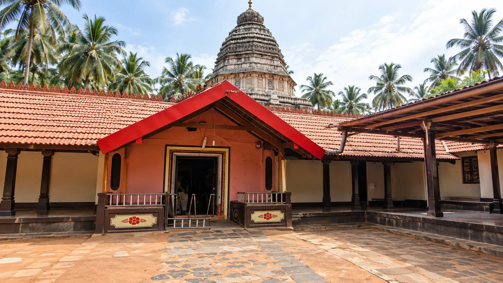
- Gokarna Pilgrimage and Coastal Beaches (~21 km to ~24 km north): Home to the historic 4th-century CE Mahabaleshwar Temple enshrining the sacred Atmalinga, the adjacent Maha Ganapati Temple, the holy Kotiteertha stepwell tank, and the world-famous coastal trekking chain connecting Kudle Beach, Om Beach, Half Moon Beach, and Paradise Beach.
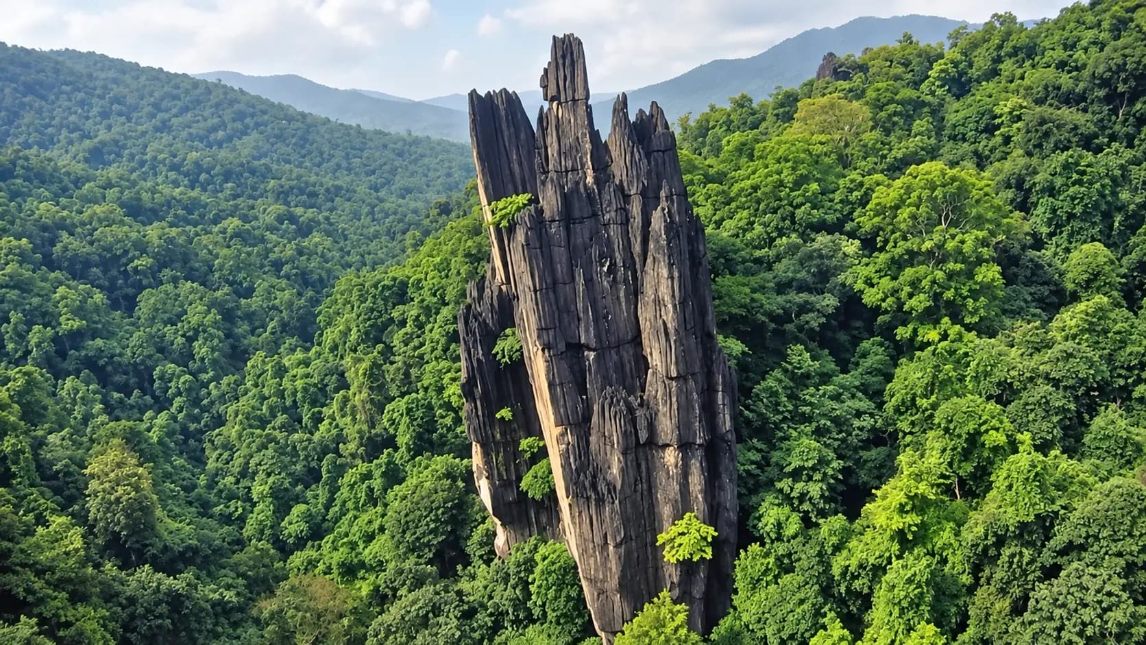
- Yana Caves (~35 km southeast via Kumta - Sirsi Road): A geological and mythological wonderland nestled deep inside the dense evergreen rainforests of the Sahyadri Western Ghats. Two towering, 3,000-year-old black karst limestone monoliths - Bhairaveshwara Shikhara (120 meters) and Mohini Shikhara (90 meters) - soar above the forest canopy, featuring a self-manifested cave temple beneath their spires.
- Vibhuti Falls (~45 km inland near Yana): A multi-tiered perennial cascade tumbling through lush bamboo thickets and limestone boulders into an emerald-green natural plunge pool, popular for post-hike refreshing swims.
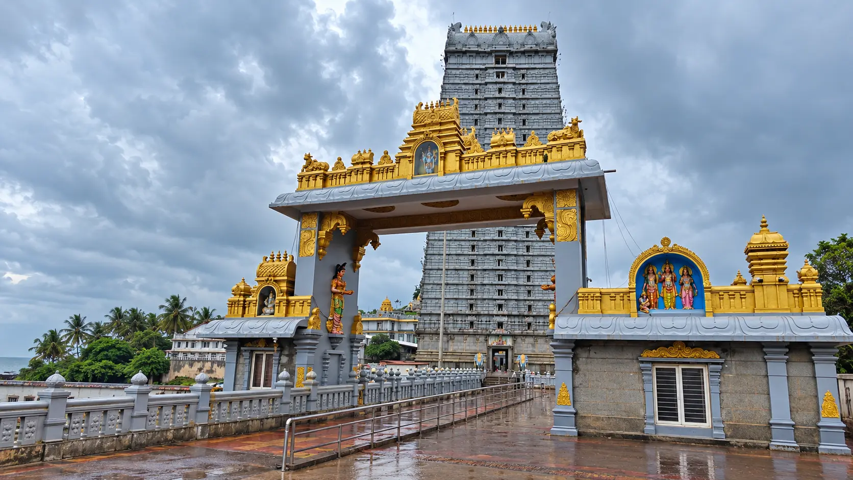
- Murudeshwar Temple and Colossal Shiva Statue (~56 km south via NH-66): Situated on the rocky headland of Kanduka Giri jutting into the Arabian Sea, Murudeshwar features the world's second-tallest statue of Lord Shiva (123 feet tall) and the monumental 20-storey, 237-foot-tall Raja Gopura, alongside scuba diving excursions to Netrani Island.
In pictures
The practical bits
Before you go.
Plan ahead
To maximize your historical appreciation and comfort during your excursion to Mirjan Fort, keep these five…Explore detailsClose details
To maximize your historical appreciation and comfort during your excursion to Mirjan Fort, keep these five essential preparation recommendations in mind:
Footwear Traction and Slippery Laterite Awareness
Visitors exploring the ramparts, high sentry lookouts, and ancient stepped wells should wear sturdy, closed-toe…Explore detailsClose details
Visitors exploring the ramparts, high sentry lookouts, and ancient stepped wells should wear sturdy, closed-toe walking shoes or hiking sandals with textured rubber grip, as the dark laterite surfaces and ancient staircases can be uneven and become exceptionally slick during the monsoon and early post-monsoon months.
Sun Protection and Hydration Logistics
Check the current visiting hours and permitted access with the site operator before departure; ceremonies…Explore detailsClose details
Check the current visiting hours and permitted access with the site operator before departure; ceremonies, closures and visitor sessions can affect access.
Monsoon Velvet Moss Photography Protocol
Photographers visiting between July and October to capture the legendary emerald-green moss covering the laterite…Explore detailsClose details
Photographers visiting between July and October to capture the legendary emerald-green moss covering the laterite walls should carry wind-resistant umbrellas, silica-gel packs, and waterproof dry-bags to shield sensitive camera bodies and lenses from sudden coastal squalls and pervasive humidity.
Rampart Edge and Well Safety Caution
Families traveling with young children must exercise strict vigilance along the high curtain walls and around the…Explore detailsClose details
Families traveling with young children must exercise strict vigilance along the high curtain walls and around the nine historic stepped wells, ensuring children remain on established gravel paths and never climb or sit upon the low, unfenced laterite parapet edges.
Combined Coastal Heritage Circuit Routing
To maximize your travel itinerary across Uttara Kannada, structure your visit to Mirjan Fort as a 1.5-to-2-hour…Explore detailsClose details
To maximize your travel itinerary across Uttara Kannada, structure your visit to Mirjan Fort as a 1.5-to-2-hour morning cultural excursion paired with an early visit to Gokarna's Mahabaleshwar Temple (~22 km north) or an afternoon exploration of the dramatic limestone monoliths of Yana Caves (~35 km inland).
A few things you might wonder
Common questions about visiting Mirjan Fort. Fees, visiting hours and ceremonies are researched details that may change; confirm current arrangements with the operator before travelling.
Who built Mirjan Fort and what is its historical connection to the Pepper Queen?
Is there an entry fee to visit Mirjan Fort?
What are the visiting hours and opening timings of Mirjan Fort?
Why does Mirjan Fort turn green during and after the monsoon season?
How many wells are located inside Mirjan Fort and what was their purpose?
How do I reach Mirjan Fort from Gokarna or Kumta?
Are there secret escape tunnels inside Mirjan Fort?
What facilities and safety precautions should visitors keep in mind at Mirjan Fort?
Explore more in Gokarna Murudeshwar
Discover other destinations around this hub
More Hubs in Karnataka
Continue exploring other travel hubs in this state
Planning a trip to Gokarna Murudeshwar?