Naina Peak (Cheena Peak)
Comprehensive guide to trekking Naina Peak (Cheena Peak) in Nainital, Uttarakhand. Explore the highest point in Nainital (2,615 m), Himalayan views, and trek tips.
Location
Nainital Jim Corbett, Uttarakhand
A closer look
Your visit, at a glance.
Nainital Jim Corbett, Uttarakhand
GET TO KNOW THE PLACE
Perched commanding at an altitude of 2,615 metres (8,579 feet) above sea level in Nainital District, Uttarakhand, Naina Peak - historically designated during the British colonial…
The story of Naina Peak (Cheena Peak)
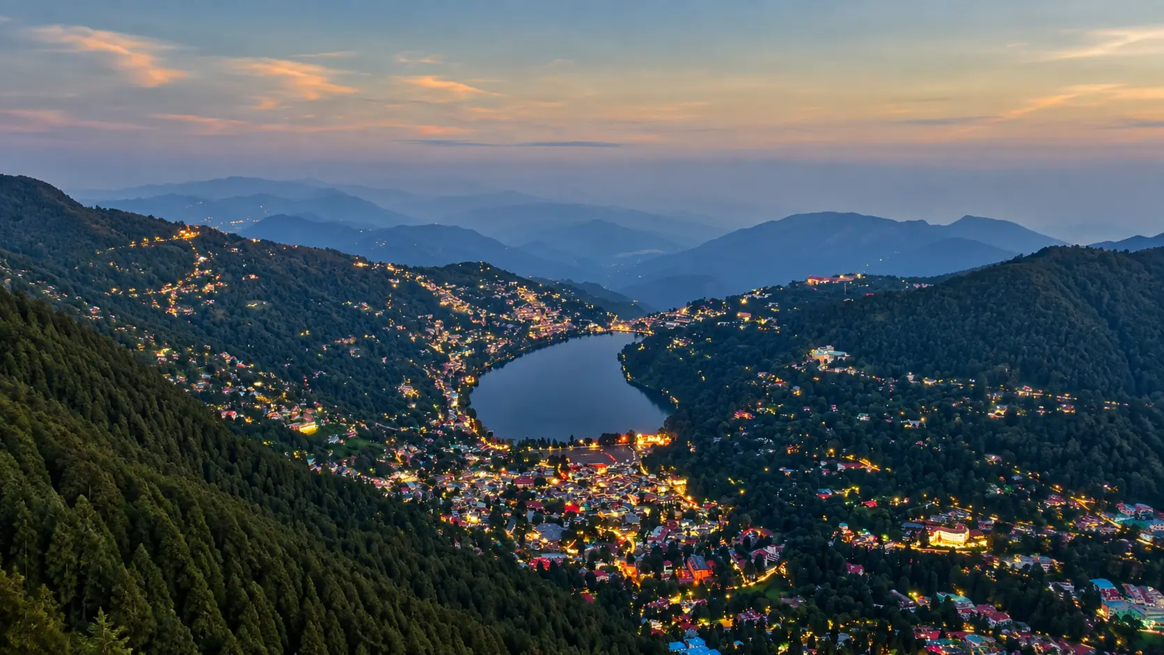
Perched commanding at an altitude of 2,615 metres (8,579 feet) above sea level in Nainital District, Uttarakhand, Naina Peak - historically designated during the British colonial era as China Peak or Cheena Peak - is the highest mountain summit, the apex geographical landmark, and the crowning observation point of the entire Nainital hill resort region. Situated approximately 6 kilometres north of Mallital, this prominent limestone mountain ridge rises more than 670 vertical metres above the glistening crescent of Naini Lake. Named in reverent honour of the patron deity of the valley, Goddess Naina Devi, Naina Peak offers a sublime natural retreat from the commercial bustle of the lower town, drawing trekkers, landscape photographers, birdwatchers, and Himalayan enthusiasts to its peaceful summit.
The mountain has captivated travelers since the founding of Nainital as a British hill station in 1841 by English sugar merchant P. Barron. During the nineteenth century, British administrators, naturalists, and surveyors climbed China Peak to conduct geodetic surveys of the Kumaon Himalayas and establish astronomical sightlines. From the summit, Barron and later British cartographers marveled at the sheer contrast between the jagged, glacier-draped peaks of the Great Himalayan Range to the north and the endless, sunlit plains of northern India stretching south towards Rohilkhand and the Ganges basin. Today, while officially rechristened as Naina Peak, both names remain widely recognized by local Kumaoni residents and seasoned mountaineers.
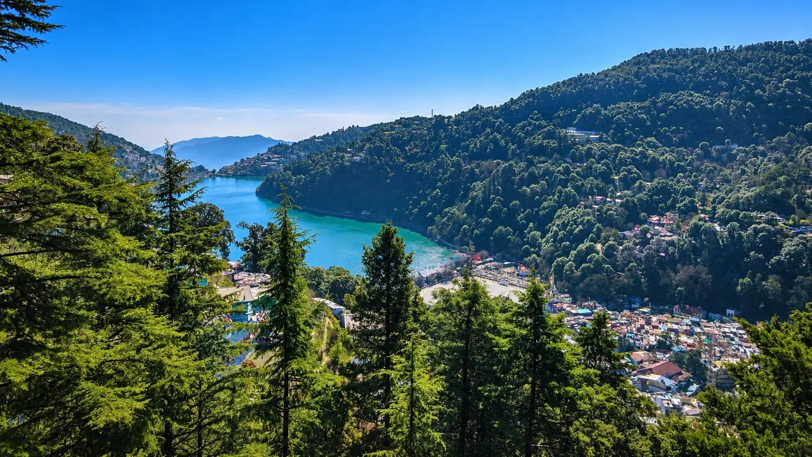
Reaching Naina Peak is widely regarded as the premier day hike in the Kumaon hills. Unlike commercialized viewpoints that permit direct vehicular access, Naina Peak has preserved its pristine wilderness character by requiring hikers to complete a 3-kilometre walking trail starting from Tanki Band along the Kilbury Road. The trail ascends gently at first, before winding upward through switchbacks enclosed by dense, ancient stands of Himalayan cypress (Cupressus torulosa), towering deodar cedars (Cedrus deodara), broad-leaved banj oaks (Quercus leucotrichophora), and brilliant scarlet rhododendrons (Rhododendron arboreum). As hikers gain elevation, the canopy periodically parts, revealing dramatic glimpses of the deep turquoise waters of Naini Lake nestled far below within its volcanic-like bowl.
Upon stepping onto the summit ridge, visitors are greeted by an unparalleled 360-degree panoramic spectacle. To the north, on clear autumn and winter mornings, the horizon is dominated by an unbroken 300-kilometre wall of snow-capped Himalayan giants, including India’s second-highest peak Nanda Devi (7,816 m), the trident-shaped summit of Trishul (7,120 m), Nanda Ghunti, Nanda Kot, Kamet, and the distant peaks of western Nepal such as Api and Nampa. To the south, hikers look straight down upon the miniature buildings of Nainital town, the emerald crescent of the lake, and the rolling forested slopes of the Shiwaliks merging into the distant haze of the Bhabar plains.
Start here. Open a tile for the full details.
Why goRead details
Naina Peak provides an exhilarating alpine trekking experience and the finest vantage points in the Kumaon Himalayas:
When to visitRead details
Naina Peak is accessible throughout the year, but the quality of the experience varies dramatically across seasons:
Entry & permissionsRead details
Fees, visiting hours and entry rules may change. Confirm the latest details with the official operator or local authority before travelling.
Access to Naina Peak is straightforward and eco-friendly:
- Permits and Fees: There is no entry fee or official forest permit required for visiting Naina Peak. Day hikers can walk the trail freely without advance booking.
- Vehicle Parking: If driving a private car or two-wheeler to Tanki Band, a nominal municipal/forest parking charge applies (approx. ₹50 for cars, ₹20 for two-wheelers).
- Operating Hours: The peak is open during daylight hours, recommended between 06:00 and 18:00. Hikers should plan their ascent to reach the summit in the early morning (between 07:00 and 10:00) when Himalayan visibility is at its peak.
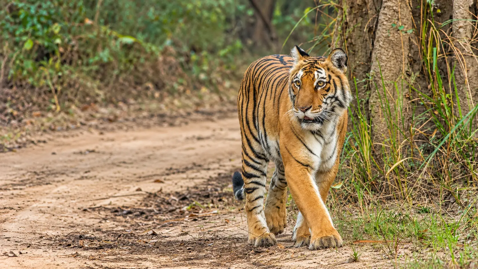
- Descent Regulations and Wildlife Safety: All hikers must begin their descent from the summit by 16:30 or 17:00 to ensure they exit the forest before darkness sets in. The surrounding reserve forest is part of the Kilbury-Pangot wildlife corridor, home to leopards, barking deer, wild boars, and Himalayan black bears that become active at dusk.
- Overnight Camping Ban: Pitching personal tents and camping overnight at Naina Peak is strictly prohibited by the Uttarakhand Forest Department to safeguard wildlife habitats and prevent accidental forest fires.
Plan your visitRead details
Naina Peak is located in the hills directly above Nainital town, easily reached via the following transit routes:
Explore the full guide - choose a topic below.
Why visit?
Naina Peak provides an exhilarating alpine trekking experience and the finest vantage points in the Kumaon…Explore detailsClose details
Naina Peak provides an exhilarating alpine trekking experience and the finest vantage points in the Kumaon Himalayas:
- Experience the Highest Point in Nainital: Standing at 2,615 metres, Naina Peak is the highest geographic elevation in the Nainital basin, offering a true mountain summit experience and refreshing, crisp pine-scented air far above the tourist crowds.
- Unobstructed Greater Himalayan Panoramas: On clear mornings between October and April, the summit offers an awe-inspiring, front-row view of the snow-mantled peaks of Nanda Devi, Trishul, Nanda Kot, Panchachuli, and Chaukhamba, standing bright white against deep cobalt Himalayan skies.
- Classic 3-km Forest Trek: The well-defined trekking trail from Tanki Band winds through pristine evergreen forests of Himalayan cypress, oak, and deodar. In March and April, the trail is ablaze with the vibrant red blooms of wild rhododendrons carpeting the forest floor.
- Spectacular Bird’s-Eye Perspective of Naini Lake: Looking down from the southern crest of the peak reveals a captivating, map-like view of the entire eye-shaped emerald lake, colorful pedal boats, Mall Road, and the surrounding colonial-era cottages clinging to the steep green slopes.
- Exceptional Birdwatching and Wildlife: The secluded forest slopes of Naina Peak and the adjacent Kilbury sanctuary are home to rich avian life, including the Himalayan Monal, Kalij Pheasant, Koklass Pheasant, Rufous Sibia, Blue Whistling Thrush, and various laughingthrushes, along with barking deer (kakar) and Himalayan goral.
What to expect
Trekking to Naina Peak is a moderately challenging, deeply rewarding half-day outdoor excursion suitable for…Explore detailsClose details
Trekking to Naina Peak is a moderately challenging, deeply rewarding half-day outdoor excursion suitable for anyone with reasonable physical stamina:
- The Trailhead at Tanki Band: Most hikers drive or hire a local cab from Mallital to Tanki Band (approx. 3 km / 10-15 minutes), situated at an elevation of roughly 2,200 metres. Tanki Band features a modest vehicle parking area and small tea stalls where hikers can stretch and stock up on water before starting the hike.
- The Forest Trail Ascent: From Tanki Band, the 3-kilometre walking trail ascends through continuous switchbacks, gaining approximately 415 vertical metres of elevation. The path consists of earthen tracks, loose gravel, and stone steps reinforced with wooden logs. The forest canopy is dense, offering cooling shade even during midday sun, while the scent of wild pine resin and damp cedar needles fills the air.
- Summit Crest and Historical Ruins: As you approach the top, the trees thin out into wind-scoured grassy knolls and rocky limestone outcrops. At the apex sits a concrete triangulation pillar and the stone foundation ruins of a British-era signal tower and former rest station.
- Summit Tea Shack and Panoramic Ledges: A rustic wooden tea stall operates near the summit during daylight hours, where friendly local shopkeepers prepare steaming cups of ginger-cardamom tea, instant Maggi noodles, and warm snacks. Trekkers can sit along the rock ledges, sipping hot chai while admiring the majestic Himalayan panorama unfolding before them.
Best time to visit
Naina Peak is accessible throughout the year, but the quality of the experience varies dramatically across…Explore detailsClose details
Naina Peak is accessible throughout the year, but the quality of the experience varies dramatically across seasons:
- Autumn and Post-Monsoon (October to November): Widely regarded as the absolute best time of year for Naina Peak. Post-monsoon atmospheric clearing scrubs the air of dust, resulting in crystal-clear skies and exceptional visibility. Himalayan panoramas of Nanda Devi and Trishul are sharpest during this period, with daytime temperatures hovering comfortably between 14°C and 20°C.
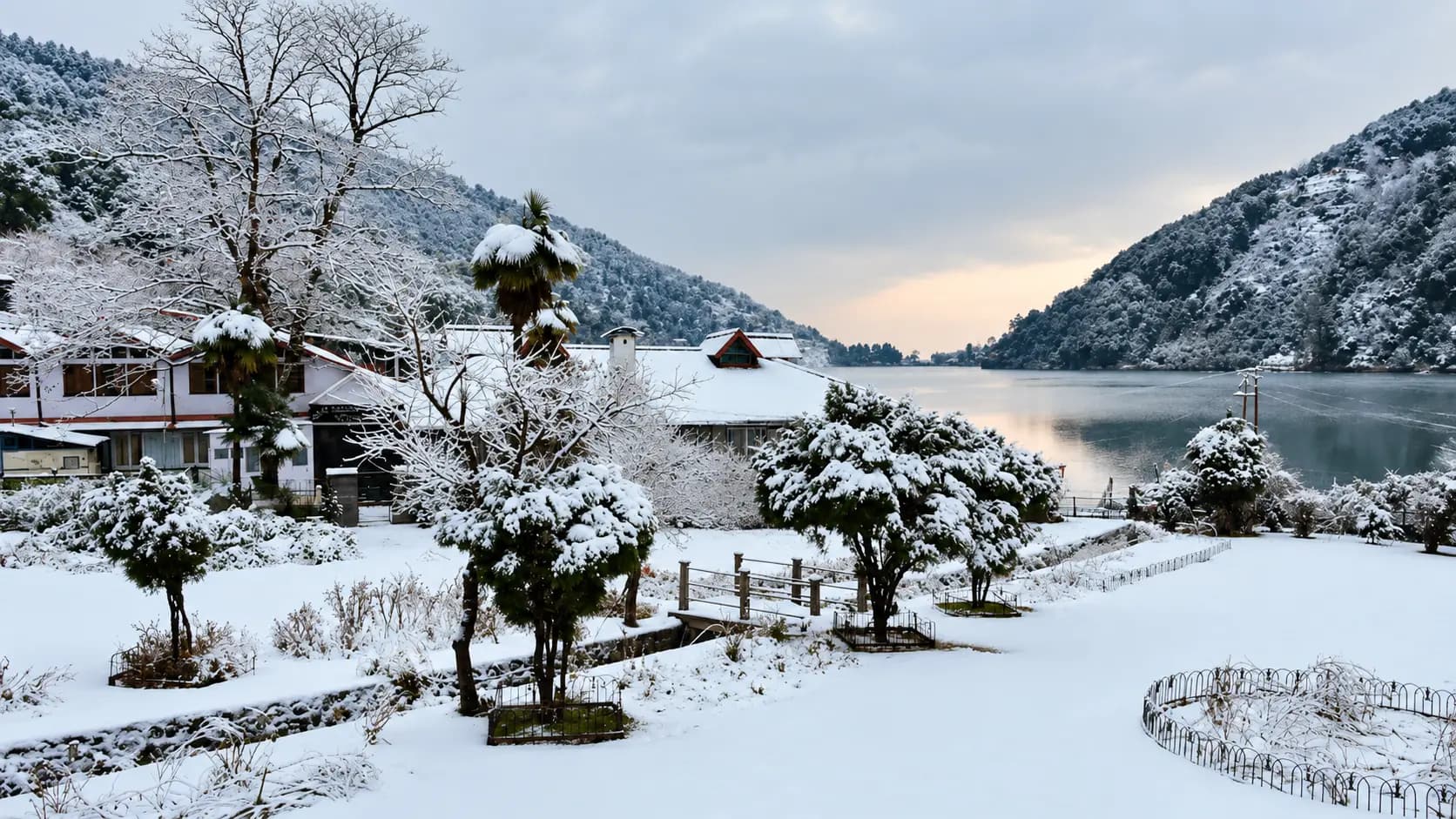
- Winter Wonderland (December to February): Winter brings crisp, cold mountain air with daytime temperatures between 6°C and 12°C, and sub-zero nights (-2°C to 4°C). The snow-capped Himalayas appear at their most dramatic. During January and February, the peak periodically receives moderate snowfall (1 to 2 feet), transforming the oak and cypress forests into a magical winter scene. Trekkers should carry warm fleece jackets, beanies, gloves, and sturdy hiking shoes with good grip.
- Spring Blossom Season (March to April): A delightful season as the weather warms (15°C to 24°C) and wild rhododendrons (buransh) burst into brilliant scarlet blossoms along the mountain trails. Clear morning skies usually provide excellent mountain views before afternoon haze rolls in.
- Summer Season (May to June): Pleasant daytime temperatures (20°C to 26°C) provide escape from the scorching heat of the north Indian plains. The trail is shaded and cool, though afternoon haze may slightly diminish distant mountain views; early morning hikes (arriving by 07:00 to 08:30) offer the clearest sightlines.
- Monsoon Season (July to August): Heavy rains bring dense fog, cloud cover, and frequent showers. Mountain views are almost completely obscured, and the trail becomes muddy, slippery, and infested with active forest leeches. Trekking during monsoon requires extreme caution and waterproof gear.
How to reach
Naina Peak is located in the hills directly above Nainital town, easily reached via the following transit routes…Explore detailsClose details
Naina Peak is located in the hills directly above Nainital town, easily reached via the following transit routes:
- By Train: The nearest railhead is Kathgodam Railway Station (KGM), located approximately 41 kilometres south of Nainital (1.5 hours by taxi). Kathgodam is well connected to New Delhi, Dehradun, Lucknow, and Kolkata via daily express trains, including the Kathgodam Shatabdi Express and Ranikhet Express. Private cabs and shared taxis are readily available outside the station to Nainital Mallital.
- By Road: Nainital is connected by smooth, paved highways to Haldwani (35 km), Kathgodam (41 km), Delhi (310 km, approx. 7 hours via Moradabad and Rampur), and Dehradun (280 km). State transport buses (UTC) and private luxury coaches operate regular daily services from Delhi’s Anand Vihar ISBT to the Nainital Tallital bus terminus.
- By Air: The closest domestic airport is Pantnagar Airport (PGH), situated 75 kilometres south (approx. 2 to 2.5 hours by road via Haldwani). It operates direct scheduled flights to New Delhi and Dehradun.
- Reaching the Trailhead from Nainital: Confirm the current charge and what it includes with the operator or service provider. Visitor admission, vehicles, parking, activities and accommodation can have separate charges. From Tanki Band, hikers proceed on foot along the designated 3-km forest trail to the peak.
Entry, timings and permissions
Fees, visiting hours and entry rules may change.Explore detailsClose details
Fees, visiting hours and entry rules may change. Confirm the latest details with the official operator or local authority before travelling.
Access to Naina Peak is straightforward and eco-friendly:
- Permits and Fees: There is no entry fee or official forest permit required for visiting Naina Peak. Day hikers can walk the trail freely without advance booking.
- Vehicle Parking: If driving a private car or two-wheeler to Tanki Band, a nominal municipal/forest parking charge applies (approx. ₹50 for cars, ₹20 for two-wheelers).
- Operating Hours: The peak is open during daylight hours, recommended between 06:00 and 18:00. Hikers should plan their ascent to reach the summit in the early morning (between 07:00 and 10:00) when Himalayan visibility is at its peak.
- Descent Regulations and Wildlife Safety: All hikers must begin their descent from the summit by 16:30 or 17:00 to ensure they exit the forest before darkness sets in. The surrounding reserve forest is part of the Kilbury-Pangot wildlife corridor, home to leopards, barking deer, wild boars, and Himalayan black bears that become active at dusk.
- Overnight Camping Ban: Pitching personal tents and camping overnight at Naina Peak is strictly prohibited by the Uttarakhand Forest Department to safeguard wildlife habitats and prevent accidental forest fires.
Nearby places to consider
A morning hike to Naina Peak can be combined with other scenic viewpoints and ecological reserves in the Nainital…Explore detailsClose details
A morning hike to Naina Peak can be combined with other scenic viewpoints and ecological reserves in the Nainital hills:
- Kilbury and Pangot Bird Sanctuary: Located just 8 kilometres further along the scenic ridge road beyond Tanki Band, Pangot is an internationally famous birdwatching paradise boasting over 250 species of Himalayan birds nestled amidst tranquil oak and pine forests.
- Naina Devi Temple: Situated at the northern edge of Naini Lake in Mallital, this revered 8th-century Shakti Peetha temple honours the patron goddess of Nainital, whose fallen eye is believed to have created the sacred lake.
- Snow View Point: Located on the opposite northern ridge at 2,270 metres, accessible via an exhilarating aerial ropeway cable car from Mallital, offering family-friendly views of the Himalayas and colonial-era telescopes.
- Tiffin Top (Dorothy’s Seat): Perched at 2,292 metres on Ayarpatta hill, 4 km from Nainital, this popular stone picnic perch honours English artist Dorothy Kellet and offers sweeping views of the southern valleys.
- Eco Cave Gardens: Located in Sukhatal on the road to Mallital, this family-oriented park features interconnected natural rocky caves sculpted to resemble tiger, bat, and panther caverns, complete with a musical fountain.
In pictures
The practical bits
Before you go.
Plan ahead
Preparation ensures a safe, comfortable, and memorable trek to the highest summit in Nainital: -Explore detailsClose details
Preparation ensures a safe, comfortable, and memorable trek to the highest summit in Nainital:
Start Early for the Best Himalayan Views
Himalayan peaks are notorious for gathering cloud cover and thermal haze by midday.Explore detailsClose details
Himalayan peaks are notorious for gathering cloud cover and thermal haze by midday. Begin your trek from Tanki Band by 06:30 or 07:30 to arrive at the summit when the morning sun illuminates the snowfields of Nanda Devi and Trishul against clear blue skies.
Footwear and Trekking Gear
The 3-kilometre trail climbs over 400 vertical metres along uneven dirt paths and loose rock switchbacks.Explore detailsClose details
The 3-kilometre trail climbs over 400 vertical metres along uneven dirt paths and loose rock switchbacks. Wear sturdy hiking shoes or trail runners with aggressive tread to prevent slipping. A lightweight trekking pole is highly advantageous for joint support during the steep descent.
Hydration and Personal Snacks
There are no natural springs or running water sources along the trail.Explore detailsClose details
There are no natural springs or running water sources along the trail. Carry at least 1 to 1.5 litres of drinking water per person in reusable flasks. While the summit tea shack sells packaged noodles and biscuits, carrying energy bars, dry fruits, and fresh fruit keeps stamina high.
Sun Protection and Layered Clothing
Because of the high altitude (2,615 m), ultraviolet radiation is intense, even in cool weather.Explore detailsClose details
Because of the high altitude (2,615 m), ultraviolet radiation is intense, even in cool weather. Apply broad-spectrum sunscreen, wear polarized sunglasses, and carry a brimmed sun hat. Temperatures at the summit can be 5°C to 8°C cooler than down in Nainital town, with brisk summit breezes; always pack a lightweight windbreaker or fleece jacket.
A few things you might wonder
Common questions about visiting Naina Peak (Cheena Peak). Fees, visiting hours and ceremonies are researched details that may change; confirm current arrangements with the operator before travelling.
How long does it take to trek to Naina Peak from Mallital?
Is the trek to Naina Peak difficult for beginners and children?
Can I hire horses or ponies to reach Naina Peak?
What peaks can be seen from the top of Naina Peak?
Are there food and washroom facilities at Naina Peak?
Is it safe to trek to Naina Peak alone?
Explore more in Nainital Jim Corbett
Discover other destinations around this hub
More Hubs in Uttarakhand
Continue exploring other travel hubs in this state
Planning a trip to Nainital Jim Corbett?