Kunzum Pass
Complete travel guide to Kunzum Pass (4,551 m) in Himachal Pradesh. Explore the gateway between Lahaul and Spiti, Kunzum Mata Temple, Bara Shigri Glacier, and Chandratal trek.
Location
Spiti Valley, Himachal Pradesh
A closer look
Your visit, at a glance.
Spiti Valley, Himachal Pradesh
GET TO KNOW THE PLACE
Perched with stark, monumental grandeur at an astonishing elevation of 4,551 meters (14,931 feet) above mean sea level, Kunzum Pass (locally and traditionally revered as Kunzum…
The story of Kunzum Pass
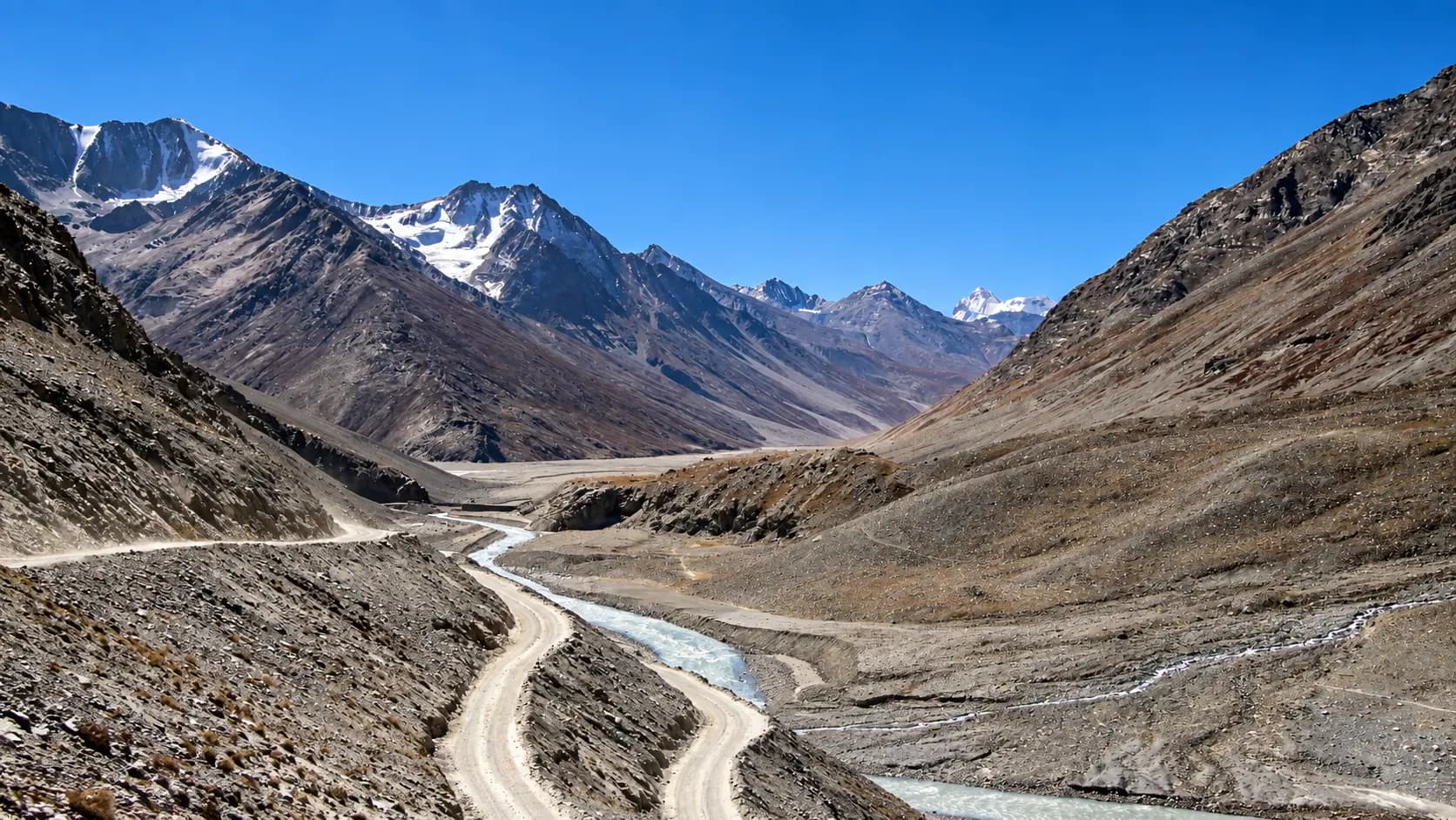
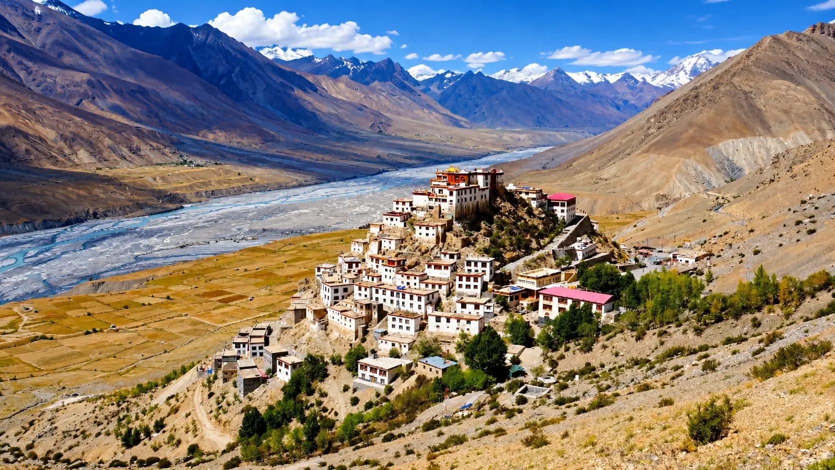
Perched with stark, monumental grandeur at an astonishing elevation of 4,551 meters (14,931 feet) above mean sea level, Kunzum Pass (locally and traditionally revered as Kunzum La) is one of the highest and most formidable motorable mountain passes in the Indian Himalayas. Situated within the Spiti Tehsil of Himachal Pradesh’s high-altitude Lahaul and Spiti District, approximately seventy-five kilometers northwest of Kaza and one hundred and twenty-two kilometers east of Manali, Kunzum Pass functions as the colossal natural barrier and high hydrological divide that separates the lush, river-fed valleys of Lahaul and Kullu from the desolate, rain-shadow expanse of the Trans-Himalayan cold desert of Spiti.
Traversed by the rugged and adventurous National Highway 505 (NH-505), Kunzum Pass is far more than a physical transit corridor; it is a sacred geographical threshold and a landscape of raw, glacial splendor. Standing atop the windswept crest, travelers are enveloped in a silence broken only by the fierce roar of high-altitude gales and the fluttering of thousands of brightly colored Tibetan Buddhist prayer flags (lungta). The pass provides breathtaking, 360-degree vistas across a sea of jagged 6,000-meter peaks, snowfields, hanging glaciers, and the immense frozen bulk of the Bara Shigri Glacier - the second longest glacier in the Himalayas. At the geometric center of the pass stands the revered Kunzum Mata Temple, where every passing vehicle, from local state transport buses to rugged commercial trucks and adventure motorcyclists, halts to perform a mandatory clockwise circumambulation to seek the protective blessings of the mountain goddess before daring the perilous descent into the abyss.
+----------------------------------------------------------------------------------------------------+
|                                    KUNZUM PASS WATERSHED DIVIDE PROFILE                            |
|                                                                                                    |
|                             [Kunzum Pass Summit Ridge: 4,551 m]                                    |
|                       (Kunzum Mata Temple & Stupa, Prayer Flag Forest)                             |
|                                            /\                                                      |
|                                           /  \                                                     |
|  [Western Approach: Lahaul Basin]        /    \        [Eastern Approach: Spiti Basin]             |
|  - Chandra River Valley                 /      \       - Spiti River Valley                        |
|  - Batal (3,960 m) [15 km west]        /        \      - Losar Village (4,080 m) [19 km east]      |
|  - Boulder-strewn stream crossings    /          \     - Gentle Trans-Himalayan terraces           |
|  - Glacial meltwater *pagal nallas*  /            \    - Gateway to Rangrik, Key, Kaza (3,650 m)   |
|  - Bara Shigri Glacier views        /              \   - Arid rain-shadow cold desert              |
|                                                                                                    |
|  Summit Elevation: 4,551 m | Operational Window: June to October | Highway: National Highway 505   |
+----------------------------------------------------------------------------------------------------+
Start here. Open a tile for the full details.
Why goRead details
Kunzum Pass is a bucket-list destination for global mountaineers, high-altitude road-trippers, wilderness trekkers, and cultural explorers. It embodies the supreme drama of Trans-Himalayan geography, blending sacred pilgrimage traditions with colossal geological formations.
When to visitRead details
Because of its extreme elevation and heavy Trans-Himalayan snowfall, Kunzum Pass is strictly accessible for only four to five months of the year. Attempting to visit outside the designated summer window is impossible, as the pass is buried beneath ten to thirty feet of packed snow and ice.
Entry & permissionsRead details
Fees, visiting hours and entry rules may change. Confirm the latest details with the official operator or local authority before travelling.
Crossing Kunzum Pass is subject to civil highway regulations, border surveillance protocols, and high-altitude safety guidelines enforced by the District Administration of Lahaul and Spiti.
+----------------------------------------------------------------------------------------------------+
|                                    PERMIT & ACCESS PROTOCOL MATRIX                                 |
|                                                                                                    |
|  Category             | Regulations & Requirements                                                 |
|  ---------------------+--------------------------------------------------------------------------- |
|  Pass Access Fee      | Free; No entry ticket, toll tax, or road fee levied                        |
|  Indian Citizens      | Confirm current permit requirements for your planned activities; Must carry valid government photo ID for Losar post   |
|  Foreign Nationals    | No Inner Line Permit (ILP) required between Manali and Kaza across Kunzum;  |
|                       | Passports and Indian visas inspected and registered at Losar checkpost     |
|  Operating Hours      | Daylight crossing exclusively recommended (05:00 to 17:00); Night barred   |
|  Drone Flights        | Strictly prohibited without written approval from SDM Kaza / BRO           |
|  Camping at Crest     | Strictly prohibited due to extreme sub-zero night freeze and high winds    |
+----------------------------------------------------------------------------------------------------+
Entry Fees and Toll Regulations
Crossing Kunzum Pass is completely free of charge. Neither the Himachal Pradesh state government nor the Border Roads Organisation levies any toll tax, vehicle entry fee, or environmental green cess to traverse National Highway 505 across the summit. While visiting the Kunzum Mata temple at the crest, travelers customarily place a nominal voluntary offering of coins, small currency notes (₹10 to ₹50), or ceremonial silk scarves (katas) upon the altar, though this is entirely voluntary.
Border Permissions and Checkpost Registration
- Indian Nationals: Indian citizens do not require an Inner Line Permit or specialized security clearance to cross Kunzum Pass or travel between Manali and Kaza. However, all private and commercial vehicles must halt at the Losar Police Checkpost (situated 19 km east of the pass) to log driver details, vehicle registration numbers, passenger counts, and destination itineraries. Carrying a valid government photo ID (Aadhaar, Passport, Voter Card, or Driving License) is mandatory.
- Foreign Passport Holders: Foreign citizens (including OCI and PIO cardholders) do not require an Inner Line Permit (ILP) if they are traveling exclusively between Manali and Kaza across Kunzum Pass, because this route does not traverse the sensitive Indo-Tibetan border corridor. However, foreign nationals must present their original passports and valid Indian visas for inspection and registration at the Losar checkpost. An Inner Line Permit is only required if foreign travelers choose to continue east past Kaza toward Reckong Peo and Shimla through the restricted border sector at Sumdo and Khab.
Timing Restrictions and Safety Curfews
While the pass is physically Daylight visits recommended; confirm any after-dark access during the summer season, civil authorities and the Spiti Police strongly enforce an unwritten daylight crossing policy. Travelers are advised to cross the pass exclusively between 05:00 and 17:00. Traversing the pass after dark is perilous: temperatures plunge deep below freezing, black ice coats steep hairpins, glacial meltwater streams freeze into treacherous icy ramps, and the total lack of mobile communication makes nighttime rescue virtually impossible in the event of a mechanical breakdown or medical emergency.
Plan your visitRead details
Reaching Kunzum Pass is one of the ultimate overland driving adventures in Asia. The pass is situated along National Highway 505 (NH-505), which links the Kullu and Lahaul valleys with the Spiti Valley.
Strict Altitude Exposure Limit
Limit your total halt at the summit of Kunzum Pass to no more than twenty to thirty minutes for photography and temple circumambulation, descending promptly toward Losar (4,080 m) or Kaza (3,650 m) to prevent the onset of severe hypoxia, acute headache, and Acute Mountain Sickness (AMS).
Explore the full guide - choose a topic below.
Why visit?
Kunzum Pass is a bucket-list destination for global mountaineers, high-altitude road-trippers, wilderness…Explore detailsClose details
Kunzum Pass is a bucket-list destination for global mountaineers, high-altitude road-trippers, wilderness trekkers, and cultural explorers. It embodies the supreme drama of Trans-Himalayan geography, blending sacred pilgrimage traditions with colossal geological formations.
1. The Spectacular Trans-Himalayan Gateway
Kunzum Pass marks the dramatic morphological transition between two completely different worlds:
- The Ecological Divide: As travelers ascend from the Chandra valley in Lahaul, patches of alpine turf, dwarf willows, and melting snowdrifts line the road. Once the pass is crossed, the landscape transforms instantly into the barren, stark, Martian-like moonscapes of Spiti Valley. Here, moisture-bearing monsoon clouds are permanently blocked by the Great Himalayan barrier, creating an arid desert expanse of yellow shale, red sedimentary cliffs, and wind-sculpted clay ridges.
- Glacial Panoramas of Bara Shigri: From the crest and the nearby ridgelines, one can gaze directly southwest across the Chandra River valley at the colossal Bara Shigri Glacier. Stretching for over 27.7 kilometers and covering an area of more than 126 square kilometers, Bara Shigri is the second longest glacier in the Himalayas after Gangotri. The glacier spills out from towering cirques crowned by jagged 6,000-meter peaks of the Chandrabhaga (CB) mountain range, including CB-13, CB-14, and Shigri Parbat.
2. The Sacred Tradition of Kunzum Mata Temple
The spiritual heartbeat of Kunzum Pass is the mountaintop shrine dedicated to Kunzum Mata (revered in local folklore as Goddess Kanta, considered a ferocious yet compassionate manifestation of Goddess Durga or the Buddhist deity Tara).
- The Mandatory Circumambulation (Kora): By ancient high-altitude tradition, no motor vehicle - whether a heavily loaded Himachal Road Transport Corporation (HRTC) bus, a local shepherd’s camper jeep, an army convoy, or an adventure motorcycle - will ever drive across the pass without stopping at the temple complex. Drivers pull over, disembark, and complete a full, respectful clockwise circumambulation (parikrama) around the whitewashed Buddhist stupas and shrines, offering coins, ceremonial silk scarves (katas), or fresh incense sticks to pray for mechanical reliability, clear weather, and safe passage across the treacherous hairpin roads below.
- The Legend of the Pass: Local folklore maintains that Kunzum Mata is the guardian protector of all who traverse the valley. Legends recount instances where travelers trapped by unseasonal autumn blizzards were miraculously guided to safety after invoking the goddess, cementing deep reverence among the trans-Himalayan transport community.
3. Trailhead for the Legendary Chandratal Trek
Kunzum Pass serves as the official trailhead for one of the most stunning alpine ridge treks in northern India: the 14-kilometer high-altitude trail to Chandratal Lake (the Lake of the Moon, situated at 4,250 meters).
- The Ridgeline Panorama: Branching off just below the summit chorten on the western face, this narrow footpath hugs the high lateral moraines and alpine ridges high above the Chandra River gorge. Trekkers walk with continuous panoramic vistas of glaciated peaks, crossing alpine meadows adorned with wild blue edelweiss and high-altitude gentians, before descending directly to the crescent-shaped turquoise shores of Chandratal.
- Acclimatization Challenge: Because the trek begins at 4,551 meters and remains above 4,200 meters throughout its duration, it demands sound cardiovascular fitness, thorough acclimatization, and careful hydration, rewarding trekkers with unmatched photographic vistas without vehicular noise.
What to expect
Visiting or crossing Kunzum Pass is an intense, physically demanding experience governed by extreme altitude…Explore detailsClose details
Visiting or crossing Kunzum Pass is an intense, physically demanding experience governed by extreme altitude, wild weather, and absolute isolation. At 4,551 meters (nearly 15,000 feet), the effective atmospheric pressure and oxygen density are roughly 42 percent lower than at sea level. Visitors stepping out of their vehicles into the biting high-altitude air will immediately experience an elevated heart rate, deep labored breathing, and the sudden shock of freezing temperatures.
+----------------------------------------------------------------------------------------------------+
|                                    KUNZUM PASS SUMMIT ENVIRONMENT MATRIX                           |
|                                                                                                    |
|  Environmental Factor | Conditions at 4,551 Meters                                                 |
|  ---------------------+--------------------------------------------------------------------------- |
|  Atmospheric Oxygen   | Approx. 58% of sea-level oxygen; severe risk of hypoxia and AMS            |
|  Wind Conditions      | Persistent, gale-force mountain winds gusting between 30 and 70 km/h       |
|  Daytime Temperatures | 4°C to 12°C during summer midday; rapid plunge near zero in overcast skies |
|  Night Temperatures   | Regularly drops to -5°C to -15°C even in midsummer; deep freeze in autumn  |
|  Solar Radiation      | Extreme UV index (>11); severe danger of photokeratitis and sunburn        |
|  Civic Infrastructure | Zero electricity, zero plumbing, zero commercial stalls, zero mobile signal|
|  Recommended Stay     | Maximum 20 to 30 minutes for photography and temple circumambulation       |
+----------------------------------------------------------------------------------------------------+
The Summit Landscape and Temple Complex
The crest of Kunzum Pass is a wide, rocky saddle surrounded by gently sloping shale scree and jagged snow-patched ridges. In the center of the plateau stands the Kunzum Mata shrine: a whitewashed stone stupa (chorten) flanked by a modest concrete temple housing the sacred idol of the goddess. Radiating outward from the stupa in every direction are thousands of wind-tattered Tibetan prayer flags strung across ropes anchored to stone cairns. As high-speed winds howl across the pass, the flags whip with a rhythmic roar, carrying printed Buddhist prayers for peace, compassion, and strength into the open sky.
The ground underfoot is composed of fractured limestone, frost-shattered slate, and patches of resilient high-alpine moss. There is no vegetation taller than two inches. The horizon is entirely dominated by rock, ice, and sky. Looking west toward Lahaul reveals deep glacial trenches, boulder moraines, and the snaking turquoise thread of the Chandra River. Looking east toward Spiti reveals the gentle alluvial terraces leading downward toward the whitewashed village of Losar, flanked by dry ochre hills that glow in the intense, unclouded Himalayan sunlight.
Complete Absence of Commercial Facilities
Visitors must understand that Kunzum Pass is a raw, untamed wilderness crest. There are no tea stalls, restaurants, souvenir vendors, heated shelters, public restrooms, or trash disposal bins anywhere on the pass. There is no cellular mobile coverage (BSNL, Jio, and Airtel have zero reception here), and there is no electricity or tap water. Travelers must carry their own emergency warm clothing, drinking water, and personal medical kits. The nearest food and shelter options are fifteen kilometers down the western switchbacks at Batal (where rustic stone roadside dhabas operate in summer) or nineteen kilometers down the eastern slopes at Losar village.
Best time to visit
Because of its extreme elevation and heavy Trans-Himalayan snowfall, Kunzum Pass is strictly accessible for only…Explore detailsClose details
Because of its extreme elevation and heavy Trans-Himalayan snowfall, Kunzum Pass is strictly accessible for only four to five months of the year. Attempting to visit outside the designated summer window is impossible, as the pass is buried beneath ten to thirty feet of packed snow and ice.
+----------------------------------------------------------------------------------------------------+
|                                    ANNUAL OPERATIONAL & CLIMATIC CYCLE                             |
|                                                                                                    |
|  Month        | Pass Status     | Conditions & Highlights                                          |
|  -------------+-----------------+----------------------------------------------------------------- |
|  Jan - April  | Closed Solid    | Extreme Arctic winter; buried under 15-30 ft snow; temp -35°C    |
|  May          | Closed / Clearing| BRO Project Deepak heavy snow clearance operations underway     |
|  June         | Opens Early June| Opening window; giant snow walls (10-15 ft) lining highway       |
|  July         | Open            | Peak summer; high meltwater *pagal nallas* on western approach   |
|  August       | Open            | Monsoon cloud runoff on Manali side; clear sunny skies at pass   |
|  September    | Open (Optimal)  | Prime travel window; stabilized roads, crisp air, autumn light   |
|  October      | Closes Mid-Late | Early blizzards; severe sub-zero freeze; black ice; BRO shuts pass|
|  Nov - Dec    | Closed Solid    | Winter lockdown; road officially decommissioned for the season   |
+----------------------------------------------------------------------------------------------------+
Early Summer (June to Early July): The Snow-Wall Spectacle
The Border Roads Organisation typically completes snow clearance operations and opens Kunzum Pass between late May and early June, depending on the severity of the preceding winter’s snowpack. Travelers crossing the pass during June are treated to the sensational spectacle of driving through sheer vertical snow walls standing eight to fifteen feet high on either side of the newly carved roadway. Daytime temperatures range from 2°C to 8°C, and the surrounding peaks are coated in pristine, blinding white snow. However, early season road surfaces are exceptionally rough, composed of slush, mud, and loose moraine gravel, requiring high ground-clearance 4x4 vehicles.
Peak Summer (Mid-July to August): Warmest Days and High Meltwater
July and August bring the warmest weather to Kunzum Pass, with midday temperatures occasionally reaching 10°C to 14°C under brilliant sunshine. While the Spiti side remains completely dry due to its rain-shadow location, the southern approaches from Manali (before the Atal Tunnel) experience heavy monsoon rains, which can trigger landslides in the Kullu valley. More critically, high midsummer temperatures dramatically accelerate glacial melt, causing small roadside streams on the Batal - Gramphu sector (pagal nallas, or crazy streams) to swell into raging torrents of boulder-churning water by mid-afternoon. Travelers visiting in July and August must cross these stream zones early in the morning before glacial runoff peaks.
Autumn (September to Early October): The Connoisseur’s Prime Window
September is universally acclaimed as the finest month to cross Kunzum Pass. By early September, the summer monsoon has retreated from Himachal Pradesh, eliminating landslide risks on approach roads. Glacial meltwater streams subside into manageable shallow trickles, road surfaces dry out and stabilize, and the high-altitude atmosphere attains crystal-clear transparency, offering breathtaking photographic visibility of the Bara Shigri Glacier and the snow peaks. Midday temperatures hover around 6°C to 10°C, while nights begin to drop well below freezing (-5°C). By early October, early autumn blizzards can strike without warning. The BRO officially closes the pass when heavy snowfall renders snow clearance unsustainable, usually between October 15 and October 31.
How to reach
Reaching Kunzum Pass is one of the ultimate overland driving adventures in Asia.Explore detailsClose details
Reaching Kunzum Pass is one of the ultimate overland driving adventures in Asia. The pass is situated along National Highway 505 (NH-505), which links the Kullu and Lahaul valleys with the Spiti Valley.
+----------------------------------------------------------------------------------------------------+
|                                    NH-505 HIGHWAY ROUTE TO KUNZUM PASS                             |
|                                                                                                    |
|  [Western Approach from Manali: 122 km]                                                            |
|  Manali (2,050 m) ---> Atal Tunnel (3,050 m) ---> Sissu ---> Koksar ---> Gramphu (NH-505 junction) |
|  Gramphu ---> Chhatru (3,360 m) ---> Chhota Dhara ---> Batal (3,960 m) ---> Kunzum Pass (4,551 m)  |
|  Road Character: 50 km unpaved boulder bed along Chandra River; deep water crossings; 4x4 needed   |
|                                                                                                    |
|  [Eastern Approach from Kaza: 75 km]                                                               |
|  Kaza (3,650 m) ---> Rangrik ---> Morang ---> Hal ---> Losar Village (4,080 m)                     |
|  Losar (Police Post) ---> Switchback Ascent (19 km) ---> Kunzum Pass Summit (4,551 m)             |
|  Road Character: Fully paved between Kaza and Losar; well-graded unpaved switchbacks to summit     |
+----------------------------------------------------------------------------------------------------+
Approach 1: The Western Highway from Manali via Atal Tunnel and Batal (122 km)
The drive from Manali to Kunzum Pass is renowned among overland drivers for its raw, unforgiving terrain:
- Sector 1 (Manali to Gramphu - 52 km): Leaving Manali, vehicles travel smoothly north along NH-3 through the world-famous Atal Tunnel (9.02 km long) under the Pir Panjal Range, emerging into the Lahaul valley near Sissu. Continuing downstream along the Chandra River, the route reaches Gramphu, where NH-505 branches east into the wild Chandra gorge.
- Sector 2 (Gramphu to Batal - 55 km): This is one of the most rugged, unpaved stretches of national highway in India. The road is carved directly into the scree cliffs and boulder beds of the Chandra River, passing the temporary seasonal halts of Chhatru and Chhota Dhara. Vehicles must cross several unbridged glacial streams (pagal nallas) flowing across the rocky road surface. High ground-clearance SUVs, 4x4 vehicles, or commercial Bolero campers are mandatory; low-clearance hatchbacks and sedans risk severe undercarriage and oil-sump damage.
- Sector 3 (Batal to Kunzum Pass - 15 km): From Batal (3,960 m), home to the famous roadside refuge of Chacha-Chachi Dhaba, the road leaves the riverbed and begins a steep, dramatic ascent of nineteen hairpin switchbacks climbing nearly 600 vertical meters to the summit of Kunzum Pass at 4,551 meters.
Approach 2: The Eastern Highway from Kaza via Losar (75 km)
The ascent to Kunzum Pass from the Spiti side is significantly smoother and more gradual:
- Leaving Kaza (3,650 m), the road follows the wide, paved valley floor of the Spiti River north past Rangrik, Morang, and Hanse, reaching the picturesque village of Losar at 4,080 meters (56 km from Kaza). Losar is the highest major village in western Spiti and houses the mandatory Himachal Pradesh Police checkpost, where all passing vehicles, drivers, and passengers must register.
- Beyond Losar, the road begins its nineteen-kilometer climb toward Kunzum Pass. The road surface here is unpaved but consists of wide, well-graded gravel and crushed shale switchbacks that ascend through wide mountain bowls, providing expansive vistas of the valley below before cresting at the prayer flag forest of the summit.
Public Transit and Bus Connectivity
During the summer operational window (typically July through September), the Himachal Road Transport Corporation (HRTC) operates a legendary daily passenger bus service between Kullu/Manali and Kaza. The bus departs Manali early in the morning (around 05:00), traverses the Atal Tunnel, battles the rocky Chandra riverbed, stops briefly at Batal for lunch, crosses Kunzum Pass in the early afternoon, and arrives in Kaza by late evening. In addition, private shared taxis and tempo travelers can be booked through travel operators in Manali and Kaza.
Entry, timings and permissions
Fees, visiting hours and entry rules may change.Explore detailsClose details
Fees, visiting hours and entry rules may change. Confirm the latest details with the official operator or local authority before travelling.
Crossing Kunzum Pass is subject to civil highway regulations, border surveillance protocols, and high-altitude safety guidelines enforced by the District Administration of Lahaul and Spiti.
+----------------------------------------------------------------------------------------------------+
|                                    PERMIT & ACCESS PROTOCOL MATRIX                                 |
|                                                                                                    |
|  Category             | Regulations & Requirements                                                 |
|  ---------------------+--------------------------------------------------------------------------- |
|  Pass Access Fee      | Free; No entry ticket, toll tax, or road fee levied                        |
|  Indian Citizens      | Confirm current permit requirements for your planned activities; Must carry valid government photo ID for Losar post   |
|  Foreign Nationals    | No Inner Line Permit (ILP) required between Manali and Kaza across Kunzum;  |
|                       | Passports and Indian visas inspected and registered at Losar checkpost     |
|  Operating Hours      | Daylight crossing exclusively recommended (05:00 to 17:00); Night barred   |
|  Drone Flights        | Strictly prohibited without written approval from SDM Kaza / BRO           |
|  Camping at Crest     | Strictly prohibited due to extreme sub-zero night freeze and high winds    |
+----------------------------------------------------------------------------------------------------+
Entry Fees and Toll Regulations
Crossing Kunzum Pass is completely free of charge. Neither the Himachal Pradesh state government nor the Border Roads Organisation levies any toll tax, vehicle entry fee, or environmental green cess to traverse National Highway 505 across the summit. While visiting the Kunzum Mata temple at the crest, travelers customarily place a nominal voluntary offering of coins, small currency notes (₹10 to ₹50), or ceremonial silk scarves (katas) upon the altar, though this is entirely voluntary.
Border Permissions and Checkpost Registration
- Indian Nationals: Indian citizens do not require an Inner Line Permit or specialized security clearance to cross Kunzum Pass or travel between Manali and Kaza. However, all private and commercial vehicles must halt at the Losar Police Checkpost (situated 19 km east of the pass) to log driver details, vehicle registration numbers, passenger counts, and destination itineraries. Carrying a valid government photo ID (Aadhaar, Passport, Voter Card, or Driving License) is mandatory.
- Foreign Passport Holders: Foreign citizens (including OCI and PIO cardholders) do not require an Inner Line Permit (ILP) if they are traveling exclusively between Manali and Kaza across Kunzum Pass, because this route does not traverse the sensitive Indo-Tibetan border corridor. However, foreign nationals must present their original passports and valid Indian visas for inspection and registration at the Losar checkpost. An Inner Line Permit is only required if foreign travelers choose to continue east past Kaza toward Reckong Peo and Shimla through the restricted border sector at Sumdo and Khab.
Timing Restrictions and Safety Curfews
While the pass is physically Daylight visits recommended; confirm any after-dark access during the summer season, civil authorities and the Spiti Police strongly enforce an unwritten daylight crossing policy. Travelers are advised to cross the pass exclusively between 05:00 and 17:00. Traversing the pass after dark is perilous: temperatures plunge deep below freezing, black ice coats steep hairpins, glacial meltwater streams freeze into treacherous icy ramps, and the total lack of mobile communication makes nighttime rescue virtually impossible in the event of a mechanical breakdown or medical emergency.
Nearby places to consider
Kunzum Pass connects the rugged wilderness of Lahaul with the cultural sanctuaries of Spiti.Explore detailsClose details
Kunzum Pass connects the rugged wilderness of Lahaul with the cultural sanctuaries of Spiti. Travelers crossing the pass can easily explore several of the most iconic natural wonders and frontier settlements in northern Himachal Pradesh.
+----------------------------------------------------------------------------------------------------+
|                                    NEARBY DESTINATIONS NETWORK                                     |
|                                                                                                    |
|  [Bara Shigri Glacier Viewpoint: 4,000 m]       [Chandratal Lake: 4,250 m]                         |
|  (Second longest glacier in the Himalayas)      (Turquoise Crescent Moon Lake; 14 km ridge trek)   |
|         ^                                              ^                                           |
|          \                                            /                                            |
|           \                                          /                                             |
|  [Batal Roadside Halt: 3,960 m] <--- 15 km ---> [Kunzum Pass: 4,551 m] <--- 19 km ---> [Losar]     |
|  (Chacha-Chachi Dhaba, Chandra River)            (Crest Temple & Divide)                | 4,080 m   |
|                                                                                         |           |
|                                                                                         | 56 km     |
|                                                                                         v           |
|                                                                               [Kaza Hub: 3,650 m]   |
|                                                                               (Sub-Divisional Base) |
+----------------------------------------------------------------------------------------------------+
Chandratal Lake (The Moon Lake - 4,250 m)
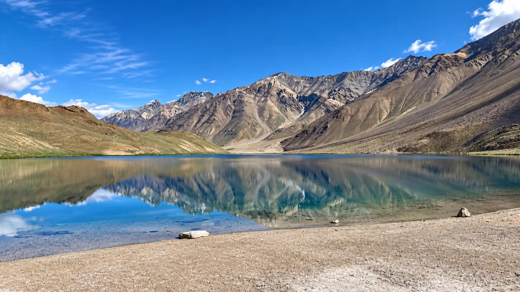
Located approximately twelve kilometers north of the main NH-505 highway (accessible via a dedicated narrow link road from Batal or a 14-kilometer alpine ridgeline trek directly from Kunzum Pass), Chandratal is an internationally celebrated high-altitude Ramsar wetland. Nestled in a sweeping glacial cirque at an elevation of 4,250 meters, the lake is famous for its crescent shape and crystalline waters, which change color throughout the day from deep emerald green to luminous turquoise and brilliant sapphire blue. Fringed by alpine meadows and moraine hills, Chandratal offers seasonal eco-camping facilities located strictly three kilometers outside the statutory conservation buffer zone.
Batal and the Historic Chacha-Chachi Dhaba (3,960 m)
Situated fifteen kilometers west of Kunzum Pass at the base of the switchback ascent, Batal is a legendary staging halt on the boulder-strewn banks of the Chandra River. For decades, Batal has been famous across the global mountaineering community for the humble roadside stone refuge operated by an elderly Spitian couple, affectionately known as Chacha and Chachi (Dorje and Hishey Chhomo). Their dhaba has saved countless lives during unseasonal autumn blizzards, providing hot meals of steaming dal-rice, warm beds, and emergency rescue shelter to stranded travelers and mountaineers. Batal also provides the iron bridge crossing the Chandra River toward Chandratal.
Losar Village (4,080 m)
Located nineteen kilometers east of Kunzum Pass, Losar is the first permanently inhabited village in Spiti Valley when entering from the pass. Situated at an altitude of 4,080 meters at the confluence of the Losar and Peeno streams, the village consists of whitewashed stone houses framed by weeping willows and barley terraces. Losar houses the sub-divisional police checkpost, a basic health sub-centre, and several welcoming family-run homestays and guesthouses. It offers a tranquil, peaceful stopover for travelers seeking to rest after the grueling drive across the pass before continuing onward to Key Monastery and Kaza.
Bara Shigri Glacier and Trekking Cirques
Visible directly to the southwest of Kunzum Pass and Batal, the Bara Shigri Glacier is a colossal tongue of ice extending over twenty-seven kilometers down the northern slopes of the main Himalayan range. The glacier feeds the torrents of the Chandra River and serves as a premier destination for high-altitude scientific glaciology expeditions and technical mountaineering ascents targeting peaks such as Central Peak, Gunther’s Peak, and Shigri Parbat.
In pictures
The practical bits
Before you go.
Plan ahead
Traversing a high-altitude mountain pass at 4,551 meters requires rigorous advance planning, vehicular…Explore detailsClose details
Traversing a high-altitude mountain pass at 4,551 meters requires rigorous advance planning, vehicular preparation, and strict adherence to physiological acclimatization principles.
Strict Altitude Exposure Limit
Limit your total halt at the summit of Kunzum Pass to no more than twenty to thirty minutes for photography and…Explore detailsClose details
Limit your total halt at the summit of Kunzum Pass to no more than twenty to thirty minutes for photography and temple circumambulation, descending promptly toward Losar (4,080 m) or Kaza (3,650 m) to prevent the onset of severe hypoxia, acute headache, and Acute Mountain Sickness (AMS).
Vehicle Preparation and Clearance
Utilize only sturdy high ground-clearance SUVs, commercial 4x4 camper jeeps, or heavy-duty adventure motorcycles…Explore detailsClose details
Utilize only sturdy high ground-clearance SUVs, commercial 4x4 camper jeeps, or heavy-duty adventure motorcycles equipped with sump guards, ensuring that engine coolant, air filters, brake fluid, and all tires (including a fully inflated spare) are thoroughly inspected before departing Manali or Kaza.
Layered Alpine Clothing Essentials
Dress in a windproof and waterproof outer mountain shell layered over a heavy fleece jacket and thermal base…Explore detailsClose details
Dress in a windproof and waterproof outer mountain shell layered over a heavy fleece jacket and thermal base layers, and carry a woolen beanie, thermal gloves, polarized UV400 sunglasses to protect against high-altitude snow blindness, and SPF 50 sunscreen.
Fuel and Cash Self-Sufficiency
Fill your vehicle's fuel tank to capacity at Manali or Kaza before embarking, carry an auxiliary jerrycan of fuel…Explore detailsClose details
Fill your vehicle's fuel tank to capacity at Manali or Kaza before embarking, carry an auxiliary jerrycan of fuel if driving older vehicles, and ensure you have sufficient physical cash in hand, as there are zero ATMs or fuel stations between Manali and Kaza along the 200-kilometer mountain route.
Early Morning Departure Timing
Depart early in the morning (by 05:30 or 06:00 AM) when crossing from Manali toward Kaza, allowing your vehicle…Explore detailsClose details
Depart early in the morning (by 05:30 or 06:00 AM) when crossing from Manali toward Kaza, allowing your vehicle to cross the turbulent glacial meltwater streams (pagal nallas) between Gramphu and Batal while water levels are at their lowest before afternoon solar melting accelerates.
+----------------------------------------------------------------------------------------------------+
|                                  OVERLAND CROSSING ITINERARY: MANALI TO KAZA                       |
|                                                                                                    |
|  05:30 AM  -  Early Departure from Manali (2,050 m)                                                  |
|  - Drive through the 9.02 km Atal Tunnel; emerge into the Lahaul valley at Sissu.                  |
|  - Turn east at Gramphu onto the rugged unpaved surface of NH-505.                                 |
|                                                                                                    |
|  07:30 AM to 10:30 AM  -  Navigating the Chandra Gorge & Stream Crossings                            |
|  - Traverse rocky boulder beds past Chhatru and Chhota Dhara.                                      |
|  - Safely negotiate low-flow morning meltwater streams (*pagal nallas*).                           |
|                                                                                                    |
|  11:00 AM to 12:00 PM  -  Rest & Acclimatization Halt at Batal (3,960 m)                             |
|  - Stop at the legendary Chacha-Chachi Dhaba for hot dal-rice, instant noodles, and sweet tea.     |
|  - Inspect vehicle tire pressures, coolant levels, and ensure all passengers are hydrated.         |
|                                                                                                    |
|  12:30 PM to 01:15 PM  -  Ascent & Summit Halt at Kunzum Pass (4,551 m)                              |
|  - Climb nineteen switchbacks (15 km) from Batal to the summit plateau.                            |
|  - Complete the mandatory clockwise circumambulation (*kora*) of the Kunzum Mata Temple.          |
|  - Capture panoramic photographs of the Bara Shigri Glacier and prayer flags (max 25 min halt).    |
|                                                                                                    |
|  01:45 PM to 02:30 PM  -  Descent to Losar Village (4,080 m)                                        |
|  - Descend 19 km of wide gravel switchbacks into Spiti Valley.                                     |
|  - Halt at the Losar Police Checkpost for mandatory identity and vehicle registration.             |
|                                                                                                    |
|  03:00 PM to 05:00 PM  -  Scenic Drive to Kaza (3,650 m)                                            |
|  - Follow the smooth paved valley road along the Spiti River past Rangrik into Kaza.              |
|  - Check into guesthouse, rehydrate with warm water, and rest to complete acclimatization.         |
+----------------------------------------------------------------------------------------------------+
A few things you might wonder
Common questions about visiting Kunzum Pass. Fees, visiting hours and ceremonies are researched details that may change; confirm current arrangements with the operator before travelling.
What is the elevation of Kunzum Pass, and what are the main altitude risks?
Why do all vehicles circumambulate the Kunzum Mata Temple at the pass?
When does Kunzum Pass open and close each year?
Can regular hatchback and sedan cars drive across Kunzum Pass?
Are there restrooms, food stalls, or hotels at the summit of Kunzum Pass?
Is there mobile network connectivity at Kunzum Pass?
How does one hike from Kunzum Pass to Chandratal Lake?
Is an Inner Line Permit required for foreign tourists crossing Kunzum Pass?
Explore more in Spiti Valley
Discover other destinations around this hub
More Hubs in Himachal Pradesh
Continue exploring other travel hubs in this state
Planning a trip to Spiti Valley?