Kaza & Langza
Comprehensive travel guide to Kaza and Langza in Spiti Valley. Explore high-altitude culture, ancient marine fossils, giant Golden Buddha, homestays, and routes.
Location
Spiti Valley, Himachal Pradesh
A closer look
Your visit, at a glance.
Spiti Valley, Himachal Pradesh
GET TO KNOW THE PLACE
Kaza and Langza represent the dual heartbeats of Spiti Valley, combining the essential administrative and logistical vitality of the valley floor with the timeless, windswept…
The story of Kaza & Langza
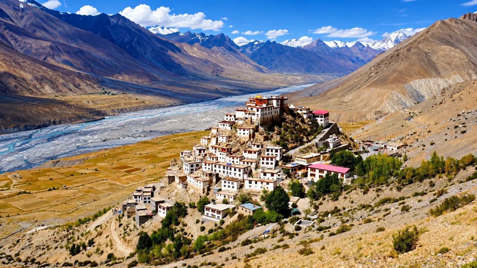
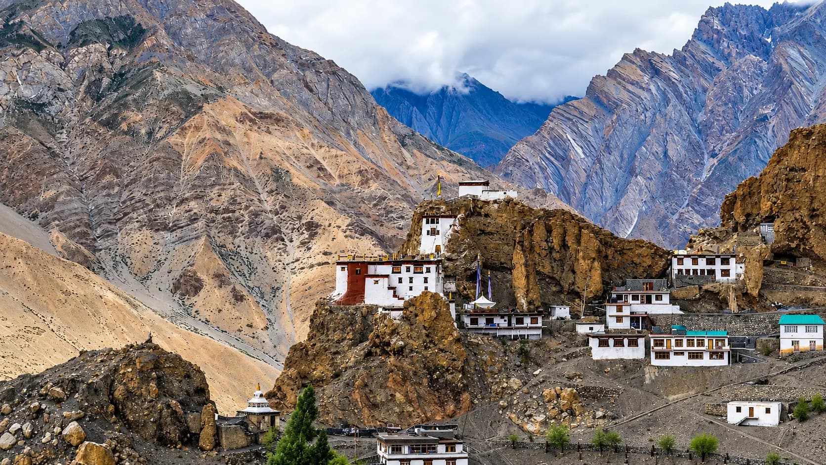
Kaza and Langza represent the dual heartbeats of Spiti Valley, combining the essential administrative and logistical vitality of the valley floor with the timeless, windswept grandeur of the high-altitude Trans-Himalayan plateaus. Situated within the Lahaul and Spiti district of Himachal Pradesh, Kaza sits at an elevation of approximately 3,650 meters along the wide braided gravel floodplains of the Spiti River. Serving as the sub-divisional headquarters, Kaza is the indispensable base camp where mountain roads converge, fuel tanks are replenished, high-altitude supplies are procured, and permits are verified. In contrast, sixteen kilometers to the northeast and perched dramatically at 4,400 meters, lies Langza - a pastoral highland village framed by emerald barley terraces, mud-brick houses, and the towering snow-capped bulk of Mount Chau Chau Kang Nilda rising to 6,303 meters. Langza is globally celebrated both for its thousand-year-old Buddhist heritage, epitomized by a giant golden statue of Sakyamuni Buddha gazing over the canyon, and for its extraordinary paleontological identity as the "Fossil Village," where the prehistoric marine life of the extinct Tethys Sea lies preserved within the high limestone shales of the roof of the world.
Together, Kaza and Langza capture the profound geographic and cultural spectrum that defines high-altitude Spiti. While Kaza offers the vibrant buzz of Tibetan market stalls, bustling government offices, traveler cafes, and repair workshops amidst barren ochre cliffs, Langza introduces visitors to the silence, thin air, and ancient rhythms of pastoral agro-pastoralism. The journey between the two settlements ascends from riverside alluvial plains into alpine steppe pastures frequented by Himalayan ibex, blue sheep, and the elusive snow leopard. Exploring this twin corridor requires deliberate acclimatization, respect for high-desert ecology, and an appreciation for the geological forces that transformed an equatorial seabed into one of the highest inhabited regions on Earth.
+----------------------------------------------------------------------------------------------------+
|                                    KAZA & LANGZA HIGH ELEVATION PROFILE                           |
|                                                                                                    |
|  [Chau Chau Kang Nilda: 6,303 m]                                                                   |
|             *                                                                                      |
|            ***                                                                                     |
|           *****                                                                                    |
|          *******                                                                                   |
|         *********                                                                                  |
|        ***********         [Langza Highland Village: 4,400 m]                                      |
|       *************        (Golden Buddha, Ancient Lang Temple, Ammonite Marine Shales)            |
|      ***************                 |                                                             |
|     *****************                | 16 km steep mountain link road                              |
|    *******************               | (climbs 750 vertical meters across moraine switchbacks)     |
|   *********************              v                                                             |
|  ================================== [Kaza Sub-Divisional Base: 3,650 m]                            |
|                                     (Spiti River Plains, CHC Hospital, SDM Office, Fuel Station)   |
|                                                                                                    |
|  Corridor Distance: 16 km | Elevation Gain: 750 m | Climate: Trans-Himalayan High Cold Desert      |
+----------------------------------------------------------------------------------------------------+
Start here. Open a tile for the full details.
Why goRead details
The pairing of Kaza and Langza delivers an encounter with the rawest elements of Himalayan geology, living Buddhist traditions, and frontier life. Kaza is far more than a staging ground; it is an atmospheric Trans-Himalayan settlement split between Old Kaza (Kaza Khas), with its traditional whitewashed houses and centuries-old mud-plaster alleys, and New Kaza (Kaza Soma), where travelers, regional traders, and government officials gather. Walking through Kaza's central marketplace reveals a vibrant cross-section of Spitian society, where local women sell hand-knitted yak-wool socks, dried sea buckthorn berries, and wooden butter churns alongside modern expedition stores stocking trekking poles and emergency medical oxygen.
When to visitRead details
Visiting Kaza and Langza is shaped by the extreme seasonality of the Trans-Himalayas. Planning a journey depends entirely on road accessibility, high-altitude tolerance, and the specific natural phenomena a traveler wishes to experience.
Entry & permissionsRead details
Fees, visiting hours and entry rules may change. Confirm the latest details with the official operator or local authority before travelling.
Visiting Kaza and Langza is subject to civil regulations, border security protocols, and cultural conservation guidelines designed to protect high-altitude communities and sensitive border zones.
+----------------------------------------------------------------------------------------------------+
|                                    PERMIT & ENTRY FEE MATRIX                                       |
|                                                                                                    |
|  Category             | Indian Nationals                    | Foreign Nationals                    |
|  ---------------------+-------------------------------------+------------------------------------- |
|  Kaza Township Entry  | Free; Confirm current permit requirements for your planned activities            | Free; Inner Line Permit (ILP)       |
|                       |                                     | required if transiting via Kinnaur  |
|  Langza Village Entry | Free; No entry fee                  | Free; Included under Spiti entry    |
|  Lang Village Temple  | Free; Voluntary donation welcome    | Free; Voluntary donation welcome    |
|  Golden Buddha Statue | Free public outdoor access          | Free public outdoor access          |
|  Where to Obtain ILP  | Not applicable                      | SDM Office: Shimla, Reckong Peo,    |
|                       |                                     | or Kaza; DC Office Shimla/Kinnaur   |
|  Fossil Extraction    | Strictly prohibited under local     | Strictly prohibited under local     |
|                       | environmental regulations           | environmental regulations           |
+----------------------------------------------------------------------------------------------------+
Inner Line Permits (ILP) and Border Regulations
Because Spiti shares an international boundary with the Tibet Autonomous Region of China, specific administrative rules govern foreign travel:
- Indian Citizens: Indian nationals do not require an Inner Line Permit to visit Kaza, Langza, or any other standard tourist destination within Spiti Valley. Travelers need only carry valid government-issued photo identification (such as an Aadhaar Card, Passport, Voter ID, or Driving License) for verification at police checkposts in Sumdo and Losar.
- Foreign Nationals: Foreign passport holders (including OCI and PIO cardholders) are legally required to obtain an Inner Line Permit (ILP) when traveling along the Kinnaur-Spiti route between Jangi and Sumdo. The permit can be issued at the Deputy Commissioner or Sub-Divisional Magistrate (SDM) offices in Shimla, Reckong Peo, or Kaza. By statutory regulation, foreign permits are granted to groups of at least two persons traveling through a registered travel agency. Foreign visitors traveling exclusively between Manali and Kaza via Kunzum Pass do not traverse the restricted border strip and therefore do not require an ILP, though their passports and visas are inspected and stamped at the Losar checkpost.
Timings and Visiting Etiquette
Kaza town operates on open public hours. Government administrative offices, the SDM complex, and bank branches are open Monday through Saturday from 10:00 to 17:00 (closed on Sundays and second Saturdays). The Kaza retail market is bustling between 09:00 and 20:00 during summer.
In Langza, the village and the monumental outdoor Buddha statue are accessible throughout the day without restrictions. However, out of respect for village privacy and livestock management, day visitors should avoid arriving before 07:00 or lingering past 19:00 unless staying overnight in a village homestay. The ancient Lang (temple) is typically unlocked between 06:00 and 18:00; visitors wishing to view the interior shrine should inquire with local homestay hosts or village elders, who hold the keys when resident monks are conducting duties elsewhere. Shoes must be removed before stepping onto temple rugs, and circumambulation of shrines, chortens, and mani walls must always be performed in a clockwise direction.
Fossil Protection Regulations
Langza's ancient ammonite fossils (Chaudua) are an irreplaceable geological treasure. The Himachal Pradesh Forest Department and the local Langza Gram Panchayat strictly prohibit the commercial excavation, mining, bulk collection, and unauthorized export of marine fossils from the village scree beds. Travelers are encouraged to observe, touch, and photograph fossils embedded in the sedimentary rocks in situ, but are urged not to purchase fossils from roadside vendors or remove specimens from the valley. Preserving these fossil beds ensures that future generations and scientific researchers can study Earth's prehistoric marine heritage intact.
Plan your visitRead details
Accessing Kaza and Langza involves navigating some of the most rugged, high-altitude mountain highways in the world. Travelers can choose between two primary approach corridors, each presenting distinct logistical challenges, landscape vistas, and altitude acclimatization profiles.
High-Altitude Packing Essentials
Pack heavy thermal base layers, a windproof and waterproof outer jacket, polarized UV400 sunglasses to protect against high-altitude snow glare, broad-spectrum SPF 50 sunscreen, an insulated water flask, and personal prescription medications including Diamox for altitude support.
Explore the full guide - choose a topic below.
Why visit?
The pairing of Kaza and Langza delivers an encounter with the rawest elements of Himalayan geology, living…Explore detailsClose details
The pairing of Kaza and Langza delivers an encounter with the rawest elements of Himalayan geology, living Buddhist traditions, and frontier life. Kaza is far more than a staging ground; it is an atmospheric Trans-Himalayan settlement split between Old Kaza (Kaza Khas), with its traditional whitewashed houses and centuries-old mud-plaster alleys, and New Kaza (Kaza Soma), where travelers, regional traders, and government officials gather. Walking through Kaza's central marketplace reveals a vibrant cross-section of Spitian society, where local women sell hand-knitted yak-wool socks, dried sea buckthorn berries, and wooden butter churns alongside modern expedition stores stocking trekking poles and emergency medical oxygen.
Langza, accessible via a winding mountain road that climbs 750 vertical meters out of the river valley, offers one of the most iconic visual panoramas in northern India. As vehicles breach the final ridge, the village unfolds across rolling emerald or golden barley fields, dominated by a majestic, colossal outdoor statue of Sakyamuni Buddha seated in the bhumisparsha mudra (earth-touching gesture). The golden Buddha faces the vast amphitheater of the Spiti valley, set against the backdrop of Chau Chau Kang Nilda - a glaciated pyramid whose peak reflects the morning light. Below the statue stands the historic Lang (village monastery), where ancient frescoes and sacred scriptures have been preserved by the village community across successive centuries.
Beyond its spiritual monuments, Langza is a geological wonderland. Millions of years before the uplift of the Himalayas, this entire territory rested at the bottom of the warm, tropical Tethys Ocean. When the drifting Indian tectonic plate collided with the Eurasian landmass, seabed sediment was compressed, folded, and thrust thousands of meters into the sky. Today, the weathered slopes, ravines, and scree fields surrounding Langza are studded with marine fossils known scientifically as ammonites and belemnites, and revered locally as Chaudua or sacred Shaligram stones. Walking across the scree beneath the village cliffs offers travelers a tactile connection to the planet's tectonic biography, allowing one to hold the petrified shell of a 150-million-year-old cephalopod while standing nearly three miles above sea level.
For wildlife enthusiasts and astrophotographers, this corridor provides unmatched opportunities. The highland plateaus around Langza fall within the buffer zones of the Kibber Wildlife Sanctuary and Pin Valley National Park ecosystem, where herds of Himalayan ibex graze on high crags and golden eagles soar on thermal updrafts. In the deep winter months, the snowy draws around Langza become prime terrain for tracking snow leopards with community spotters. At night, completely isolated from urban light pollution, the skies above Langza and Kaza reveal the Milky Way with breathtaking clarity, turning the high desert into an outdoor observatory where stars cast shadows across the barren mountains.
What to expect
Visiting Kaza and Langza exposes travelers to the physical realities of the Trans-Himalayan cold desert…Explore detailsClose details
Visiting Kaza and Langza exposes travelers to the physical realities of the Trans-Himalayan cold desert, characterized by intense ultraviolet radiation, arid winds, low air pressure, and stark daily temperature fluctuations. Kaza functions on an unhurried, daylight-driven rhythm. Mornings begin with smoke curling from kitchen chimneys as local households fire bukhari wood stoves and prepare salted yak butter tea (po cha). By mid-morning, the markets in Kaza Soma awaken, with jeeps arriving from distant villages and mechanics servicing commercial vehicles coated in fine glacial dust. The infrastructure in Kaza is functional but rustic: while the town boasts mobile data connectivity, running water, and bank branches, power cuts are frequent, and water pressure depends on municipal tank supplies and mountain streams.
The ascent from Kaza to Langza transitions within forty minutes from a dusty valley settlement into an ethereal, windswept highland ecosystem. The air at 4,400 meters is noticeably thinner, containing approximately 40 percent less effective oxygen per breath than at sea level. Visitors stepping out of their vehicles at Langza will immediately feel the heavy thump of an elevated pulse and the chill of persistent mountain winds sweeping off the snowfields of Chau Chau Kang Nilda. The village itself consists of approximately thirty to forty traditional Spitian homesteads constructed from rammed earth, unbaked sun-dried mud bricks, and heavy timber beams, crowned by flat roofs stacked with dried scrub and yak dung used for winter thermal insulation and fuel.
+----------------------------------------------------------------------------------------------------+
|                                      KAZA VS. LANGZA COMPARISON                                    |
|                                                                                                    |
|  Metric               | Kaza Sub-Divisional Base            | Langza Highland Village              |
|  ---------------------+-------------------------------------+------------------------------------- |
|  Elevation            | 3,650 meters (11,975 feet)          | 4,400 meters (14,435 feet)           |
|  Primary Function     | Administration, Fuel, Healthcare    | Paleontology, Heritage, Homestays    |
|  Key Landmarks        | Spiti River, Sakya Gompa, Market    | Golden Buddha, Lang Temple, Fossils  |
|  Medical Support      | Community Health Centre (CHC)       | Basic Village Health Sub-Centre      |
|  Accommodation Type   | Hotels, Guesthouses, Hostels        | Community Village Homestays Only     |
|  Road Surface         | Paved NH 505 / Town Arteries        | Narrow Unpaved Mountain Link Road    |
|  Winter Temperatures  | -15°C to -25°C                      | -20°C to -32°C                       |
|  Typical Oxygen Level | ~65% Sea-Level Equivalent           | ~58% Sea-Level Equivalent            |
+----------------------------------------------------------------------------------------------------+
Walking through Langza requires physical mindfulness. The paths are steep dirt trails winding between stone corrals housing local cattle, horses, and yaks. The villagers are warm and hospitable, greeting visitors with a respectful "Julley" as they tend to their high-altitude pea and barley fields during the short summer farming season. In the surrounding gullies, local children and shepherds sometimes display fossilized ammonites found on the surface; however, visitors must note that commercial trade and excavation are strictly restricted by conservation policies to preserve the natural fossil beds in situ.
Accommodations in Langza are exclusively community-run homestays, where travelers sleep in cozy carpeted rooms heated by wood stoves and eat home-cooked vegetarian meals of thukpa (noodle soup), tsampa (roasted barley flour porridge), tingmo (steamed Tibetan bread), and fresh local pulse dishes. Sanitation in Langza homestays typically relies on traditional dry composting toilets (chhaksa), which utilize sawdust and earth to manage waste sustainably without freezing or wasting scarce water in an arid environment. Nights in Langza are piercingly cold and silent, broken only by the whistling wind and the distant barking of village mastiffs guarding livestock against nocturnal predators.
Best time to visit
Visiting Kaza and Langza is shaped by the extreme seasonality of the Trans-Himalayas.Explore detailsClose details
Visiting Kaza and Langza is shaped by the extreme seasonality of the Trans-Himalayas. Planning a journey depends entirely on road accessibility, high-altitude tolerance, and the specific natural phenomena a traveler wishes to experience.
+----------------------------------------------------------------------------------------------------+
|                                    ANNUAL CLIMATIC & SEASONAL CYCLE                                |
|                                                                                                    |
|  Month        | Max Temp  | Min Temp  | Access Status          | Travel Experience                 |
|  -------------+-----------+-----------+------------------------+---------------------------------- |
|  Jan - Feb    | -5°C      | -25°C     | Shimla route only      | Deep winter; snow leopard trails  |
|  Mar - Apr    | 2°C       | -15°C     | Shimla route only      | Snowmelt; spring thaw; high mud   |
|  May          | 12°C      | -2°C      | Shimla opens; Manali ? | Pre-season setup; clear skies     |
|  Jun - Jul    | 20°C      | 6°C       | Both routes open       | Peak summer; green barley crops   |
|  Aug          | 22°C      | 8°C       | Both routes open       | Monsoon runoff on approach roads  |
|  Sep          | 16°C      | 2°C       | Both routes open       | Prime season; crisp air, harvest  |
|  Oct          | 10°C      | -6°C      | Manali closes late Oct | Autumn gold; rapid freezing onset |
|  Nov - Dec    | 0°C       | -18°C     | Shimla route only      | Winter lockdown; frozen plumbing  |
+----------------------------------------------------------------------------------------------------+
Summer and Early Autumn (June to September): The Prime Window
The summer months represent the peak operational period for Spiti Valley. During this window, both major access routes - the southern approach from Shimla via Kinnaur along NH 5 and the northern high-mountain approach from Manali across Kunzum Pass along NH 505 - are open to regular vehicular traffic. Daytime temperatures in Kaza range from a pleasant 15°C to 22°C, while Langza enjoys crisp daytime temperatures between 10°C and 16°C under dazzling sunny skies. The agricultural terraces in Langza turn a vivid emerald green as barley and green peas mature, creating an unforgettable contrast against the ochre mountains and the snow crown of Chau Chau Kang Nilda. All homestays, cafes, government offices, and transport services operate at full capacity. September is widely regarded as the single best month to visit, as the summer monsoon clouds dissipate entirely from the approach highways, road surfaces stabilize, night skies turn crystal clear for stargazing, and daytime conditions are ideal for hiking between Langza, Komic, and Hikkim.
Shoulder Months (May and October): Solitude and Autumn Transitions
May marks the transition out of the deep winter freeze. While the Shimla route is operational, the road across Kunzum Pass from Manali remains blocked by high snowbanks until late May or early June. In May, Kaza begins dusting off its seasonal facilities, while Langza remains chilled, with snowmelt swelling local gullies. Conversely, October offers exceptional beauty as poplar trees along the Spiti River turn a luminous amber and the barley harvest is completed. However, October is characterized by biting sub-zero night temperatures (-5°C to -10°C in Langza) and the imminent closure of Kunzum Pass due to early autumn blizzards. Travelers visiting in October must be prepared for the sudden onset of winter conditions, carry thermal layers rated for sub-zero survival, and rely primarily on the Kinnaur highway for their return journey.
Deep Winter (November to April): The White Desert and Wildlife Season
Winter transforms Kaza and Langza into a silent, frozen frontier. Nighttime temperatures routinely plummet to between -20°C and -32°C, freezing water distribution pipelines, fuel lines, and drainage networks. The northern route via Manali and Kunzum Pass is buried beneath deep snowdrifts and remains closed for six months. Access to Kaza is maintained exclusively via the arduous 412-kilometer road from Shimla, which is periodically cleared of winter rockfalls and snow. In Langza, the 16-kilometer road from Kaza is frequently snowed in, requiring 4x4 vehicles fitted with snow chains or multi-hour treks on foot. Despite the extreme hardships - which include living in unheated mud homes with bukhari wood stoves, using dry composting toilets, and enduring frequent power cuts - winter attracts specialized photographers and wildlife researchers seeking to document the endangered snow leopard, which descends to lower valley slopes in pursuit of ibex herds.
How to reach
Accessing Kaza and Langza involves navigating some of the most rugged, high-altitude mountain highways in the…Explore detailsClose details
Accessing Kaza and Langza involves navigating some of the most rugged, high-altitude mountain highways in the world. Travelers can choose between two primary approach corridors, each presenting distinct logistical challenges, landscape vistas, and altitude acclimatization profiles.
+----------------------------------------------------------------------------------------------------+
|                                    ROAD APPROACH ROUTES TO KAZA                                    |
|                                                                                                    |
|  [Route 1: Shimla - Kinnaur - Kaza] (Gradual Acclimatization, Open Year-Round)                     |
|  Chandigarh / Shimla ---> Rampur ---> Reckong Peo ---> Nako ---> Sumdo (Border) ---> Kaza          |
|  Distance: ~412 km | Elevation Gain: 2,200 m to 3,650 m across 2-3 travel days                     |
|                                                                                                    |
|  [Route 2: Manali - Atal Tunnel - Kaza] (Abrupt Altitude Jump, Seasonal: June-Oct)                 |
|  Manali ---> Atal Tunnel ---> Gramphu ---> Batal ---> Kunzum Pass (4,551 m) ---> Kaza             |
|  Distance: ~200 km | Driving Time: 8-10 hours across rugged Chandra riverbed                       |
|                                                                                                    |
|  [Highland Link: Kaza to Langza]                                                                   |
|  Kaza (3,650 m) ---> Switchback Ascent ---> Langza Highland Plateau (4,400 m)                      |
|  Distance: 16 km | Driving Time: 40-50 minutes on single-lane unpaved mountain road                |
+----------------------------------------------------------------------------------------------------+
Route 1: The Southern Highway via Shimla and Kinnaur (NH 5 and NH 505)
The journey from Shimla to Kaza spans approximately 412 kilometers and is widely recommended by medical and mountaineering experts because it facilitates gradual altitude acclimatization. Starting from Chandigarh or Shimla, the road follows National Highway 5 along the Sutlej River gorge through Rampur Bushahr, Jeori, and Reckong Peo (or Kalpa) in Kinnaur. Continuing northeast past Pooh and Khab (the dramatic confluence of the Sutlej and Spiti rivers), the highway climbs across the Ka loops to Nako village (3,660 m). At Sumdo, travelers cross the administrative border into Spiti and pass the ITBP police checkpost before following NH 505 along the Spiti River past Tabo and Dhankar into Kaza.
- Acclimatization Advantage: Spreading this journey over two or three days (stopping overnight at Reckong Peo/Kalpa and Nako/Tabo) allows the human vascular system to adjust progressively to rising elevation, drastically minimizing the risk of severe Acute Mountain Sickness (AMS).
- Seasonal Reliability: The Kinnaur highway remains open almost year-round, except during monsoon flash floods in Kinnaur (July-August) or major winter landslides.
Route 2: The Northern Highway via Manali and Kunzum Pass (NH 505)
The journey from Manali to Kaza spans roughly 200 kilometers and is one of the most adventurous mountain drives in Asia. Leaving Manali, vehicles travel through the Atal Tunnel to enter the Lahaul valley, turning east at Gramphu onto the unpaved surface of NH 505. The road tracks the boulder-strewn bed of the Chandra River past Chhatru, Chhota Dhara, and Batal, requiring vehicles to negotiate deep glacial meltwater streams (pagal nallas) that swell dramatically in the afternoon. From Batal, the road climbs up steep hairpin switchbacks to conquer Kunzum Pass at an elevation of 4,551 meters before descending past Losar and Rangrik into Kaza.
- Seasonal Limitation: This route is strictly seasonal, opening only after the Border Roads Organisation (BRO) clears deep winter snowdrifts in late May or early June, and closing by mid-to-late October.
- Altitude Warning: Ascending from Manali (2,050 m) over Kunzum Pass (4,551 m) to Kaza (3,650 m) in a single day exposes travelers to severe hypoxia and AMS. It should not be attempted without prior high-altitude acclimatization.
Connecting from Kaza to Langza
Langza is reached from Kaza via a 16-kilometer single-lane mountain road. The route branches off the main valley floor at the northern end of Kaza, climbing relentlessly eastward along the bare mountain ridge. The road is largely unpaved, consisting of packed gravel, loose shale, and dirt switchbacks with sheer drops and few guard rails.
- Vehicle Requirements: High ground-clearance SUVs, 4x4 vehicles, or sturdy commercial Bolero camper jeeps are strongly recommended. Standard low-clearance hatchbacks and sedans risk scraping their undercarriages on rocky outcrops.
- Public Transit & Taxis: The Spiti Taxi Union at Kaza operates fixed-rate return taxi services covering the classic "highland triangle" of Langza, Komic, and Hikkim. In addition, an HRTC rural bus operates between Kaza and Langza on designated afternoons (typically twice or thrice weekly during summer), returning the following morning.
Entry, timings and permissions
Fees, visiting hours and entry rules may change.Explore detailsClose details
Fees, visiting hours and entry rules may change. Confirm the latest details with the official operator or local authority before travelling.
Visiting Kaza and Langza is subject to civil regulations, border security protocols, and cultural conservation guidelines designed to protect high-altitude communities and sensitive border zones.
+----------------------------------------------------------------------------------------------------+
|                                    PERMIT & ENTRY FEE MATRIX                                       |
|                                                                                                    |
|  Category             | Indian Nationals                    | Foreign Nationals                    |
|  ---------------------+-------------------------------------+------------------------------------- |
|  Kaza Township Entry  | Free; Confirm current permit requirements for your planned activities            | Free; Inner Line Permit (ILP)       |
|                       |                                     | required if transiting via Kinnaur  |
|  Langza Village Entry | Free; No entry fee                  | Free; Included under Spiti entry    |
|  Lang Village Temple  | Free; Voluntary donation welcome    | Free; Voluntary donation welcome    |
|  Golden Buddha Statue | Free public outdoor access          | Free public outdoor access          |
|  Where to Obtain ILP  | Not applicable                      | SDM Office: Shimla, Reckong Peo,    |
|                       |                                     | or Kaza; DC Office Shimla/Kinnaur   |
|  Fossil Extraction    | Strictly prohibited under local     | Strictly prohibited under local     |
|                       | environmental regulations           | environmental regulations           |
+----------------------------------------------------------------------------------------------------+
Inner Line Permits (ILP) and Border Regulations
Because Spiti shares an international boundary with the Tibet Autonomous Region of China, specific administrative rules govern foreign travel:
- Indian Citizens: Indian nationals do not require an Inner Line Permit to visit Kaza, Langza, or any other standard tourist destination within Spiti Valley. Travelers need only carry valid government-issued photo identification (such as an Aadhaar Card, Passport, Voter ID, or Driving License) for verification at police checkposts in Sumdo and Losar.
- Foreign Nationals: Foreign passport holders (including OCI and PIO cardholders) are legally required to obtain an Inner Line Permit (ILP) when traveling along the Kinnaur-Spiti route between Jangi and Sumdo. The permit can be issued at the Deputy Commissioner or Sub-Divisional Magistrate (SDM) offices in Shimla, Reckong Peo, or Kaza. By statutory regulation, foreign permits are granted to groups of at least two persons traveling through a registered travel agency. Foreign visitors traveling exclusively between Manali and Kaza via Kunzum Pass do not traverse the restricted border strip and therefore do not require an ILP, though their passports and visas are inspected and stamped at the Losar checkpost.
Timings and Visiting Etiquette
Kaza town operates on open public hours. Government administrative offices, the SDM complex, and bank branches are open Monday through Saturday from 10:00 to 17:00 (closed on Sundays and second Saturdays). The Kaza retail market is bustling between 09:00 and 20:00 during summer.
In Langza, the village and the monumental outdoor Buddha statue are accessible throughout the day without restrictions. However, out of respect for village privacy and livestock management, day visitors should avoid arriving before 07:00 or lingering past 19:00 unless staying overnight in a village homestay. The ancient Lang (temple) is typically unlocked between 06:00 and 18:00; visitors wishing to view the interior shrine should inquire with local homestay hosts or village elders, who hold the keys when resident monks are conducting duties elsewhere. Shoes must be removed before stepping onto temple rugs, and circumambulation of shrines, chortens, and mani walls must always be performed in a clockwise direction.
Fossil Protection Regulations
Langza's ancient ammonite fossils (Chaudua) are an irreplaceable geological treasure. The Himachal Pradesh Forest Department and the local Langza Gram Panchayat strictly prohibit the commercial excavation, mining, bulk collection, and unauthorized export of marine fossils from the village scree beds. Travelers are encouraged to observe, touch, and photograph fossils embedded in the sedimentary rocks in situ, but are urged not to purchase fossils from roadside vendors or remove specimens from the valley. Preserving these fossil beds ensures that future generations and scientific researchers can study Earth's prehistoric marine heritage intact.
Nearby places to consider
The road linking Kaza and Langza forms an integral gateway to several of the most extraordinary cultural…Explore detailsClose details
The road linking Kaza and Langza forms an integral gateway to several of the most extraordinary cultural, ecological, and geographical landmarks in the Trans-Himalayas. Integrating these adjacent destinations creates a comprehensive, deeply enriching journey through upper Spiti.
+----------------------------------------------------------------------------------------------------+
|                                    NEARBY DESTINATIONS NETWORK                                     |
|                                                                                                    |
|  [Hikkim Village: 4,440 m]                [Komic Village: 4,587 m]                                 |
|  (World's Highest Post Office)            (Tangyud Gompa, Highest Motorable Settlement)            |
|         ^                                        ^                                                 |
|          \                                      /                                                  |
|           \                                    /                                                   |
|            +---------- [Langza: 4,400 m] -----+                                                    |
|                               |                                                                    |
|                               | 16 km mountain link road                                           |
|                               v                                                                    |
|                    [Kaza Hub Base: 3,650 m]                                                        |
|                      /                 \                                                           |
|                     /                   \                                                          |
|                    v                     v                                                         |
|  [Key Monastery: 4,166 m]        [Kibber & Chicham Bridge: 4,300 m]                                |
|  (Fortress-Style Gelugpa Seat)   (Deepest Gorge Suspension Bridge)                                 |
+----------------------------------------------------------------------------------------------------+
Hikkim Village and the World's Highest Post Office
Located just eight kilometers southeast of Langza across the high mountain plateau, Hikkim sits at an elevation of approximately 4,440 meters. The village is internationally renowned for housing the highest functioning post office in the world (PIN Code: 172114). Established in 1983, this humble mud-brick post office provides an essential lifeline for local villagers receiving money orders and official communications. Today, travelers from across the globe journey to Hikkim specifically to purchase postcards, write messages to loved ones, and watch the local postmaster stamp their mail before it begins its multi-day journey on foot and by postal bus across Himalayan passes.
Komic Village and Tangyud Monastery
Situated roughly ten kilometers south of Langza, Komic (often spelled Komik) claims the distinction of being one of the highest motorable villages in the world, resting at an astonishing elevation of 4,587 meters. Komic is anchored by the historic Tangyud Monastery, one of only two monasteries in Spiti belonging to the Sakyapa Buddhist sect. Built like a defensive fortress into the barren hillside, the monastery houses sacred tantric shrines, historic mask dance costumes, and an impressive collection of ancient thankas. A stuffed snow leopard hanging inside the monastery entry hall serves as a reminder of the raw wilderness surrounding the settlement. Due to the extreme altitude, visitors exploring Komic must pace their steps deliberately.
Key Monastery (Kye Gompa)
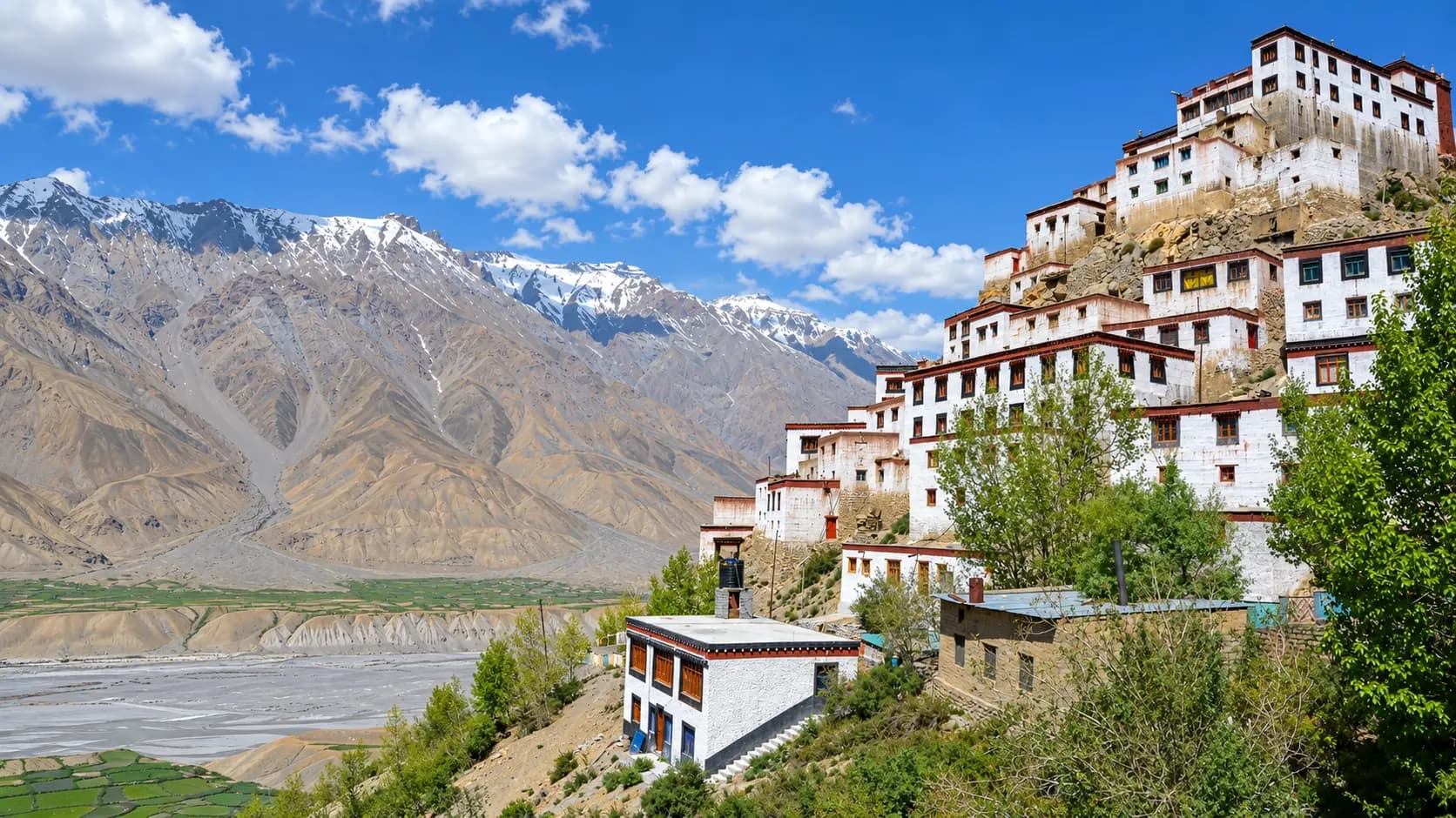
Positioned fourteen kilometers north of Kaza along the western bank of the Spiti River, Key Monastery is the largest, oldest, and most populous monastic institution in Spiti Valley. Founded in the eleventh century by Dromtön, a key disciple of the Bengali master Atisha, the monastery rises like an organic, whitewashed mountain fortress atop a conical hill at 4,166 meters. Serving as the primary educational center for the Gelugpa (Yellow Hat) order in the region, Key Monastery houses hundreds of monks, an exceptional library of sacred Tibetan texts, exquisite mural paintings, and ancient bronze Buddha statues. Ascending the monastery roof reveals sweeping 360-degree vistas across the braided floodplains of the Spiti River.
Kibber and the Chicham Suspension Bridge
Located six kilometers beyond Key Monastery at 4,270 meters, Kibber is a picturesque village of flat-roofed stone and mud houses surrounded by productive limestone agricultural terraces. Kibber serves as the gateway to the Kibber Wildlife Sanctuary, a critical protected habitat for snow leopards, ibex, and Tibetan wolves. Five kilometers past Kibber lies the sensational Chicham Bridge - one of the highest suspension bridges in Asia - spanning a terrifying 150-meter-deep vertical chasm that separates the cliffs of Kibber from the remote village of Chicham. Standing on the bridge while looking down into the narrow, shadowed canyon floor is an unforgettable highlight of upper Spiti travel.
In pictures
The practical bits
Before you go.
Plan ahead
A successful journey through the high-altitude realm of Kaza and Langza demands rigorous advance planning…Explore detailsClose details
A successful journey through the high-altitude realm of Kaza and Langza demands rigorous advance planning, physiological self-awareness, and logistical self-sufficiency.
Acclimatization Protocol
Allocate a mandatory minimum of forty-eight hours in Kaza at 3,650 meters before attempting overnight stays or…Explore detailsClose details
Allocate a mandatory minimum of forty-eight hours in Kaza at 3,650 meters before attempting overnight stays or strenuous uphill hiking in Langza at 4,400 meters, ensuring that your body adapts to thin air, preventing Acute Mountain Sickness (AMS), and monitoring your blood oxygen saturation with a pulse oximeter twice daily.
Cash and Banking Contingency
Withdraw all necessary physical cash at banks in Shimla, Reckong Peo, or Manali prior to entering Spiti Valley…Explore detailsClose details
Withdraw all necessary physical cash at banks in Shimla, Reckong Peo, or Manali prior to entering Spiti Valley, because the two commercial ATMs located in Kaza frequently run out of currency notes or experience extended network outages during power line cuts.
Vehicle Preparation and Fuel
Top off your vehicle's fuel tank completely at the Indian Oil retail outlet in Kaza - the highest commercial…Explore detailsClose details
Top off your vehicle's fuel tank completely at the Indian Oil retail outlet in Kaza - the highest commercial filling station in the world - and conduct a rigorous inspection of engine coolant, tire pressure, and brake linings before climbing the steep unpaved mountain switchbacks leading to Langza.
High-Altitude Packing Essentials
Pack heavy thermal base layers, a windproof and waterproof outer jacket, polarized UV400 sunglasses to protect…Explore detailsClose details
Pack heavy thermal base layers, a windproof and waterproof outer jacket, polarized UV400 sunglasses to protect against high-altitude snow glare, broad-spectrum SPF 50 sunscreen, an insulated water flask, and personal prescription medications including Diamox for altitude support.
Homestay Etiquette and Water Conservation
Conserve scarce high-desert water resources while staying in Langza village homestays, respect the traditional…Explore detailsClose details
Conserve scarce high-desert water resources while staying in Langza village homestays, respect the traditional dry composting toilet (chhaksa) systems by following your host's instructions regarding earth and sawdust application, and remove shoes before entering traditional carpeted living quarters.
+----------------------------------------------------------------------------------------------------+
|                                  SUGGESTED 4-DAY KAZA & LANGZA ITINERARY                           |
|                                                                                                    |
|  Day 1: Base Setup & Acclimatization in Kaza                                                       |
|  - Arrive in Kaza (3,650 m) via Kinnaur or Manali. Check into guesthouse/hotel.                    |
|  - Complete physical rest for 4-6 hours. Drink 3-4 liters of water and warm fluids.                |
|  - Late afternoon gentle stroll through Old Kaza (Kaza Khas) and Sakya Monastery.                  |
|                                                                                                    |
|  Day 2: Kaza Local Exploration & Key Monastery Staging                                            |
|  - Morning visit to Key Monastery (14 km) and Kibber Village (4,270 m) to test altitude response.  |
|  - Return to Kaza for lunch. Inspect vehicle condition, fuel up, and check tire pressure.         |
|  - Evening walk through Kaza Soma market; verify high-altitude emergency medicines.               |
|                                                                                                    |
|  Day 3: Ascent to Langza & The Highland Triangle                                                   |
|  - Morning drive (16 km) climbing from Kaza (3,650 m) to Langza (4,400 m).                         |
|  - Visit the colossal Golden Buddha statue and the 1,000-year-old Lang village temple.             |
|  - Explore the designated fossil scree beds with a local village guide (observe in situ).          |
|  - Continue along the highland loop to Komic (highest motorable village) and Hikkim (post office). |
|  - Return to Langza for an overnight homestay; witness the sunset on Chau Chau Kang Nilda.         |
|                                                                                                    |
|  Day 4: Stargazing Dawn, Descent & Onward Travel                                                  |
|  - Early morning sunrise photography over Chau Chau Kang Nilda and the golden Buddha.              |
|  - Traditional breakfast of fresh *tsampa* and herbal tea with your homestay host family.          |
|  - Descend the 16 km mountain road back to Kaza for onward transit toward Pin Valley or Tabo.     |
+----------------------------------------------------------------------------------------------------+
A few things you might wonder
Common questions about visiting Kaza & Langza. Fees, visiting hours and ceremonies are researched details that may change; confirm current arrangements with the operator before travelling.
What is the elevation of Kaza and Langza, and how do they differ?
Why is Langza called the "Fossil Village" of Spiti Valley?
Can tourists collect and take home fossils found around Langza village?
What medical facilities and altitude emergency services are available in Kaza?
Is an Inner Line Permit required to visit Kaza and Langza?
What are the accommodation and toilet facilities like in Langza?
How steep is the mountain road from Kaza to Langza, and what vehicle is required?
Are credit cards, ATMs, and mobile internet networks functional in Kaza and Langza?
Explore more in Spiti Valley
Discover other destinations around this hub
More Hubs in Himachal Pradesh
Continue exploring other travel hubs in this state
Planning a trip to Spiti Valley?