Chandratal Lake
Plan your journey to Chandratal Lake in Spiti Valley. Comprehensive guide covering high-altitude camping rules, 4,250 m elevation, Kunzum trek, route from Manali, and timings.
Location
Spiti Valley, Himachal Pradesh
A closer look
Your visit, at a glance.
Spiti Valley, Himachal Pradesh
GET TO KNOW THE PLACE
Nestled like a radiant celestial jewel amidst the stark, windswept scree slopes and glaciated massifs of the trans-Himalayan high desert at a breathless altitude of 4,250 meters…
The story of Chandratal Lake
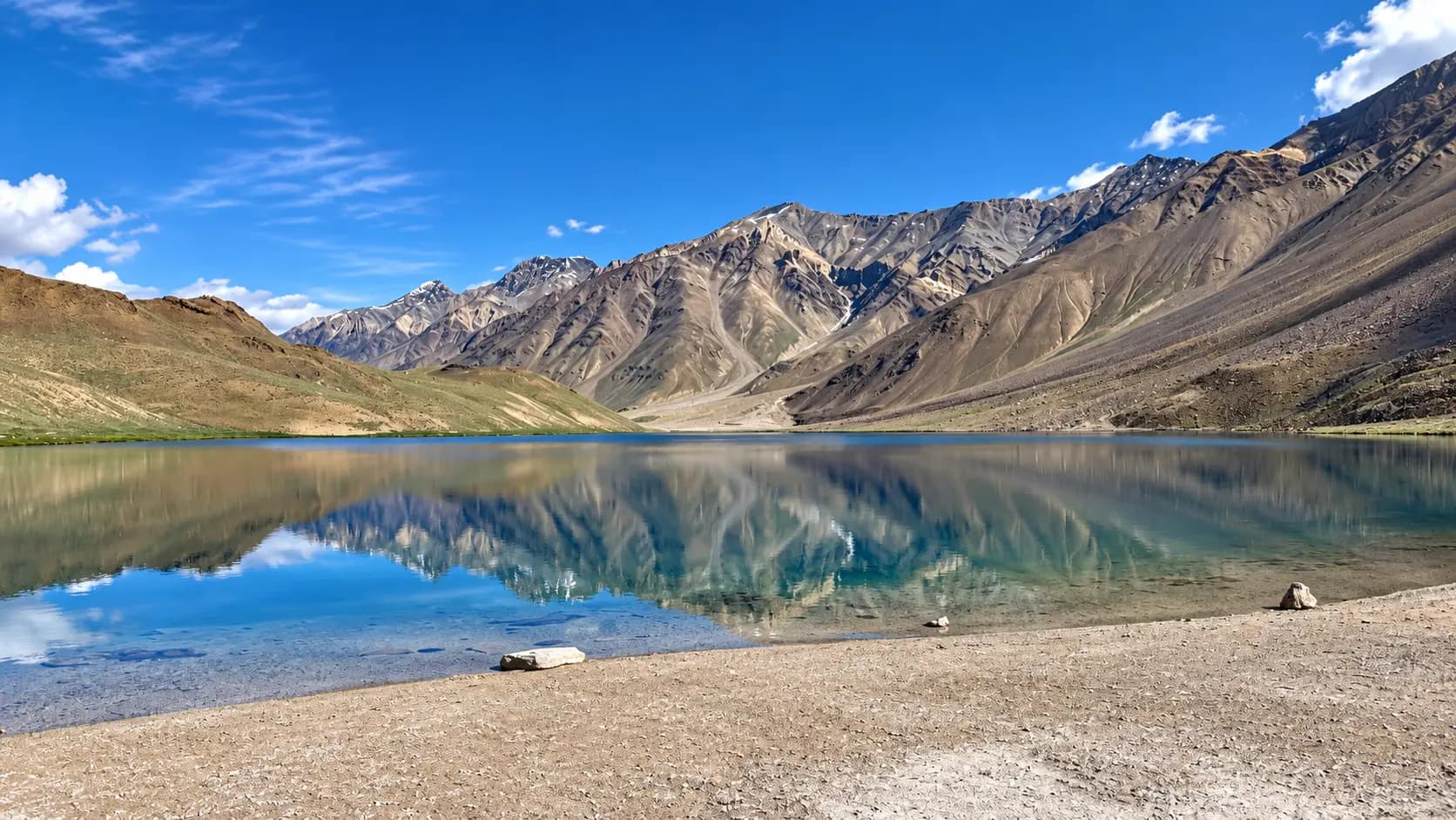
Nestled like a radiant celestial jewel amidst the stark, windswept scree slopes and glaciated massifs of the trans-Himalayan high desert at a breathless altitude of 4,250 meters (13,940 feet) above mean sea level, Chandratal Lake (also rendered as Chandra Taal, translating literally to the "Lake of the Moon" or Tso Chigma in the local Bhoti vernacular) is one of the most sublime, pristine, and ecologically precious natural wonders on planet Earth. Situated in the Spiti Tehsil of Himachal Pradesh’s remote Lahaul and Spiti District, approximately fourteen kilometers north of Batal, this ancient oligotrophic glacial tarn rests in a depression carved by Pleistocene glaciers on the Samudra Tapu plateau, flanked by the soaring snow-clad peaks of the Chandra-Bhaga (CB) mountain range.
Named for its distinct crescent-moon silhouette, Chandratal is an internationally protected freshwater sanctuary, formally designated as a Ramsar Wetland of International Importance (Ramsar Site No. 1569) in November 2005 under the United Nations Ramsar Convention on Wetlands. It is the primary hydrological origin of the sacred Chandra River, which tumbles through the arid gorges of Lahaul before joining the Bhaga River at Tandi to create the mighty Chandrabhaga (the Vedic Asikni, modern Chenab River).
Beyond its biological and hydrological prominence, Chandratal is steeped in profound epic mythology and indigenous spirituality. In the Hindu epic Mahabharata, it is celebrated as the sacred staging ground of the Swargarohana - where King Yudhishthira, the righteous Pandava king, was welcomed into the celestial chariot of Lord Indra to ascend to heaven in his mortal body. Surrounded by scree cirques that mirror themselves with mirror-glass perfection upon water that shifts dramatically from aquamarine to turquoise, sapphire, and deep obsidian as the high-altitude sun crosses the cobalt sky, Chandratal delivers an intensely spiritual, physically challenging, and unforgettable encounter with primordial wilderness.
Start here. Open a tile for the full details.
Why goRead details
For high-altitude trekkers, landscape photographers, wilderness purists, and spiritual pilgrims, reaching Chandratal Lake is a transformative life milestone. It combines extreme trans-Himalayan geography, international wetland ecology, epic mythological folklore, and unmatched astral nightscapes.
When to visitRead details
Chandratal Lake is completely inaccessible for seven to eight months of the year due to heavy snow and sub-zero blizzards. Its operational travel window is strictly limited to four months during the high Himalayan summer.
Entry & permissionsRead details
Fees, visiting hours and entry rules may change. Confirm the latest details with the official operator or local authority before travelling.
Because Chandratal is an internationally protected Ramsar wetland and a fragile cold-desert ecosystem, understanding entry regulations, conservation laws, and the strict camping ban is vital.
Admission Charges and Public Access
- Pedestrian Lake Access: Completely Free. There is no entry ticket, gate fee, or national park permit required for individuals to walk through the wetland or view the lake.
- Local Environmental Vehicle Toll: The local Gram Panchayat and administration collect a nominal green maintenance toll of approximately ₹100 to ₹200 per vehicle at the Batal checkpost / campsite barrier to fund garbage collection and seasonal road maintenance.
- Commercial Camping Tariffs: Luxury Swiss tents and dome tents at the authorized commercial campsite (3 km away) range between ₹1,500 and ₹4,000 per person per night, including dinner and breakfast.
Operating Hours and Daylight Access Guidelines
Facility / Section | Operating Days | Operating Hours | Regulatory Notes |
|---|---|---|---|
Chandratal Lake Shoreline | All 7 Days (June to Oct) | 06:00 to 18:00 (Daylight Hours) | Night walking or lingering after sunset strictly prohibited |
Vehicle Parking Barrier | All 7 Days | 06:00 to 18:00 | Vehicles must park here; 1 km walk to lake |
Official Camping Ground | All 7 Days | 24 Hours (Seasonal) | Located strictly 3 km south of the lake |
Winter Seasonal Closure | Mid-Oct to Mid-June | COMPLETELY CLOSED | Closed by heavy snow and ice; zero human presence |
Strict National Green Tribunal (NGT) Camping Prohibition
- The 3-Kilometer Buffer Zone: Following severe environmental degradation caused by unregulated tourism, the National Green Tribunal (NGT) and the Himachal Pradesh High Court passed strict, legally binding judgments banning all pitching of personal tents, commercial glamping, construction, and bonfires within a 3-kilometer radius of Chandratal Lake.
- Heavy Fines & Confiscation: Pitching a private tent near the water or on the surrounding moraines is a criminal environmental offense resulting in immediate equipment confiscation, heavy monetary fines, and potential legal prosecution by the Forest Department.
- Authorized Campsite: All overnight stays must take place at the designated official Chandratal Camping Site, situated exactly three kilometers south of the parking barrier, where organized waste management and solar lighting are maintained.
Cultural and Ecological Sanctuary Etiquette
- Strictly No Bathing or Stepping in Water: Chandratal is revered as a holy pilgrimage site by local Buddhist and Hindu communities and is a sensitive oligotrophic aquatic habitat. Stepping into the water, washing feet, soaking, swimming, or washing utensils in the lake is strictly prohibited and deeply offensive to local cultural traditions.
- Zero-Waste Mandate: There are no municipal trash bins at the lake. Carry all personal waste (candy wrappers, water bottles, tissue paper, fruit peels) back to your campsite or vehicle.
- Drone Operations: Flying unmanned aerial vehicles (drones) over Chandratal Lake is strictly prohibited without formal written clearance from the District Magistrate, Lahaul & Spiti, as drones disturb nesting migratory birds and violate wildlife protection laws.
Plan your visitRead details
Reaching Chandratal Lake requires traversing some of the most dramatic, rugged, and isolated mountain road networks in the Indian Himalayas.
Altitude Acclimatization & AMS Prevention
Chandratal sits at 4,250 meters (nearly 14,000 feet), where Acute Mountain Sickness (AMS) is a very real medical danger. Never travel directly from the plains (Delhi/Chandigarh) to Chandratal in a single day. Spend at least one full night acclimatizing in Manali (2,050 m) or Kaza (3,650 m) before ascending. Drink at least 3 to 4 liters of water daily, avoid alcohol, and carry prophylactic altitude medication (such as Diamox / Acetazolamide) after consulting your physician. If you experience severe throbbing headaches, vomiting, or breathlessness, descend immediately to Batal or Kaza.
Explore the full guide - choose a topic below.
Why visit?
For high-altitude trekkers, landscape photographers, wilderness purists, and spiritual pilgrims, reaching…Explore detailsClose details
For high-altitude trekkers, landscape photographers, wilderness purists, and spiritual pilgrims, reaching Chandratal Lake is a transformative life milestone. It combines extreme trans-Himalayan geography, international wetland ecology, epic mythological folklore, and unmatched astral nightscapes.
1. The Chromatic Miracle of the Moon Lake
The visual magic of Chandratal lies in its surreal, shifting optical character:
- Liquid Turquoise & Sapphire: Due to its immense purity, extreme cold, low organic matter (oligotrophic nature), and fine suspension of glacial rock flour, the water exhibits a color spectrum unlike almost any other body of water in Asia.
- Diurnal Transformation: At sunrise, when freezing air still hovers around the rocks, the lake reflects a soft, pale aquamarine. As the midday sun ascends through the thin high-altitude atmosphere, the water erupts into intense, electric shades of turquoise and emerald green. By late afternoon, under the shadow of the western peaks, the water deepens into rich sapphire, violet, and dark cobalt blue.
- Glass-Like Reflections: In the calm early morning before the afternoon mountain gales begin, the surface of the lake is as flat as polished crystal. The snow-streaked summits of the 6,000-meter Chandra-Bhaga range, the jagged scree pyramids, and the white stupas and prayer flags are reflected with razor-sharp fidelity, creating a disorienting, dreamlike symmetry between earth and sky.
2. A Ramsar Wetland of Global Ecological Importance
Designated on 8 November 2005 under the Ramsar Convention, the 49-hectare Chandertal wetland is recognized globally for its pristine high-altitude cold-desert ecosystem:
- High-Altitude Oasis: In an otherwise barren, gravel-strewn moonscape where annual rainfall rarely exceeds 200 millimeters, Chandratal creates an oasis of life. The surrounding marshy fringes and alpine meadows (bugyals) support rare, specialized high-altitude vegetation, including dwarf willows, wild buttercups, gentians, and medicinal Himalayan herbs.
- Avian Sanctuary for Migratory Birds: During the short summer breeding season, the lake becomes a vital nesting and transit haven for rare migratory waterfowl crossing the Himalayan barrier. Visitors can observe the striking bar-headed goose (Anser indicus - the world's highest-flying bird, capable of flying over Mount Everest), golden-hued ruddy shelducks (Brahminy ducks), common teals, snowcocks, and red-billed choughs.
- Trans-Himalayan Mammalian Fauna: The surrounding cliffs and high valleys are home to the endangered snow leopard (Panthera uncia), agile herds of Himalayan ibex (Capra sibirica) balancing on sheer scree ledges, blue sheep (bharal), Tibetan wolves, red foxes, and chubby, golden Himalayan marmots sunning themselves on granite boulders.
3. The Mahabharata Legend of Yudhishthira’s Ascent to Heaven
Chandratal carries deep mythological resonance within the sacred geography of ancient India:
- The Final Journey (Mahaprasthana): According to the concluding chapters of the Mahabharata, following the devastation of the Kurukshetra war and decades of rule in Hastinapur, the five Pandava brothers and Queen Draupadi renounced their kingdom and set forth on foot across the Himalayas toward the heavens (Swargarohana).
- The Heavenly Chariot at Chandratal: One by one, Draupadi and the four younger brothers (Sahadeva, Nakula, Arjuna, and Bhima) fell along the icy path, succumbing to their mortal attachments. Only the eldest brother, the strictly righteous King Yudhishthira, remained standing, accompanied by a loyal stray dog that had followed him across the wilderness. Upon reaching the serene shores of Chandratal, the clouds parted, and Lord Indra, King of the Gods, descended from the heavens in his radiant celestial chariot (pushpaka vimana). Indra invited Yudhishthira to step into the chariot and enter heaven in his living human body - a divine honor granted because Yudhishthira refused to enter heaven unless his faithful dog (who was Dharma, the god of righteousness, in disguise) was permitted to accompany him.
- The Sacred Kora (Circumambulation): Because of this sacred legend, local Spitian Buddhists and nomadic Gaddi shepherds revere the lake as holy. Pilgrims undertake the 2.5-kilometer ritual circumambulation (kora or parikrama) around the water's edge, walking strictly in a clockwise direction while reciting mantras and tying auspicious silk prayer scarves (khatas) to cairns.
4. World-Class High-Altitude Astral Photography
Because Chandratal is situated at 4,250 meters, isolated from any town or electric grid by dozens of kilometers of uninhabited mountain wilderness, it possesses some of the darkest, cleanest, and most transparent night skies on earth:
- Zero Light Pollution: With a Bortle Class 1 night sky, the Milky Way core arches across the celestial sphere with brilliant, three-dimensional clarity, illuminating the dark water with starlight.
- Astrophotographer's Dream: Photographers from around the world camp at the designated campsite to shoot long-exposure star trails, meteor showers, and high-altitude galactic time-lapses framed by snow peaks and glacial valleys.
What to expect
Visiting a high-altitude glacial lake at 4,250 meters in one of the most remote regions of India requires mental…Explore detailsClose details
Visiting a high-altitude glacial lake at 4,250 meters in one of the most remote regions of India requires mental preparation, physical acclimatization, and a deep respect for wilderness rules.
1. The Rough Mountain Drive from Batal
Accessing Chandratal by road is an adventure in itself:
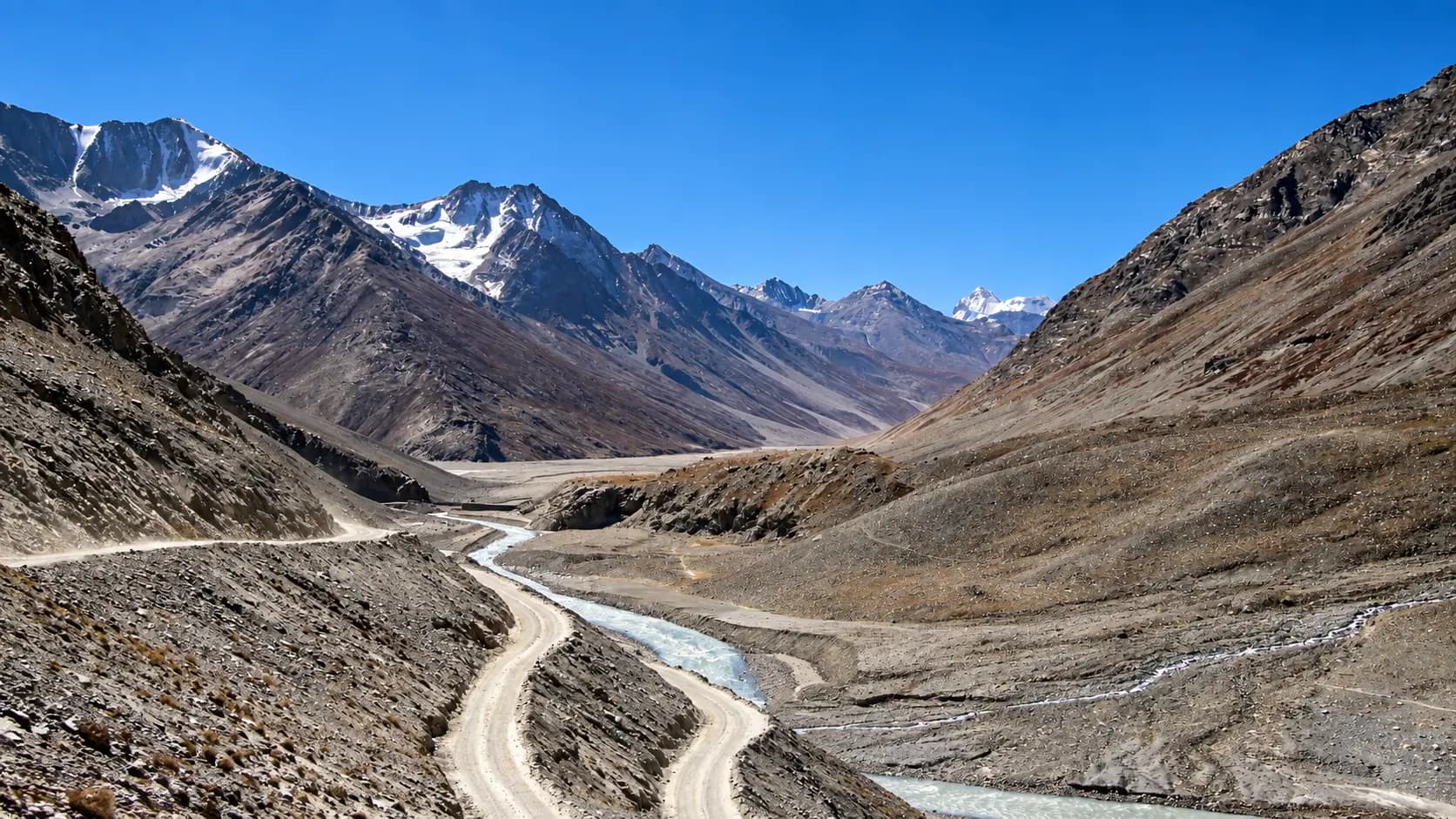
- The Batal Diversion: Branching off National Highway 505 at the tiny transit post of Batal (home to the legendary roadside dhaba of "Chacha-Chachi"), the road to Chandratal is an unpaved, single-lane dirt track carved directly into sheer scree cliffs above the roaring Chandra River.
- The 14-Kilometer Traverse: Spanning fourteen kilometers, this road features stream crossings (water nullahs), loose river gravel, and narrow shelf roads with dramatic drops and blind turns. It takes approximately 45 to 60 minutes of slow, concentrated driving in a four-wheel-drive (4x4) SUV or high-clearance mountain vehicle.
2. The Roadhead Parking Barrier & The 1-Kilometer Walk
In accordance with strict environmental protection orders:
- The Vehicle Barrier: All motorized vehicles - including taxis, private SUVs, and motorbikes - must stop at the designated parking barrier located roughly one kilometer from the lake shore. Absolutely no vehicles are permitted beyond this point.
- The Gentle Walking Trail: From the parking barrier, visitors must walk the remaining distance along a clearly marked, gently undulating earthen and stone footpath winding over ancient glacial moraines.
- Altitude Reality: While the trail has only a modest 30-meter elevation gain, at an altitude of 4,250 meters, the thin air contains roughly 40% less oxygen than at sea level. Even a gentle stroll will leave unacclimatized visitors breathing heavily. Walk at a slow, steady, rhythmic pace, take deep breaths, and avoid rushing.
3. The Grand Arrival at the Shore
Topping the final gravel ridge reveals the astonishing vista:
- First Sight: The brilliant turquoise lake suddenly opens up before you, cradled within a natural amphitheater of reddish-brown scree slopes, green alpine mosses, and distant white glaciated summits.
- The Shoreline Atmosphere: There are no concrete walkways, fences, or commercial stalls here. The shore is made of smooth gravel, slate rocks, and soft alpine turf decorated with white and purple wildflowers in summer. Small stone cairns topped with colorful Buddhist prayer flags (lungta) flutter wildly in the mountain wind.
- Strict Conservation Rules: Signs posted by the Himachal Pradesh Forest Department and the District Administration firmly remind visitors that touching the water, stepping into the lake, washing clothes, bathing, and littering are strictly prohibited.
4. High-Altitude Afternoon Winds & Rapid Weather Shifts
- Calm Mornings vs Gale-Force Afternoons: Morning hours (07:00 to 11:30) are typically calm, sunny, and serene, with mirror-glass water reflections. Starting around noon, powerful thermal winds begin howling down the Chandra Valley, whipping the lake into white-capped waves and dropping the perceived temperature dramatically within minutes.
- Extreme Solar Radiation: Due to the thin atmosphere and altitude, UV radiation is exceptionally intense. Sunburn can occur in less than twenty minutes without protective sunscreen and sunglasses.
Best time to visit
Chandratal Lake is completely inaccessible for seven to eight months of the year due to heavy snow and sub-zero…Explore detailsClose details
Chandratal Lake is completely inaccessible for seven to eight months of the year due to heavy snow and sub-zero blizzards. Its operational travel window is strictly limited to four months during the high Himalayan summer.
Season / Period | Daytime Temp | Nighttime Temp | Access & Environmental Conditions |
|---|---|---|---|
Late June (Opening Window) | 6°C to 14°C | -4°C to 2°C | Passes Open: BRO clears snow from Kunzum Pass and Batal road; residual snow walls line the trails; icy turquoise waters; cold crisp air; campsites begin setting up. |
July to August (Peak Summer) | 10°C to 18°C | 0°C to 5°C | Peak Travel Season: Warmest sunny days; alpine meadows carpeted in wildflowers; migratory bar-headed geese active; campsites fully operational; heavy stream crossings on approach roads. |
September (Prime Clarity) | 6°C to 15°C | -5°C to 0°C | Ultimate Season for Photography: Stream crossings dry up; spotless deep blue skies; razor-sharp mountain reflections; brilliant night skies; freezing sub-zero nights. |
Early to Mid-October | 0°C to 10°C | -12°C to -4°C | Late Autumn & Early Freeze: Lake begins freezing along the edges; bitter howling winds; campsites begin dismantling; first winter snowstorms close the passes. |
Late October to Early June | -30°C to -10°C | -35°C to -20°C | Completely Closed: Lake frozen solid under 10 - 15 feet of snow; all roads blocked; uninhabited arctic wilderness; zero access. |
The Prime Photography & Trekking Window (September)
September is universally recognized by mountain experts as the premier month to experience Chandratal. The southwest monsoon in the lower valleys recedes, completely eliminating cloud cover and rain risks. The high-altitude streams (pagal nullahs) on the approach road from Manali dry to manageable trickles, making driving significantly safer. The skies are a deep, spotless cobalt blue, and the air is crisp and pure, offering breathtaking lake reflections by day and unparalleled Milky Way visibility by night.
The Peak Summer Window (July to August)
July and August are ideal for travelers seeking the warmest temperatures and vibrant wildlife. The Samudra Tapu plateau comes alive with blooming yellow, purple, and white alpine flowers. Migratory waterfowl rear their chicks on the northern marshes, and the turquoise waters glisten beneath the summer sun. However, travelers driving from Manali via Gramphu and Chhatru must exercise caution, as afternoon glacial meltwater surges can make mountain stream crossings challenging.
How to reach
Reaching Chandratal Lake requires traversing some of the most dramatic, rugged, and isolated mountain road…Explore detailsClose details
Reaching Chandratal Lake requires traversing some of the most dramatic, rugged, and isolated mountain road networks in the Indian Himalayas.
Route 1: From Manali via Atal Tunnel & Batal (The Western Approach)
The most common route for travelers originating in northern India:
- The Route: Manali (2,050 m) → North Portal of Atal Tunnel (3,048 m) → Gramphu (NH-505 junction) → Chhatru (3,360 m) → Batal (3,960 m) → branch road north to Chandratal Parking Barrier (4,250 m).
- Distance & Driving Time: Approximately 125 kilometers, taking roughly 6 to 8 hours of continuous, slow-paced driving.
- Road Character: From Manali to the Atal Tunnel is a smooth four-lane highway. From Gramphu to Batal, National Highway 505 is an unpaved, rough gravel-and-boulder road hugging the cliff edge above the raging Chandra River, featuring multiple glacial stream crossings (Chhatru nullah, Chhota Dara nullahs). The final 14 kilometers from Batal to Chandratal is a narrow, single-lane dirt track with tight cliff switchbacks. High-clearance vehicles (SUVs, 4x4 Scorpios, Boleros, Innovas, or adventure motorcycles) are strongly recommended.
Route 2: From Kaza via Kunzum Pass (The Spiti Approach)
For travelers already exploring Spiti Valley:
- The Route: Kaza (3,650 m) → Rangrik → Losar (4,080 m) → Kunzum Pass (4,551 m) → Batal (3,960 m) → Chandratal (4,250 m).
- Distance & Driving Time: Approximately 85 kilometers, taking roughly 4 to 5 hours.
- Acclimatization Advantage: Travelers approaching from Kaza are already thoroughly acclimatized to high altitudes (3,600+ m), vastly reducing the risk of Acute Mountain Sickness (AMS) at the lake.
Route 3: The High-Altitude Alpine Trek from Kunzum Pass
For avid trekkers and backpackers, this is one of the most magnificent day hikes in the Himalayas:
- Trail Overview: Instead of driving down from Kunzum Pass to Batal, hikers disembark at the prayer-flag-strewn crest of Kunzum Pass (4,551 m) and take the well-marked footpath branching directly north along the high mountain ridge.
- Distance & Duration: Approximately 8.5 kilometers, taking roughly 3.5 to 4.5 hours of gentle, high-altitude ridge walking.
- Panoramic Vistas: The trail stays high above the Chandra Valley, offering sweeping vistas of the CB range glaciers and the sprawling Samudra Tapu plateau before gently descending directly onto the northern moraine of Chandratal Lake.
Broad Transit Connections
- Nearest Airport: Bhuntar Airport (KUU) near Kullu, approximately 165 kilometers southwest (approx. 7 - 8 hours by road).
- Nearest Broad-Gauge Railhead: Chandigarh Railway Station (CDG), approximately 425 kilometers southwest (approx. 13 - 15 hours via Atal Tunnel).
- Public Transport: HRTC operates a seasonal daily bus service between Manali and Kaza via Batal (operating July to September). Passengers can disembark at Batal and hire a local 4x4 taxi or hitch a ride along the 14 km branch road to the Chandratal camping zone.
Entry, timings and permissions
Fees, visiting hours and entry rules may change.Explore detailsClose details
Fees, visiting hours and entry rules may change. Confirm the latest details with the official operator or local authority before travelling.
Because Chandratal is an internationally protected Ramsar wetland and a fragile cold-desert ecosystem, understanding entry regulations, conservation laws, and the strict camping ban is vital.
Admission Charges and Public Access
- Pedestrian Lake Access: Completely Free. There is no entry ticket, gate fee, or national park permit required for individuals to walk through the wetland or view the lake.
- Local Environmental Vehicle Toll: The local Gram Panchayat and administration collect a nominal green maintenance toll of approximately ₹100 to ₹200 per vehicle at the Batal checkpost / campsite barrier to fund garbage collection and seasonal road maintenance.
- Commercial Camping Tariffs: Luxury Swiss tents and dome tents at the authorized commercial campsite (3 km away) range between ₹1,500 and ₹4,000 per person per night, including dinner and breakfast.
Operating Hours and Daylight Access Guidelines
Facility / Section | Operating Days | Operating Hours | Regulatory Notes |
|---|---|---|---|
Chandratal Lake Shoreline | All 7 Days (June to Oct) | 06:00 to 18:00 (Daylight Hours) | Night walking or lingering after sunset strictly prohibited |
Vehicle Parking Barrier | All 7 Days | 06:00 to 18:00 | Vehicles must park here; 1 km walk to lake |
Official Camping Ground | All 7 Days | 24 Hours (Seasonal) | Located strictly 3 km south of the lake |
Winter Seasonal Closure | Mid-Oct to Mid-June | COMPLETELY CLOSED | Closed by heavy snow and ice; zero human presence |
Strict National Green Tribunal (NGT) Camping Prohibition
- The 3-Kilometer Buffer Zone: Following severe environmental degradation caused by unregulated tourism, the National Green Tribunal (NGT) and the Himachal Pradesh High Court passed strict, legally binding judgments banning all pitching of personal tents, commercial glamping, construction, and bonfires within a 3-kilometer radius of Chandratal Lake.
- Heavy Fines & Confiscation: Pitching a private tent near the water or on the surrounding moraines is a criminal environmental offense resulting in immediate equipment confiscation, heavy monetary fines, and potential legal prosecution by the Forest Department.
- Authorized Campsite: All overnight stays must take place at the designated official Chandratal Camping Site, situated exactly three kilometers south of the parking barrier, where organized waste management and solar lighting are maintained.
Cultural and Ecological Sanctuary Etiquette
- Strictly No Bathing or Stepping in Water: Chandratal is revered as a holy pilgrimage site by local Buddhist and Hindu communities and is a sensitive oligotrophic aquatic habitat. Stepping into the water, washing feet, soaking, swimming, or washing utensils in the lake is strictly prohibited and deeply offensive to local cultural traditions.
- Zero-Waste Mandate: There are no municipal trash bins at the lake. Carry all personal waste (candy wrappers, water bottles, tissue paper, fruit peels) back to your campsite or vehicle.
- Drone Operations: Flying unmanned aerial vehicles (drones) over Chandratal Lake is strictly prohibited without formal written clearance from the District Magistrate, Lahaul & Spiti, as drones disturb nesting migratory birds and violate wildlife protection laws.
Nearby places to consider
Chandratal’s position in the high Himalayan corridor between Lahaul and Spiti places it near several of northern…Explore detailsClose details
Chandratal’s position in the high Himalayan corridor between Lahaul and Spiti places it near several of northern India’s most awe-inspiring mountain passes, rivers, and monasteries:
1. Kunzum Pass / Kunzum La (Approx. 22 km Southeast via Batal)
Towering at an altitude of 4,551 meters (14,931 feet), Kunzum Pass is the majestic high-altitude gateway connecting the Lahaul Valley with the Spiti Valley. Crowned by fifteen ancient Buddhist stupas draped in hundreds of colorful prayer flags, vehicles traditionally circumambulate the shrine of Kunzum Mata to pray for safe mountain passage.
2. Batal & The Chandra River Gorge (Approx. 14 km South)
The rustic transit intersection at the base of the Chandratal branch road along NH-505. Nestled beside the roaring glacial torrents of the Chandra River and beneath towering hanging glaciers, Batal is famous for the legendary roadside shelter and hospitality of the "Chacha-Chachi" dhaba.
3. Losar Village (Approx. 40 km Southeast via Kunzum Pass)
The first traditional Spitian village encountered upon descending the eastern side of Kunzum Pass into Spiti Valley. Sitting at an altitude of 4,080 meters amidst willow trees and barley terraces, Losar features traditional whitewashed mud-brick Tibetan homes and welcoming homestays.
4. Samudra Tapu Glacier & Lake (Approx. 20 km North by Trek)
A massive, remote valley glacier stretching for over 16 kilometers beneath the peaks of the Pir Panjal Range, feeding glacial meltwater into the Chandra River. Reached only via multi-day expedition-style backcountry treks.
5. Kaza & Key Monastery (Approx. 85 km Southeast)
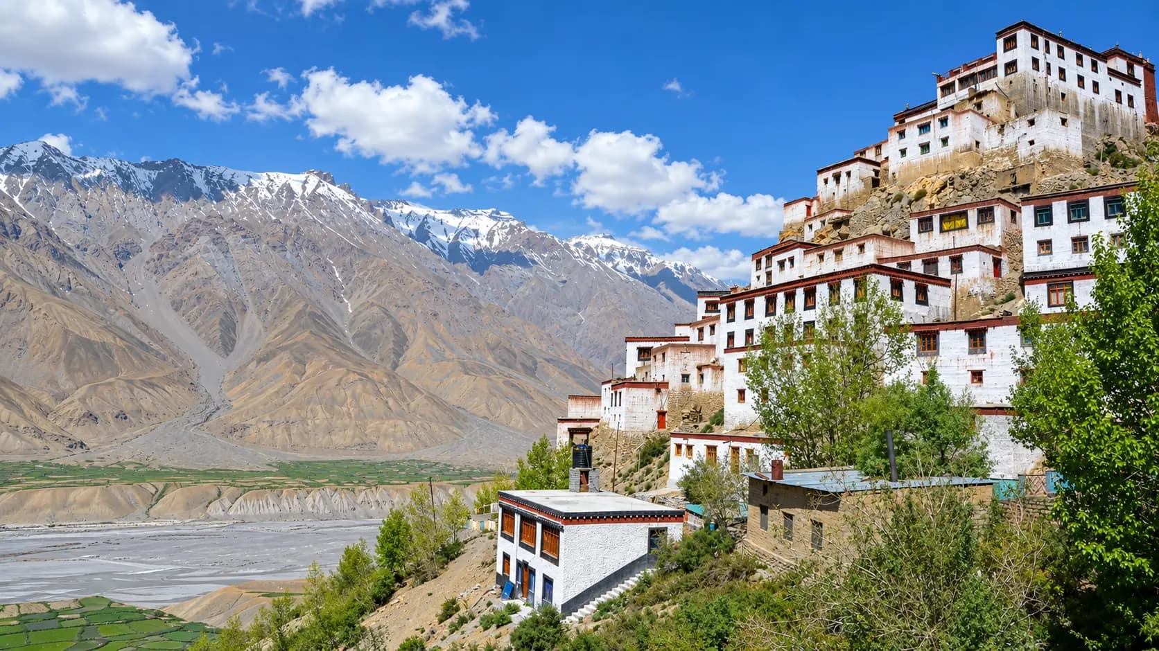
The administrative headquarters and cultural capital of Spiti Valley. Kaza is the ideal base for visiting the iconic 1,000-year-old Key Monastery, the fossil village of Langza, and the world’s highest post office at Hikkim.
In pictures
The practical bits
Before you go.
Plan ahead
A successful trip to 4,250 meters in the high Himalayas demands thorough physical preparation, altitude…Explore detailsClose details
A successful trip to 4,250 meters in the high Himalayas demands thorough physical preparation, altitude awareness, and proper cold-weather gear. Review these four mandatory preparation blocks:
Altitude Acclimatization & AMS Prevention
Chandratal sits at 4,250 meters (nearly 14,000 feet), where Acute Mountain Sickness (AMS) is a very real medical…Explore detailsClose details
Chandratal sits at 4,250 meters (nearly 14,000 feet), where Acute Mountain Sickness (AMS) is a very real medical danger. Never travel directly from the plains (Delhi/Chandigarh) to Chandratal in a single day. Spend at least one full night acclimatizing in Manali (2,050 m) or Kaza (3,650 m) before ascending. Drink at least 3 to 4 liters of water daily, avoid alcohol, and carry prophylactic altitude medication (such as Diamox / Acetazolamide) after consulting your physician. If you experience severe throbbing headaches, vomiting, or breathlessness, descend immediately to Batal or Kaza.
Sub-Zero Thermal Clothing Strategy
High-altitude desert temperatures fluctuate wildly.Explore detailsClose details
High-altitude desert temperatures fluctuate wildly. While a sunny midday can reach 16°C, the temperature plunges below freezing within thirty minutes after sunset, regularly hitting -4°C to -8°C at night even in July. Dress in three technical layers: a moisture-wicking thermal base layer, a heavy fleece or woolen mid-layer, and a windproof, waterproof down jacket (rated to -10°C). Carry warm fleece gloves, a woolen beanie that covers your ears, a neck gaiter, and polarized UV sunglasses to prevent snow and water glare blindness.
Sturdy Footwear for Moraine Walking
Wear broken-in, supportive hiking boots with deep rubber lug soles and ankle support.Explore detailsClose details
Wear broken-in, supportive hiking boots with deep rubber lug soles and ankle support. The one-kilometer trail from the parking barrier to the lake traverses uneven glacial moraines, loose shale, and gravel. Thin sneakers or flat fashion shoes will cause twisted ankles and sore feet on the rocky terrain.
Pre-Noon Lake Arrival for Glass Reflections
Plan your itinerary to arrive at Chandratal between 07:30 and 10:30 in the morning.Explore detailsClose details
Plan your itinerary to arrive at Chandratal between 07:30 and 10:30 in the morning. During these early hours, the water is as smooth as glass, creating the world-famous mirror reflections of the surrounding snow peaks. By 12:30 PM, ferocious thermal winds sweep through the valley, rippling the water and making photography and walking significantly colder and more challenging.
Suggested 2-Day Chandratal Wilderness Circuit
Day 1: Manali to Batal & Chandratal Campsite
06:00 - 07:30: Scenic Drive through Atal Tunnel
Depart Manali early.Explore detailsClose details
Depart Manali early. Drive through the 9.02 km Atal Tunnel, emerging at the North Portal in the dramatic U-shaped valley of Lahaul.
07:30 - 12:30: The Rugged NH-505 Chandra Valley Drive
Turn east at Gramphu onto National Highway 505.Explore detailsClose details
Turn east at Gramphu onto National Highway 505. Navigate the rough, boulder-strewn road past Chhatru and the cascading glacial streams of Chhota Dara, arriving at the historic transit post of Batal (3,960 m) by 12:30.
12:30 - 13:30: Lunch at Batal Dhaba
Enjoy a hearty, world-famous mountain lunch of steaming hot rajma chawal and kadhi at the legendary…Explore detailsClose details
Enjoy a hearty, world-famous mountain lunch of steaming hot rajma chawal and kadhi at the legendary "Chacha-Chachi" dhaba.
13:30 - 15:00: Drive to Chandratal Campsite
Drive the 14-kilometer dirt track along the Chandra River, checking into your pre-booked luxury dome or Swiss…Explore detailsClose details
Drive the 14-kilometer dirt track along the Chandra River, checking into your pre-booked luxury dome or Swiss tent at the official Chandratal Camping Site (3 km from the lake).
15:00 - 18:00: Rest & Acclimatization
Rest in your tent, drink plenty of warm water, and allow your body to adapt to the 4,200-meter altitude.Explore detailsClose details
Rest in your tent, drink plenty of warm water, and allow your body to adapt to the 4,200-meter altitude. Take a short, gentle walk around the campsite meadows.
18:00 - 21:00: Warm Dinner & Stargazing
Savor a hot dinner in the communal dining tent, followed by breathtaking, unpolluted views of the Milky Way…Explore detailsClose details
Savor a hot dinner in the communal dining tent, followed by breathtaking, unpolluted views of the Milky Way arching across the Himalayan summits before retiring early into heavy woolen quilts.
Day 2: Morning Lake Exploration & Onward Journey
06:30 - 07:30: Early Morning Drive to Parking Barrier
Depart the campsite in the crisp morning sunlight.Explore detailsClose details
Depart the campsite in the crisp morning sunlight. Drive the final 2 kilometers to the designated vehicle barrier.
07:30 - 08:00: The 1-Kilometer Moraine Walk
Walk the gentle earthen trail over the moraines, breathing in the crisp, pure alpine air. -Explore detailsClose details
Walk the gentle earthen trail over the moraines, breathing in the crisp, pure alpine air.
08:00 - 10:30: Sacred Lake Circumambulation (Kora)
Arrive at Chandratal.Explore detailsClose details
Arrive at Chandratal. Marvel at the liquid turquoise mirror reflections of the CB range peaks. Undertake the serene 2.5-kilometer clockwise walk around the shoreline, photograph the vibrant prayer flags, spot migratory bar-headed geese, and sit quietly in contemplation of Yudhishthira’s celestial ascent.
10:30 - 11:15: Walk Back to Vehicle
Walk back to the parking barrier before the afternoon gales begin. -Explore detailsClose details
Walk back to the parking barrier before the afternoon gales begin.
11:15 Onward: Journey to Kaza or Return to Manali
Drive back down to Batal.Explore detailsClose details
Drive back down to Batal. Either cross the 4,551-meter Kunzum Pass eastward into Spiti Valley toward Kaza, or retrace your route westward along NH-505 back to Manali.
A few things you might wonder
Common questions about visiting Chandratal Lake. Fees, visiting hours and ceremonies are researched details that may change; confirm current arrangements with the operator before travelling.
What is the exact altitude of Chandratal Lake, and where is it located?
Why is Chandratal Lake called the 'Lake of the Moon'?
Can you camp directly on the shores of Chandratal Lake?
Is Chandratal Lake open throughout the year?
How far do you have to walk to reach Chandratal Lake from your vehicle?
Can you swim or bathe in Chandratal Lake?
Explore more in Spiti Valley
Discover other destinations around this hub
More Hubs in Himachal Pradesh
Continue exploring other travel hubs in this state
Planning a trip to Spiti Valley?