Rohtang Pass
Plan your trip to Rohtang Pass in Himachal Pradesh. Comprehensive guide covering NGT permits, height (3,978 m), snow activities, road routes, and Beas Kund.
Location
Manali Kullu, Himachal Pradesh
A closer look
Your visit, at a glance.
Manali Kullu, Himachal Pradesh
GET TO KNOW THE PLACE
Towering majestically at an elevation of 3,978 meters (13,050 feet) above mean sea level across the eastern Pir Panjal Range of the Western Himalayas, Rohtang Pass is one of the…
The story of Rohtang Pass
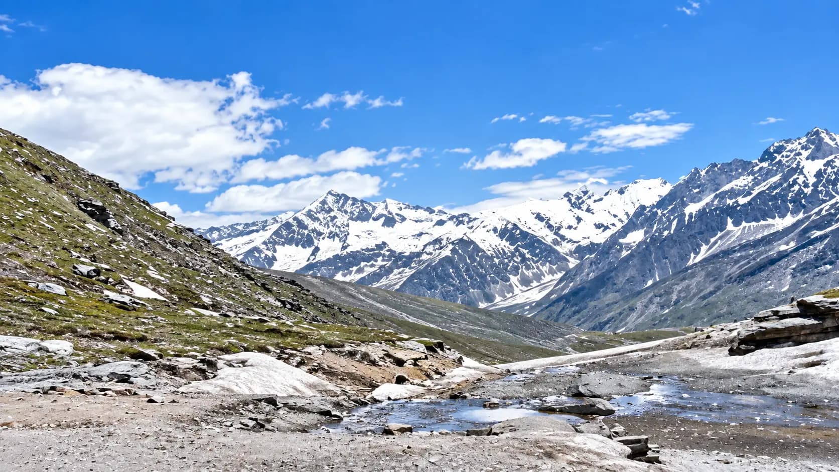
Towering majestically at an elevation of 3,978 meters (13,050 feet) above mean sea level across the eastern Pir Panjal Range of the Western Himalayas, Rohtang Pass is one of the most famous, historically formidable, and visually dramatic mountain passes on earth. Situated approximately 51 kilometers northeast of Manali in Himachal Pradesh, Rohtang Pass marks a profound geographical, ecological, and cultural boundary. To its south lie the lush, monsoon-fed deodar cedar forests, emerald apple orchards, and terraced Hindu villages of the Kullu Valley. To its north rises the arid, rain-shadow expanse of the Tibetan Plateau’s trans-Himalayan desert: the stark, windswept Buddhist valleys of Lahaul and Spiti, leading onward to Ladakh and Central Asia.
Historically revered by indigenous hill folk as Bhrigu Tung and later known in the Ladakhi and Bhoti vernacular as Rohtang La, the pass holds a storied place in trans-Himalayan trade and exploration. The very word "Rohtang" carries a grim and evocative literal translation: "Ground of Corpses" or "Pile of Dead Bodies." This chilling name was earned over centuries of brutal history, when unpredictable blizzards, howling sub-zero gale-force winds, avalanches, and sudden whiteout storms routinely claimed the lives of traders, shepherds, pack mules, and pilgrims attempting the treacherous traverse between the plains of India and the silk routes of Yarkand and Tibet.
Today, while the newly engineered 9.02-kilometer Atal Tunnel provides an all-weather vehicular bypass beneath the mountain ridge for transit into Lahaul, Rohtang Pass itself remains one of India’s ultimate high-altitude travel experiences. Regulated under strict ecological mandates by the National Green Tribunal (NGT) to preserve its fragile glaciers, the journey up Rohtang’s 38 winding hairpin bends offers travelers an exhilarating encounter with raw alpine grandeur, eternal snowfields, pristine glacial origins of the sacred Beas River, and panoramic vistas of towering 6,000-meter Himalayan summits.
Start here. Open a tile for the full details.
Why goRead details
For mountaineers, nature lovers, photographers, and high-altitude adventurers, standing upon the windswept crest of Rohtang Pass is a quintessential Himalayan milestone. It combines epic geography, mythological heritage, and jaw-dropping alpine scenery into an unforgettable day excursion from Manali.
When to visitRead details
Rohtang Pass is completely inaccessible during the winter due to avalanche hazards and 20-foot snowdrifts. Its operational tourist season is limited to roughly five to six months of the year.
Entry & permissionsRead details
Fees, visiting hours and entry rules may change. Confirm the latest details with the official operator or local authority before travelling.
Because Rohtang Pass is an ecologically sensitive alpine zone strictly regulated by the judiciary and district administration, understanding entry rules and permit procedures is paramount.
The National Green Tribunal (NGT) Permit System
In order to arrest the rapid melting of the Rahla and Rohtang glaciers caused by vehicular emissions and diesel soot, the National Green Tribunal (NGT) instituted a legally binding daily vehicular quota:
- Daily Quota: Only 1,200 vehicles per day are permitted to cross the Gulaba checkpost to visit Rohtang Pass.
- 800 Petrol Vehicles
- 400 Diesel Vehicles
- Online Booking Portal: Vehicle permits must be applied for and downloaded exclusively through the official Kullu District portal:
https://rohtangpermits.nic.in/Home/InformatoryScreen/. - Application Window: Permits open in rolling advance windows:
- First window opens 6 days prior to the travel date at 10:00 AM (for 50% of the quota).
- Second window opens 2 days prior to the travel date at 10:00 AM (for the remaining 50% of the quota).
- Required Documents: You must upload a scanned copy of the vehicle’s valid Registration Certificate (RC) and a current Pollution Under Control (PUC) certificate. Vehicles older than 10 years (for diesel) or 15 years (for petrol) are denied permits under NGT pollution control norms.
Tariff and Environmental Fees
Fee Category | Amount (INR) | Applicability & Regulatory Basis |
|---|---|---|
NGT Environmental Congestion Cess | ₹500 | Mandatory statutory fee per vehicle per trip; allocated to Kullu Valley green fund |
Municipal Toll / Road Maintenance Fee | ₹50 | Collected by local municipal council at Gulaba checkpost |
Total Permit Fee per Vehicle | ₹550 | Payable online during permit generation |
Pedestrian / Passenger Entry Fee | ₹0 (Free) | Individual travelers inside authorized vehicles pay no entry tax |
Checkpost Operating Schedule & Weekly Closure
Facility / Section | Operating Days | Operating Hours | Regulatory Notes |
|---|---|---|---|
Gulaba Electronic Checkpost | Wed to Mon | 06:00 to 12:00 (Uphill Entry) | Barcode scanner verifies QR permit and vehicle RC/PUC |
Rohtang Pass Summit | Wed to Mon | 07:00 to 16:30 | Visitors must begin descending before 16:00 |
Tuesday Maintenance Closure | Every Tuesday | COMPLETELY CLOSED | Strictly closed to all tourist traffic for ecological rest and BRO road maintenance |
Winter Seasonal Closure | Mid-Nov to Mid-May | COMPLETELY CLOSED | Closed due to heavy snowpacks (10 - 20 ft) and avalanche risk |
Photography, Drone Regulations, and High-Altitude Sports
- Handheld Photography: Smartphone, mirrorless, and DSLR photography for personal travel use is completely unrestricted and free.
- Drone Operations: Flying unmanned aerial vehicles (drones) at Rohtang Pass is strictly prohibited. The pass is a sensitive strategic corridor under the surveillance of the Indian Army, Indo-Tibetan Border Police (ITBP), and Border Roads Organisation. Unauthorized drones are subject to immediate confiscation and police prosecution under national aviation security laws.
- Winter Sports Operators: Only local guides and horse/sled operators holding official identification badges issued by the Kullu District Tourism Development Officer (DTDO) are authorized to provide commercial sports activities at the pass. Standardized rate cards for sledding and snow equipment are displayed at Marhi.
Plan your visitRead details
Reaching Rohtang Pass requires planning an early morning departure from Manali to navigate the 51-kilometer mountain highway and clear police checkposts before mid-day.
Cold Weather & High-Altitude Layering
Dress in multiple warm thermal layers regardless of the weather in Manali. While Manali may be a balmy 25°C in June, Rohtang can easily be hovering at 4°C with gale-force winds dropping the wind chill below freezing. Wear a thermal base layer (merino wool or polypropylene), a fleece mid-layer, a windproof and waterproof outer jacket, sturdy waterproof boots with wool socks, thermal gloves, UV-protective sunglasses (to prevent snow blindness), and a warm beanie that covers your ears.
High-Altitude Acclimatization & Hydration
Ascending rapidly from 2,050 meters (Manali) to 3,978 meters (Rohtang) in under three hours causes acute altitude stress. Drink at least one liter of water before departing, carry thermos flasks of warm ginger tea or water, and avoid alcohol or heavy greasy meals the previous night. Move slowly upon reaching the summit; do not run or exert yourself rapidly. If you experience dizziness, nausea, throbbing headache, or severe breathlessness (symptoms of Acute Mountain Sickness - AMS), inform your companions immediately and descend to Marhi (3,300 m) where symptoms typically subside quickly.
Explore the full guide - choose a topic below.
Why visit?
For mountaineers, nature lovers, photographers, and high-altitude adventurers, standing upon the windswept crest…Explore detailsClose details
For mountaineers, nature lovers, photographers, and high-altitude adventurers, standing upon the windswept crest of Rohtang Pass is a quintessential Himalayan milestone. It combines epic geography, mythological heritage, and jaw-dropping alpine scenery into an unforgettable day excursion from Manali.
1. The Great Climatic & Geographic Divide
Few places on earth showcase as dramatic a climatic transition over such a short distance as Rohtang Pass. The Pir Panjal Range acts as a colossal meteorological barrier, capturing the dense, moisture-laden clouds of the Indian summer monsoon sweeping up from the Arabian Sea and Bay of Bengal.
- The Southern Slopes (Kullu): As you ascend from Manali through Kothi and Gulaba, the mountainsides are densely cloaked in moist temperate forests of giant deodar cedar, Himalayan spruce, horse chestnut, and silver fir, draped in hanging mosses and wildflowers.
- The Crest & Northern Slopes (Lahaul): The moment you cross the 3,978-meter saddle of Rohtang Pass, the green world abruptly vanishes. You are thrust into a moonscape of raw granite cliffs, gravel moraines, and snowfields. The northern descent drops into the deep U-shaped gorge of the Chandra River, where barren ochre mountainsides rise toward dazzling blue skies untouched by monsoon rains. Experiencing this radical ecological metamorphosis within the span of a single hour is one of the great wonders of physical geography.
2. Mythological Lore and the Origin of the Beas River
Rohtang Pass is deeply woven into the spiritual tapestry of ancient India. In the epic Mahabharata, the pass is referred to as Bhrigu Tung, a sacred mountain sanctuary where the great Vedic sage Bhrigu engaged in severe spiritual penance.
Even more sacred is the origin of the Beas River (known anciently in Sanskrit as the Vipasha). Near the crest of the pass stands Beas Kund (and the wayside shrine of Beas Rishi), a spring of crystalline glacial meltwater emerging from a natural rock cavern. Here, according to Hindu tradition, the revered sage Maharishi Vyasa - the legendary author and compiler of the Mahabharata, the Bhagavata Purana, and the four Vedas - meditated upon the cosmic order. The sacred spring gives birth to the Beas River, which tumbles downward through the Kullu Valley, merges with the Sutlej in Punjab, and historically marked the easternmost limit of the conquests of Alexander the Great in 326 BCE.
3. A Dramatic History of Trans-Himalayan Caravans
Long before asphalt roads were carved into the cliffs, Rohtang was an ancient branch of the high-altitude trade networks connecting India with Central Asia. For centuries, intrepid caravans of the Gaddi nomadic shepherds, Lahauli horse traders, and Ladakhi wool merchants drove laden pack goats, mules, and yaks across the pass. They exchanged salt, brick tea, raw pashmina wool, and musk from the Tibetan plateau for sugar, spices, grain, and brass utensils from the plains.
The journey was fraught with extreme danger. The weather at Rohtang is notorious for transforming within minutes: a warm, sunny morning can instantly degenerate into a howling blizzard with gale-force winds, zero-visibility whiteouts, and temperatures plummeting to -15°C. Unprepared caravans caught in the open were frozen where they stood, giving rise to the somber moniker "Ground of Corpses." Standing on the pass today, one cannot help but feel profound awe for the endurance and courage of the ancient mountain travelers who forged this path with bare feet and woollen capes.
4. Panoramic Vistas of 6,000-Meter Glaciated Peaks
The visual rewards from the summit of Rohtang Pass are extraordinary:
- Gepang Goh (6,050 m): Looking northward across the deep Chandra Valley, the jagged, matterhorn-like pyramid of Gepang Goh - revered as the divine seat of Lord Gepang, the patron deity of Lahaul - soars into the sky clad in dazzling blue ice.
- Twin Glacial Peaks of CB-13 and CB-14: To the northeast, the colossal massifs of the Chandra-Bhaga range dominate the horizon, feeding immense hanging glaciers that spill down sheer granite precipices.
- The Beas Valley Gorge: Looking southward, the view plunges thousands of meters down through layers of floating clouds into the verdant valley of the Beas River, where toy-like villages cling to terraced mountain spurs.
5. Year-Round Alpine Snow and Ice
Due to its high altitude and shaded cirque topography, Rohtang Pass retains extensive fields of hard-packed snow and blue glacial ice well into June, July, and August. For thousands of travelers from the tropical and sub-tropical plains of India who have never seen snow, Rohtang Pass provides an accessible, thrilling winter wonderland in the middle of summer. Visitors can touch eternal snow, build snowmen, slide down snow slopes on traditional wooden sleds, and photograph pristine glaciers glistening under the intense Himalayan sun.
What to expect
Visiting a high-altitude mountain pass at nearly 4,000 meters requires understanding the physical terrain…Explore detailsClose details
Visiting a high-altitude mountain pass at nearly 4,000 meters requires understanding the physical terrain, altitude physiology, weather variability, and the day's operational flow.
1. The Ascent: 38 Hairpin Bends of Engineering Marvel
The 51-kilometer drive from Manali along National Highway 3 is an exhilarating, cliff-hanging journey maintained by the Border Roads Organisation (BRO) under Project Deepak.
- The Lower Valley (Nehru Kund to Kothi): The road winds along the left bank of the Beas River, passing through charming rural hamlets and pine groves before reaching Kothi (elevation 2,500 m), where the river plunges into a sheer, 300-meter-deep vertical granite canyon.
- Gulaba Checkpost: At Gulaba (elevation 2,700 m), all vehicles must stop at the automated boom barriers. Police officers scan electronic QR codes on NGT permits and inspect vehicle pollution certificates. Vehicles without valid permits are strictly turned back.
- Marhi Meadow (3,300 m): Beyond Gulaba, the tree line abruptly ends. The road enters an immense natural amphitheater of alpine meadows at Marhi. Here, travelers will find roadside tea stalls, traditional eateries serving hot Maggi noodles and rajma chawal, clean public restrooms, and shops renting thermal snowsuits, rubber gumboots, and woolen gloves.
- The Final Switchbacks: Above Marhi, the road tackles the legendary switchbacks carved into near-vertical slate and shale cliffs. Waterfalls fed by melting snow tumble directly across the roadway, and the air becomes noticeably colder, thinner, and crisper.
2. Arrival at the Pass Crest
Upon cresting the summit ridge, the terrain opens into a broad, rolling plateau of scree, granite boulders, and snowfields.
- Summit Marker & Prayer Flags: The highest point is marked by a stone pillar erected by the Border Roads Organisation displaying the elevation: "Rohtang Pass - 3978 M (13050 FT)." Thousands of colorful Buddhist prayer flags (lungta) flutter wildly in the fierce alpine breeze, carrying prayers of peace, compassion, and protection into the mountain winds.
- Atmospheric Conditions: The wind at the crest is relentless and biting. Even on a clear, sunny summer day with an ambient temperature of 10°C, the wind chill factor makes it feel close to freezing. Oxygen levels are roughly 35% lower than at sea level, meaning even a light 50-meter uphill walk will leave you breathing heavily.
3. Snow Points and Winter Sports
Depending on the month of your visit, snowfields are concentrated either right alongside the main pass or in the sheltered northern cirques:
- June & Early July: Deep snow banks line the road, and extensive snowfields cover the slopes. Licensed local operators provide wooden sledding rides, ski lessons, and snow-tube sliding.
- August & September: Snow recedes to the higher gulleys and high peaks, but the alpine meadows burst into brilliant bloom with purple primulas, yellow buttercups, edelweiss, and wild aconite.
- October: The first autumn blizzards dust the pass in fresh powder snow, turning the slopes brilliant white against cobalt-blue skies.
4. Beas Rishi Shrine and Sacred Spring
Located approximately 500 meters before the crest along the southern roadside is the Beas Rishi sanctuary:
- The Stone Igloo: An architecturally unique, circular domed structure built of dressed mountain stone without mortar, designed to resemble an igloo or ancient Buddhist stupa.
- The Holy Spring: Inside, crystalline, ice-cold water bubbles up from an underground glacial rock chamber into a stone basin. Devotees reverently drink the sacred water, collect it in copper flasks, and pay homage at the small shrine dedicated to Sage Vyasa.
Best time to visit
Rohtang Pass is completely inaccessible during the winter due to avalanche hazards and 20-foot snowdrifts.Explore detailsClose details
Rohtang Pass is completely inaccessible during the winter due to avalanche hazards and 20-foot snowdrifts. Its operational tourist season is limited to roughly five to six months of the year.
Month / Period | Daytime Temp | Nighttime Temp | Snow & Travel Conditions |
|---|---|---|---|
Late May to June | 4°C to 14°C | -2°C to 4°C | Peak Snow Season: Pass opens after BRO snow-clearing; towering snow walls up to 15 feet high; peak tourist crowds; heavy demand for permits. |
July to Mid-August | 6°C to 16°C | 2°C to 7°C | Monsoon Period: Shaded snow remains; lush green lower meadows; frequent cloud cover and rain; risk of landslides along the lower highway between Kothi and Marhi. |
Late August to September | 4°C to 14°C | 0°C to 5°C | Clear Skies & Wildflowers: Monsoon ceases; crystal-clear visibility with sharp views of 6,000 m peaks; alpine meadows ablaze with wildflowers; minimal road disruptions. |
October to Early November | -2°C to 8°C | -8°C to -1°C | Autumn Chill & Fresh Powder: Freezing temperatures; icy road surfaces; first fresh winter snowfalls; pass closes permanently for the season around mid-November. |
Late November to Mid-May | -20°C to -2°C | -25°C to -10°C | Completely Closed: Pass buried under 10 - 20 feet of snow; closed to all vehicles; winter transit to Lahaul moves exclusively via the Atal Tunnel. |
The Peak Snow Window (Late May to June)
For travelers whose primary goal is to see vast expanses of snow, late May and June represent the ultimate window. As the Border Roads Organisation’s heavy snow cutters finish carving open the highway, vehicles drive between dramatic, glistening snow walls standing 10 to 15 feet high. The weather is crisp and sunny, but competition for the 1,200 daily NGT vehicle permits is intense. Booking permits several days in advance is absolutely mandatory.
The Clear Alpine Window (September)
For photographers, trekkers, and cultural travelers, September is the premier month to visit Rohtang Pass. The monsoon rains have departed, sweeping the Himalayan atmosphere clean of haze and dust. Visibility extends for over 80 kilometers across the glaciated peaks of Lahaul and Spiti. The road surface is dry and stable, tourist crowds are substantially lower, and the high-altitude meadows are decorated with late-blooming alpine flora.
How to reach
Reaching Rohtang Pass requires planning an early morning departure from Manali to navigate the 51-kilometer…Explore detailsClose details
Reaching Rohtang Pass requires planning an early morning departure from Manali to navigate the 51-kilometer mountain highway and clear police checkposts before mid-day.
Route Description & Driving Logistics
- Highway: National Highway 3 (NH-3), famously known as the Manali-Leh Highway.
- Total Distance: Approximately 51 kilometers each way from Manali Mall Road to the pass crest.
- Driving Duration: Roughly 2.5 to 3.5 hours each way, depending on traffic density, weather, and road conditions.
- The Route Profile: Manali (2,050 m) → Palchan (2,250 m) → Kothi (2,500 m) → Gulaba Checkpost (2,700 m) → Marhi (3,300 m) → Rohtang Pass Crest (3,978 m).
- Hairpin Switchbacks: The ascent features 38 severe hairpin bends with continuous 7% to 10% gradients. Driving requires experienced mountain driving skills, low gears, and steady clutch control.
Transit Modes from Manali
Travelers can choose between three primary transit options to visit Rohtang Pass:
- Authorized Taxi from Manali Union: The most popular and stress-free option. Local drivers belonging to the Manali Taxi Operators Union are highly skilled at navigating the treacherous switchbacks and adverse weather. Confirm the current charge and what it includes with the operator or service provider. Visitor admission, vehicles, parking, activities and accommodation can have separate charges.
- HPTDC Luxury & Electric Sightseeing Buses: The Himachal Pradesh Tourism Development Corporation (HPTDC) operates daily eco-friendly electric and luxury AC sightseeing buses departing from The Mall in Manali at 07:00 and 08:00.
- Self-Driven Private or Rental Cars: Permitted only if you hold a confirmed, QR-coded electronic NGT permit issued in your vehicle’s registration number. Four-wheel-drive (4x4) or vehicles with high ground clearance (minimum 180 mm) are strongly recommended, especially above Marhi where running snowmelt and gravel moraines can cause smaller hatchbacks to scrape bottom or lose traction.
Air, Rail, and Broad-Gauge Connections
- Nearest Airport (Bhuntar - KUU): Located near Kullu, approximately 102 kilometers south of Rohtang Pass (about 3.5 to 4 hours driving time). Operates direct regional flights connecting to New Delhi (DEL) and Chandigarh (IXC).
- Nearest Broad-Gauge Railhead (Chandigarh - CDG): Located approximately 362 kilometers south of Rohtang Pass (10 to 11 hours by road via NH-21 and NH-3).
- Inter-State Bus Terminal (Manali): Regular HRTC luxury Volvo buses link New Delhi (ISBT Kashmiri Gate) and Chandigarh (ISBT Sector 43) directly to the Manali Bus Stand, 51 km south of the pass.
Entry, timings and permissions
Fees, visiting hours and entry rules may change.Explore detailsClose details
Fees, visiting hours and entry rules may change. Confirm the latest details with the official operator or local authority before travelling.
Because Rohtang Pass is an ecologically sensitive alpine zone strictly regulated by the judiciary and district administration, understanding entry rules and permit procedures is paramount.
The National Green Tribunal (NGT) Permit System
In order to arrest the rapid melting of the Rahla and Rohtang glaciers caused by vehicular emissions and diesel soot, the National Green Tribunal (NGT) instituted a legally binding daily vehicular quota:
- Daily Quota: Only 1,200 vehicles per day are permitted to cross the Gulaba checkpost to visit Rohtang Pass.
- 800 Petrol Vehicles
- 400 Diesel Vehicles
- Online Booking Portal: Vehicle permits must be applied for and downloaded exclusively through the official Kullu District portal:
https://rohtangpermits.nic.in/Home/InformatoryScreen/. - Application Window: Permits open in rolling advance windows:
- First window opens 6 days prior to the travel date at 10:00 AM (for 50% of the quota).
- Second window opens 2 days prior to the travel date at 10:00 AM (for the remaining 50% of the quota).
- Required Documents: You must upload a scanned copy of the vehicle’s valid Registration Certificate (RC) and a current Pollution Under Control (PUC) certificate. Vehicles older than 10 years (for diesel) or 15 years (for petrol) are denied permits under NGT pollution control norms.
Tariff and Environmental Fees
Fee Category | Amount (INR) | Applicability & Regulatory Basis |
|---|---|---|
NGT Environmental Congestion Cess | ₹500 | Mandatory statutory fee per vehicle per trip; allocated to Kullu Valley green fund |
Municipal Toll / Road Maintenance Fee | ₹50 | Collected by local municipal council at Gulaba checkpost |
Total Permit Fee per Vehicle | ₹550 | Payable online during permit generation |
Pedestrian / Passenger Entry Fee | ₹0 (Free) | Individual travelers inside authorized vehicles pay no entry tax |
Checkpost Operating Schedule & Weekly Closure
Facility / Section | Operating Days | Operating Hours | Regulatory Notes |
|---|---|---|---|
Gulaba Electronic Checkpost | Wed to Mon | 06:00 to 12:00 (Uphill Entry) | Barcode scanner verifies QR permit and vehicle RC/PUC |
Rohtang Pass Summit | Wed to Mon | 07:00 to 16:30 | Visitors must begin descending before 16:00 |
Tuesday Maintenance Closure | Every Tuesday | COMPLETELY CLOSED | Strictly closed to all tourist traffic for ecological rest and BRO road maintenance |
Winter Seasonal Closure | Mid-Nov to Mid-May | COMPLETELY CLOSED | Closed due to heavy snowpacks (10 - 20 ft) and avalanche risk |
Photography, Drone Regulations, and High-Altitude Sports
- Handheld Photography: Smartphone, mirrorless, and DSLR photography for personal travel use is completely unrestricted and free.
- Drone Operations: Flying unmanned aerial vehicles (drones) at Rohtang Pass is strictly prohibited. The pass is a sensitive strategic corridor under the surveillance of the Indian Army, Indo-Tibetan Border Police (ITBP), and Border Roads Organisation. Unauthorized drones are subject to immediate confiscation and police prosecution under national aviation security laws.
- Winter Sports Operators: Only local guides and horse/sled operators holding official identification badges issued by the Kullu District Tourism Development Officer (DTDO) are authorized to provide commercial sports activities at the pass. Standardized rate cards for sledding and snow equipment are displayed at Marhi.
Nearby places to consider
The highway corridor between Manali and Rohtang Pass is packed with dramatic natural viewpoints and high-altitude…Explore detailsClose details
The highway corridor between Manali and Rohtang Pass is packed with dramatic natural viewpoints and high-altitude attractions that can easily be woven into your itinerary:
1. Marhi Alpine Meadow (Approx. 16 km South of Pass)
Situated at an elevation of 3,300 meters, Marhi is a vast, saucer-shaped mountain pasture nestled beneath soaring cliffs. It serves as the primary roadside rest and refreshment stop along the Rohtang highway, offering traditional dhabas, snowsuit rental depots, public amenities, and magnificent views of cascading waterfalls tumbling down vertical rock faces.
2. Rahla Waterfalls (Approx. 22 km South of Pass)
Located roughly 16 kilometers above Manali near the start of the steep climb to Gulaba, Rahla Falls is a thunderous glacial cataract plunging down a 50-meter vertical cliff face amidst dense deodar and silver fir forests. It is an iconic roadside photo stop celebrated for its misty rainbows and rushing torrents.
3. Solang Valley (Approx. 13 km Northwest of Manali)
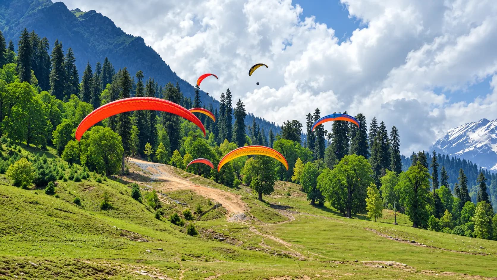
Located on a spur road branching off from Palchan before the Rohtang climb, Solang Valley is the adventure capital of the Kullu region. It features paragliding, ATV quad rides, zorbing, a scenic passenger ropeway cable car, and premier winter skiing slopes.
4. Atal Tunnel & Sissu, Lahaul (Approx. 28 km from Manali via Tunnel)
For travelers who wish to experience the trans-Himalayan desert valley of Lahaul without enduring Rohtang’s 38 hairpin bends, the world's longest highway tunnel above 10,000 feet - the Atal Tunnel - drills 9.02 km straight through the Pir Panjal range beneath Rohtang Pass. Emerging from the north portal brings you directly to Sissu, celebrated for its thundering 50-meter waterfall, willow groves, and ancient Buddhist culture.
5. Gulaba & Bhrigu Lake Trailhead (Approx. 27 km South of Pass)
Gulaba is not only the official administrative checkpost for Rohtang Pass but also a stunning expanse of rolling alpine meadows. It serves as the primary base and trailhead for the celebrated Bhrigu Lake Trek, a high-altitude alpine trail climbing to a sacred, crystal-clear glacial lake at 4,300 meters that is said to never freeze completely.
In pictures
The practical bits
Before you go.
Plan ahead
A successful day trip to nearly 4,000 meters requires meticulous physical preparation, cold-weather clothing, and…Explore detailsClose details
A successful day trip to nearly 4,000 meters requires meticulous physical preparation, cold-weather clothing, and strategic timing. Review these four mandatory preparation blocks before setting out:
Mandatory Advance Permit Procurement
Secure your electronic NGT Rohtang Pass Permit several days in advance through rohtangpermits.nic.in or ensure…Explore detailsClose details
Secure your electronic NGT Rohtang Pass Permit several days in advance through rohtangpermits.nic.in or ensure that your contracted taxi operator has confirmed and printed the QR-coded permit. Never attempt to drive past Gulaba without a valid permit; police checkpoints will turn you back immediately without exception, ruining your entire day. Remember that the pass is strictly closed to all tourists every Tuesday.
Cold Weather & High-Altitude Layering
Dress in multiple warm thermal layers regardless of the weather in Manali.Explore detailsClose details
Dress in multiple warm thermal layers regardless of the weather in Manali. While Manali may be a balmy 25°C in June, Rohtang can easily be hovering at 4°C with gale-force winds dropping the wind chill below freezing. Wear a thermal base layer (merino wool or polypropylene), a fleece mid-layer, a windproof and waterproof outer jacket, sturdy waterproof boots with wool socks, thermal gloves, UV-protective sunglasses (to prevent snow blindness), and a warm beanie that covers your ears.
High-Altitude Acclimatization & Hydration
Ascending rapidly from 2,050 meters (Manali) to 3,978 meters (Rohtang) in under three hours causes acute altitude…Explore detailsClose details
Ascending rapidly from 2,050 meters (Manali) to 3,978 meters (Rohtang) in under three hours causes acute altitude stress. Drink at least one liter of water before departing, carry thermos flasks of warm ginger tea or water, and avoid alcohol or heavy greasy meals the previous night. Move slowly upon reaching the summit; do not run or exert yourself rapidly. If you experience dizziness, nausea, throbbing headache, or severe breathlessness (symptoms of Acute Mountain Sickness - AMS), inform your companions immediately and descend to Marhi (3,300 m) where symptoms typically subside quickly.
Pre-Dawn Departure to Avoid Traffic
Depart from Manali no later than 05:30 or 06:00 in the morning.Explore detailsClose details
Depart from Manali no later than 05:30 or 06:00 in the morning. Check the current visiting hours and permitted access with the site operator before departure; ceremonies, closures and visitor sessions can affect access. An early arrival guarantees empty snow slopes, breathtaking early morning lighting for photography, and a smooth, unhurried return drive before afternoon mountain fog rolls in.
Suggested 7-Hour Rohtang Pass Day Circuit
05:30 - 06:30: Scenic Early Drive from Manali to Gulaba
Depart Manali Mall Road in the crisp morning twilight.Explore detailsClose details
Depart Manali Mall Road in the crisp morning twilight. Drive past Nehru Kund and the dizzying gorge at Kothi, arriving at the Gulaba police checkpost by 06:15. Present your digital QR code permit for automated barrier scanning.
06:30 - 07:45: Climb the 38 Hairpins to Marhi
Ascend through alpine meadows, enjoying breathtaking views of the rising sun striking the glaciated summits of…Explore detailsClose details
Ascend through alpine meadows, enjoying breathtaking views of the rising sun striking the glaciated summits of the Pir Panjal Range. Stop at Marhi for a 20-minute breakfast break to enjoy piping hot parathas and ginger tea while renting thermal gumboots if needed.
07:45 - 08:45: Final Ascent & Beas Rishi Visit
Drive the final steep switchbacks above Marhi.Explore detailsClose details
Drive the final steep switchbacks above Marhi. Stop at the stone igloo sanctuary of Beas Rishi to witness the sacred glacial spring originating the Beas River and collect holy water.
08:45 - 11:30: Exploration of Rohtang Pass Summit
Arrive at the 3,978-meter summit crest.Explore detailsClose details
Arrive at the 3,978-meter summit crest. Photograph the BRO milestone and colorful Buddhist prayer flags. Walk across the eternal snowfields, enjoy sledding or skiing, and take in the awe-inspiring 360-degree panorama of Gepang Goh and the trans-Himalayan Lahaul peaks.
11:30 - 12:45: Descend to Marhi for Hot Lunch
Begin your descent before the high noon sun turns snowbanks into slush.Explore detailsClose details
Begin your descent before the high noon sun turns snowbanks into slush. Stop at Marhi for a hearty lunch of traditional Himachali rajma chawal and hot noodles at a mountain stall.
12:45 - 14:00: Return Drive via Rahla Falls & Gulaba
Continue your scenic descent through the switchbacks, stopping at the viewpoint overlooking the thundering…Explore detailsClose details
Continue your scenic descent through the switchbacks, stopping at the viewpoint overlooking the thundering cascades of Rahla Falls. Arrive safely back in Manali by 14:00, leaving your afternoon free to relax and recover.
A few things you might wonder
Common questions about visiting Rohtang Pass. Fees, visiting hours and ceremonies are researched details that may change; confirm current arrangements with the operator before travelling.
What is the exact altitude of Rohtang Pass, and where is it located?
Why is Rohtang Pass named 'Ground of Corpses'?
Is an NGT permit mandatory to visit Rohtang Pass, and how do I get one?
Why is Rohtang Pass closed every Tuesday?
How does the Atal Tunnel relate to Rohtang Pass?
Can I experience Acute Mountain Sickness (AMS) at Rohtang Pass?
Explore more in Manali Kullu
Discover other destinations around this hub
More Hubs in Himachal Pradesh
Continue exploring other travel hubs in this state
Planning a trip to Manali Kullu?