Thuria Konda
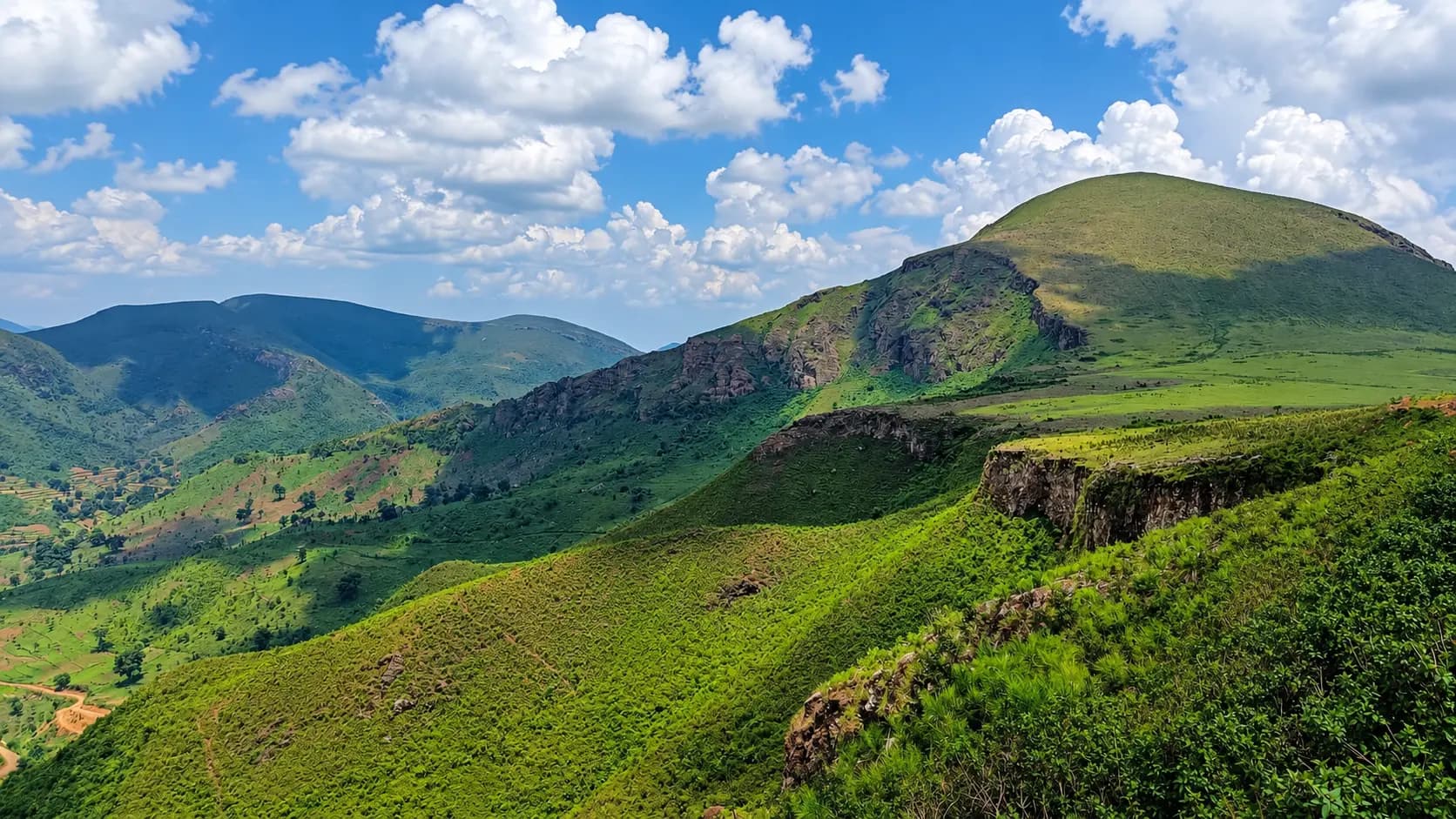
A walking outing in the Koraput highlands, Thuria Konda is described by local trek operators as a grassland climb with views towards Deomali.
Location
Koraput, Odisha
Duration
No measured walking duration has been verified.
Difficulty
Trail and accessibility details require local confirmation.
A closer look
Your visit, at a glance.
Koraput, Odisha
GET TO KNOW THE PLACE
Thuria Konda is a trekking outing in the Koraput highlands, described by local operators with a village approach and views towards Deomali.
The story of Thuria Konda
Thuria Konda is a trekking outing in the Koraput highlands, described by local operators with a village approach and views towards Deomali. GoKoraput reports an elevation around 1,597 metres, but published elevation figures vary and an official state ranking has not been established for this guide. We do not identify it with another named peak on the basis of a similar height. Choose it for the walking experience and mountain scenery, with local route advice before setting out.
Start here. Open a tile for the full details.
Why goRead details
- A grassland summit trek: The main reward is the climb and broad mountain scenery; do not choose the outing on the basis of an unverified official ranking.
- The Ultimate Panoramic Vantage Point for Deomali: While standing on Deomali itself is magnificent, you cannot view the iconic twin-hump silhouette of Deomali while standing atop it. Thuria Konda sits directly opposite Deomali, providing the most dramatic, postcard-perfect view of Odisha's highest mountain rising majestically against the sky.
- Untamed Wilderness & Authentic Trekking: There are no paved concrete walkways, handrails, souvenir kiosks, or motor horns on Thuria Konda. The trail follows genuine tribal pastoral routes across rocky terrain and open alpine-like grasslands, offering an immersive escape into pure montane nature.
- Cascades and Tribal Heritage at the Trailhead: The journey begins at the base village of Galigabderu, passing the beautiful Galigabdar (Rathibali) waterfall. Do not enter pools or cross streams without checking restrictions and water conditions.
- Exceptional Birdlife and Montane Flora: Shaded by stunted montane shola vegetation in the ravines and blanketed by native khondalite grass varieties on the upper shoulders, the mountain provides critical habitat for mountain raptors, vibrant sunbirds, endemic wild orchids, and medicinal forest flora.
When to visitRead details
Because Thuria Konda is an exposed, high-altitude wilderness peak, seasonal conditions dramatically affect the quality and safety of the trek:
Entry & permissionsRead details
Fees, visiting hours and entry rules may change. Confirm the latest details with the official operator or local authority before travelling.
- Charges: Current admission, vehicle, parking and guide charges have not been confirmed. Ask the local operator or authority about the charges and permitted access before visiting; do not assume entry is free.
- Daylight planning: Plan a daylight visit and return before sunset. This is planning advice, not a verified daily opening schedule.
- Permissions: Confirm the permitted route with local residents or the responsible authority. Day access does not imply permission for overnight camping, commercial activities or drones.
- Care for the place: Carry back litter, respect homes and grazing land, and stay well back from exposed edges.
Explore the full guide - choose a topic below.
Why visit?
A grassland summit trek: The main reward is the climb and broad mountain scenery; do not choose the outing on the…Explore detailsClose details
- A grassland summit trek: The main reward is the climb and broad mountain scenery; do not choose the outing on the basis of an unverified official ranking.
- The Ultimate Panoramic Vantage Point for Deomali: While standing on Deomali itself is magnificent, you cannot view the iconic twin-hump silhouette of Deomali while standing atop it. Thuria Konda sits directly opposite Deomali, providing the most dramatic, postcard-perfect view of Odisha's highest mountain rising majestically against the sky.
- Untamed Wilderness & Authentic Trekking: There are no paved concrete walkways, handrails, souvenir kiosks, or motor horns on Thuria Konda. The trail follows genuine tribal pastoral routes across rocky terrain and open alpine-like grasslands, offering an immersive escape into pure montane nature.
- Cascades and Tribal Heritage at the Trailhead: The journey begins at the base village of Galigabderu, passing the beautiful Galigabdar (Rathibali) waterfall. Do not enter pools or cross streams without checking restrictions and water conditions.
- Exceptional Birdlife and Montane Flora: Shaded by stunted montane shola vegetation in the ravines and blanketed by native khondalite grass varieties on the upper shoulders, the mountain provides critical habitat for mountain raptors, vibrant sunbirds, endemic wild orchids, and medicinal forest flora.
What to expect
Ascending Thuria Konda is a rewarding half-day outdoor excursion that challenges your legs and delights your…Explore detailsClose details
Ascending Thuria Konda is a rewarding half-day outdoor excursion that challenges your legs and delights your senses:
1. The Approach Drive and Galigabdar Waterfall
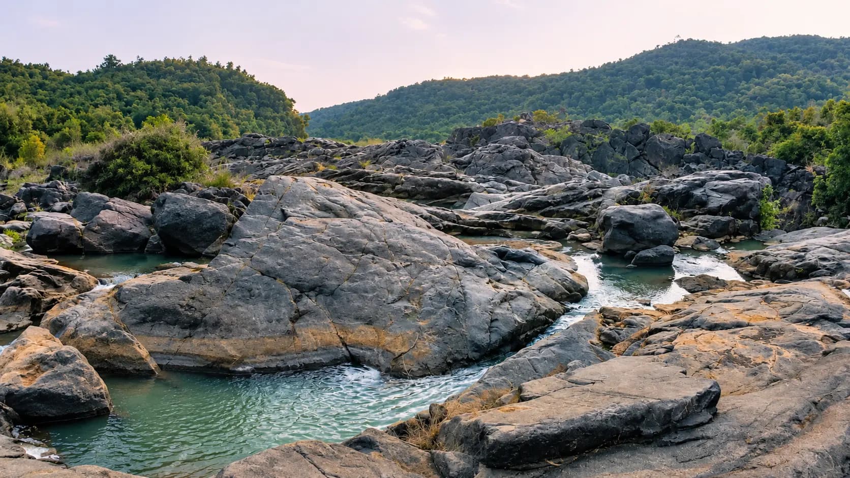
The adventure begins by driving east from Semiliguda toward the foothills of the Pottangi range. Following rural paved roads through rolling eucalyptus plantations and tribal farmland, you reach the approach to Galigabdar waterfall (locally known as Rathibali waterfall). Here, a perennial mountain torrent drops through a rocky woodland ravine, creating natural rock pools and cool spray. Visitors frequently pause here to enjoy the waterfall before continuing a short distance further along the dirt road to the tribal hamlet of Galigabderu, where vehicles are parked in an open clearing.
2. The Trailhead at Galigabderu Village
Galigabderu is an authentic tribal village characterized by clay-plastered houses with thatched or tiled roofs, traditional grain-drying courtyards, and terraced plots of ginger, turmeric, and finger millet (mandia). Villagers are welcoming and accustomed to curious hikers; hiring a local youth as an informal trail guide is easy and strongly recommended, as multiple cattle trails crisscross the lower slopes.
3. The Mountain Ascent (1 to 1.5 Hours)
The trail immediately begins climbing up the western shoulder of Thuria Konda:
- Lower Stage: The first 20 to 25 minutes wind through terraced agricultural margins and scattered scrub forest. The path is narrow packed dirt with embedded stones, climbing at a steady, moderate gradient.
- Mid-Ridge Stage: Emerging above the tree line, the trail transitions onto an open, steep grassy spur. Cool mountain breezes pick up significantly, and sweeping views of the surrounding valleys begin to open up behind you. Sturdy footwear is essential here to grip the loose gravel and rocky outcrops.
- Upper Shoulder & False Summits: As you near the high crest, the trail negotiates a series of natural rocky steps and quartzite ledges. The climb is physically stimulating but technically straightforward, requiring no specialized mountaineering gear beyond good stamina and steady balance.
4. The Summit Ridge and 360-Degree Panorama
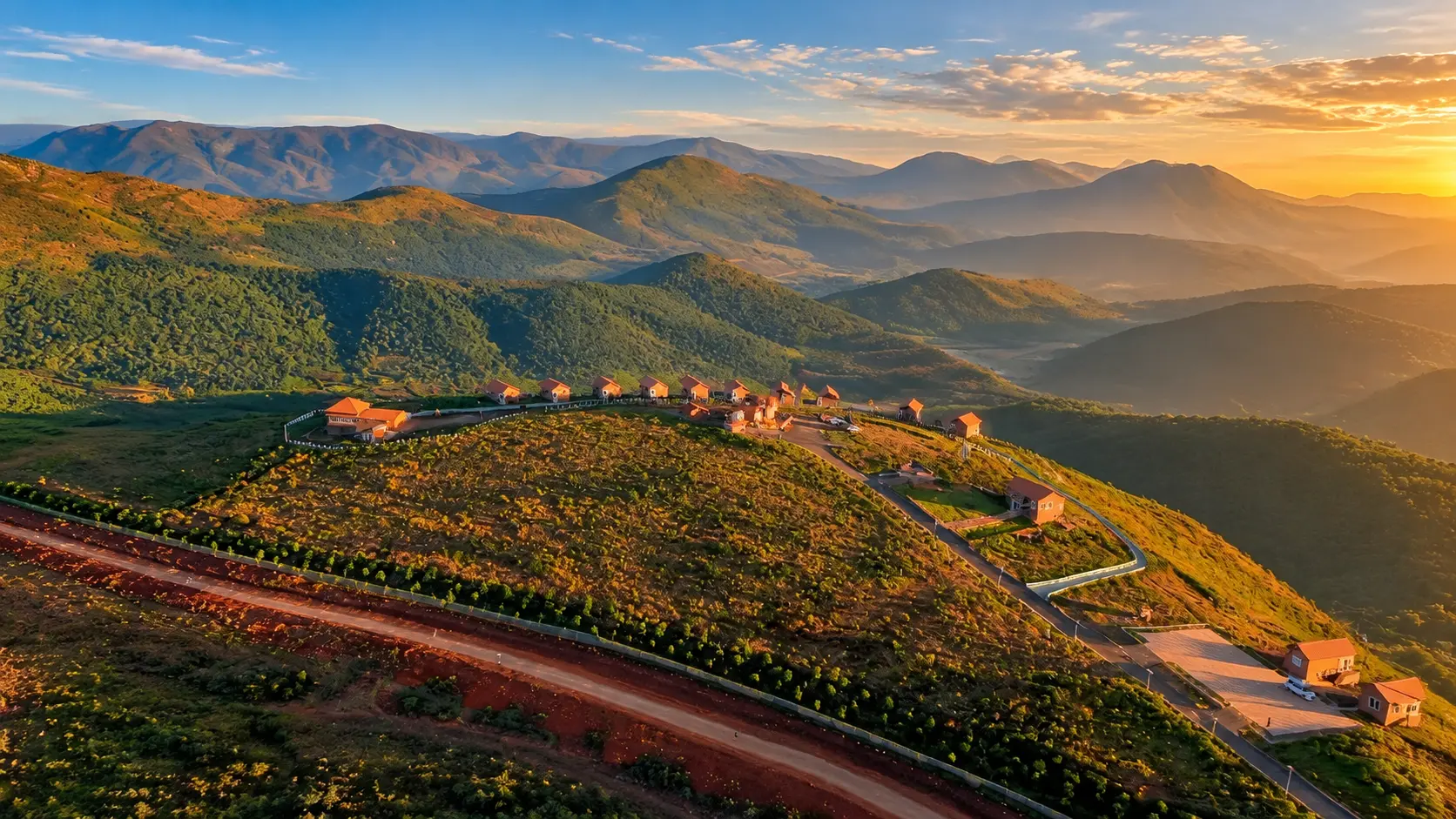
Reaching the summit ridge of Thuria Konda is breathtaking. The crest is an elongated, windswept grassland plateau dotted with weathered granite boulders. Directly across the valley to the northeast, the monumental twin peaks of Deomali dominate the skyline, revealing its dramatic cliffs and winding access roads in sharp relief. Looking eastward, successive mountain ranges ripple toward the horizon like ocean waves, often draped in rolling clouds. The brisk, unpolluted mountain wind carries the clean scent of wild grass and mountain air.
Best time to visit
Because Thuria Konda is an exposed, high-altitude wilderness peak, seasonal conditions dramatically affect the…Explore detailsClose details
Because Thuria Konda is an exposed, high-altitude wilderness peak, seasonal conditions dramatically affect the quality and safety of the trek:
Season | Months | Weather & Trail Conditions | Travel Recommendation |
|---|---|---|---|
Post-Monsoon | October to November | Emerald-green grassy slopes; rushing streams and full-volume Galigabdar waterfall; cool, pleasant temperatures (18°C - 25°C). | Supreme Season: The most beautiful time of year for vibrant landscape photography and lush mountain scenery. Trails may have minor damp sections. |
Winter | December to February | Crisp, dry montane breezes; cold mornings (6°C - 12°C) and sunny, mild afternoons (18°C - 24°C); crystal-clear visibility across the Deomali valley. | Peak Trekking Season: The ideal climatic window for comfortable hiking without heat fatigue; completely dry, stable footing along the rocky ridges. |
Spring Transition | March | Warming temperatures (24°C - 32°C); dry, firm trails; blossoming flame-of-the-forest (palash) and mahua trees across the lower slopes. | Good Window: Recommended for early morning hikes (06:00 to 09:30); mid-afternoon sun can be intense on unshaded upper ridges. |
Summer | April to June | Hot, dry weather (32°C - 37°C); dry, golden grasses; strong hot winds; lack of shade on the summit ridge. | Challenging Season: Not recommended for general travellers; if trekking, depart at dawn (05:30) and carry abundant water (at least 3 litres). |
Monsoon | July to September | Heavy rainfall, cloudbursts, and thick fog; slippery grassy slopes; swollen mountain streams. | Not Advised: Steep grassy ridges become dangerously slick; low cloud cover obliterates the spectacular Deomali views; lightning risks on exposed peaks. |
Recommended Hours of the Day: Trekkers should begin their ascent in the early morning between 06:30 and 08:30. This allows you to complete the uphill climb while the air is crisp and cool, spend an hour absorbing the panoramic views atop the summit, and descend back to Galigabderu village before midday heat sets in. All hikers must ensure they are off the mountain and back at their vehicle before 17:00, as sunset brings rapid darkness and the trail has no artificial lighting.
How to reach
Local operators describe an approach via Galigabdar waterfall and Galigabderu village, followed by an uphill walk.Explore detailsClose details
Plan the final approach
Local operators describe an approach via Galigabdar waterfall and Galigabderu village, followed by an uphill walk. Discuss the route and any stream crossing with a local guide; do not cross high water to follow an online itinerary.
Choose a practical base
Koraput and Semiliguda provide places to arrange onward transport and supplies. Check your train or flight arrival against the onward journey; no transfer duration or service frequency is promised here.
Entry, timings and permissions
Fees, visiting hours and entry rules may change.Explore detailsClose details
Fees, visiting hours and entry rules may change. Confirm the latest details with the official operator or local authority before travelling.
- Charges: Current admission, vehicle, parking and guide charges have not been confirmed. Ask the local operator or authority about the charges and permitted access before visiting; do not assume entry is free.
- Daylight planning: Plan a daylight visit and return before sunset. This is planning advice, not a verified daily opening schedule.
- Permissions: Confirm the permitted route with local residents or the responsible authority. Day access does not imply permission for overnight camping, commercial activities or drones.
- Care for the place: Carry back litter, respect homes and grazing land, and stay well back from exposed edges.
Nearby places to consider
Thuria Konda's location in the Pottangi mountain corridor places it at the centre of an extraordinary cluster of…Explore detailsClose details
Thuria Konda's location in the Pottangi mountain corridor places it at the centre of an extraordinary cluster of adventure and eco-tourism attractions:
[Deomali Peak] (12 km via road)
              ^
              |
      [THURIA KONDA PEAK]
     /                   \
    v                     v
[Galigabdar Falls]    [Putsil Tabletop]
(Trailhead Base) (18 km west)- Galigabdar Waterfall (Rathibali Waterfall) (At the trail base): A scenic natural cascade tumbling through a rocky forest gorge near Galigabderu village, offering refreshing natural plunge pools and shaded picnic rocks before or after the mountain climb.
- Deomali Mountain Peak (12 km by road): The highest point in Odisha (1,672 m), featuring paved road access, panoramic hang-gliding launch pads, high-altitude alpine-like meadows, and sweeping vistas across the Koraput highlands.
- Putsil Tabletop Mountain & Valley (18 km west): Celebrated as the "Switzerland of Odisha," known for its vast flat-topped plateau, winter cloud beds, rolling green meadows, and the seasonal Eco Retreat glamping installations.
- Talamali Tabletop Ridge (20 km west): A tabletop hill outing near Putsil, famous for sunrise cloud inversions and dark-sky stargazing.
- Subai Jain Temple (22 km southwest): An ancient 8th - 10th century CE archaeological monument near Semiliguda, preserving rare chlorite carvings of Jain Tirthankaras and a co-located medieval stone Shiva shrine.
In pictures
The practical bits
Before you go.
Plan ahead
A successful ascent of Thuria Konda requires thoughtful wilderness preparation.Explore detailsClose details
A successful ascent of Thuria Konda requires thoughtful wilderness preparation. Observe these four essential planning rules:
Trekking Footwear and Ankle Support
The trail up Thuria Konda traverses uneven terrain characterized by loose gravel, sharp metamorphic rocks, and…Explore detailsClose details
The trail up Thuria Konda traverses uneven terrain characterized by loose gravel, sharp metamorphic rocks, and steep grassy slopes. Standard sneakers, canvas shoes, and casual sandals provide inadequate grip and risk painful slips or twisted ankles. Wear sturdy, broken-in trekking boots or trail-running shoes with aggressive rubber lugs and good ankle support. Carrying a lightweight collapsible trekking pole significantly reduces knee strain during the steep descent.
Hydration and High-Energy Nutrition
There are no mountain springs, potable water taps, or food stalls anywhere along the trail or at the summit.Explore detailsClose details
There are no mountain springs, potable water taps, or food stalls anywhere along the trail or at the summit. Each hiker must carry a minimum of 2 litres of drinking water, supplemented with electrolyte powder or glucose packets to combat dehydration during the steady 1.5-hour climb. Pack nutrient-dense snacks such as dry fruits, nuts, energy bars, and fresh fruit. Ensure you eat a balanced breakfast before leaving Semiliguda.
Local Village Guide Engagement
Because the trail up Thuria Konda is an authentic pastoral route without painted trail blazes, signposts, or…Explore detailsClose details
Because the trail up Thuria Konda is an authentic pastoral route without painted trail blazes, signposts, or cairns, multiple branching goat and cattle trails can easily confuse first-time visitors. Upon arriving at Galigabderu village, ask local residents for a guide. Confirm the current charge and what it includes with the operator or service provider. Visitor admission, vehicles, parking, activities and accommodation can have separate charges.
Sun Protection and Montane Layering
Once you emerge above the lower village scrub line, the entire ridge and summit of Thuria Konda are completely…Explore detailsClose details
Once you emerge above the lower village scrub line, the entire ridge and summit of Thuria Konda are completely exposed to the open sky without natural tree canopy shade. Wear a wide-brimmed sun hat, apply high-SPF sunscreen, and wear UV-protective sunglasses. However, because the summit sits at nearly 1,600 metres, winds can be brisk and chilling, especially in winter mornings. Pack a lightweight windbreaker jacket in your daypack to stay comfortable while resting at the summit.
A few things you might wonder
Common questions about visiting Thuria Konda. Fees, visiting hours and ceremonies are researched details that may change; confirm current arrangements with the operator before travelling.
What is known about Thuria Konda’s elevation?
Can I drive to the viewpoint?
How demanding is the walk?
Where does the approach begin?
Are there fees or permits?
When should I start?
What should I carry?
Can I see Deomali?
Explore more in Koraput
Discover other destinations around this hub
More Hubs in Odisha
Continue exploring other travel hubs in this state
Planning a trip to Koraput?