Machkund
Machkund is a dramatic river gorge, sacred pilgrimage valley (Matsya Tirtha), and historic hydroelectric power center in Koraput district along the Odisha-Andhra border.
Location
Koraput, Odisha
A closer look
Your visit, at a glance.
Koraput, Odisha
GET TO KNOW THE PLACE
Carving a monumental rift through the rugged tablelands of the southern Eastern Ghats, Machkund is one of the most storied geographical, industrial, and spiritual landscapes in…
The story of Machkund
Carving a monumental rift through the rugged tablelands of the southern Eastern Ghats, Machkund is one of the most storied geographical, industrial, and spiritual landscapes in southern Odisha. Formed by the swift, torrential course of the Machkund River - which serves as the natural interstate boundary between Koraput district in Odisha and Alluri Sitharama Raju district in Andhra Pradesh - the valley is steeped in epic legend as the sacred "Matsya Tirtha." Concurrently, it represents a towering monument of early post-independence Indian engineering as the site of the Machkund Hydro Electric Scheme (MHES).
Enclosed by sheer vertical rock escarpments rising 700 to 800 feet above the churning riverbed, the Machkund valley offers travelers an awe-inspiring vista of raw geology, historic mid-century hydroelectric ingenuity, and deep cultural connections to the indigenous Bonda and Didayi tribal communities.
Start here. Open a tile for the full details.
Why goRead details
Machkund brings together spectacular canyon topography, mid-20th-century industrial history, and profound regional cultural lore in a single captivating destination.
When to visitRead details
The climate and visual drama of the Machkund valley vary substantially across the seasons, making careful timing essential for visitors.
Entry & permissionsRead details
Fees, visiting hours and entry rules may change. Confirm the latest details with the official operator or local authority before travelling.
- Entry Fees: General access to the Machkund valley, public river overlooks, and highway viewpoints is completely free of charge. There are no mandatory entry gates or ticketing booths for public roads.
- Visiting Hours: Visitors are strongly advised to explore the area during daylight hours between 6:00 AM and 6:00 PM. Remote forested mountain roads lack lighting, and night transit is discouraged for safety.
- Hydroelectric Security Guidelines: As a critical interstate power generation installation operated under joint APGENCO and OHPC management:
- Entry into the active powerhouse turbine halls, control centers, high-voltage switchyards, and penstock intake portals is restricted to authorized personnel holding official security permits.
- Riding the industrial winch trolley down the gorge face is strictly forbidden to tourists due to stringent industrial safety laws.
- Photography of security gates, military guards, and critical electrical substations is prohibited; photography of the natural canyon, riverbed, and distant valley panoramas is permitted from public lookouts.
- Tribal Cultural Etiquette: When visiting neighboring villages or the weekly market at Onukudelli, travelers must strictly respect the privacy of local indigenous residents, especially members of the Bonda community. Do not take close-up portrait photographs of indigenous women or elders without explicit, respectful permission, and never offer alcohol or cigarettes.
Plan your visitRead details
Machkund is situated in the south-western extremity of Koraput district along the Andhra Pradesh border, approximately 88 km from Koraput town and 70 km south of Jeypore.
Explore the full guide - choose a topic below.
Why visit?
Machkund brings together spectacular canyon topography, mid-20th-century industrial history, and profound…Explore detailsClose details
Machkund brings together spectacular canyon topography, mid-20th-century industrial history, and profound regional cultural lore in a single captivating destination.
- The Epic Legacy of Matsya Tirtha: As documented in the official Koraput District Gazetteer, the Machkund River has been venerated for centuries as "Matsya Tirtha" (the sacred fish pilgrimage). Ancient regional folklore connects this dramatic gorge to the wanderings of Lord Rama during his epic exile through the Dandakaranya forest. Pilgrims historically visited the sacred pools of the river to perform holy ablutions, revering the native mahseer and river fish that thrived in its mountain waters.
- Pioneering Mid-Century Hydroelectric Heritage: Commissioned in the late 1940s and formally inaugurated on 19 August 1955 by Dr. Rajendra Prasad, India's first President, the Machkund Hydro Electric Scheme was a watershed achievement in bilateral cooperation between the governments of Odisha and Andhra Pradesh. Harnessing an extraordinary gross hydraulic head of 844 feet, the 120 MW generating station built deep within the inaccessible gorge symbolized the dawn of modern electrification across the eastern tribal belt.
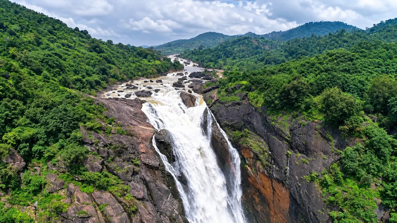
- Dramatic Gorge and Canyon Geomorphology: Below the famous 175-metre cataract of Duduma Falls, the Machkund River plunges into a sheer, 5- to 6-kilometre canyon hemmed in on both flanks by towering granite and khondalite precipices. The sheer scale of the rock faces, dense semi-evergreen canopy, and mist-veiled gorge depths make Machkund one of the most imposing natural canyon systems in eastern India.
- Crossroads of Indigenous Tribal Culture: The Machkund valley is the ancestral homeland of some of the subcontinent's most ancient indigenous communities, most notably the Didayi and the secluded Bonda tribes. Visiting Machkund places travelers just 3 kilometres from the vibrant weekly market village of Onukudelli, offering an authentic glimpse into the timeless customs, attire, and barter traditions of the highlands.
What to expect
Visiting Machkund is a multi-dimensional journey through high plateau forests, industrial heritage settlements…Explore detailsClose details
Visiting Machkund is a multi-dimensional journey through high plateau forests, industrial heritage settlements, and dramatic river overlooks.
The Valley Approach and Township
The journey to Machkund winds south-west from Koraput or Jeypore through the undulating tablelands of Lamtaput. As the road approaches Onukudelli and Handiput, the landscape transforms from open farmland into dense sal, bamboo, and mixed deciduous forest. The departmental settlement of Machkund features vintage stone quarters, quiet shaded avenues, and administrative offices built during the 1950s construction boom, giving the colony a nostalgic mid-century ambiance.
The Diversion Weir and River Vistas
Approximately 17 kilometres downstream of the massive Jalaput storage dam and 1.5 miles above Duduma Falls, the river reaches the Machkund Diversion Dam. Here, the river's flow is channeled into an intricate network of flumes, tunnels, and penstock surge tanks perched atop the plateau rim. From public bridge approaches and hillside road lookouts, visitors can view the rushing mountain stream before it is diverted toward the turbines or cascades into the gorge.
The Canyon Overlook and Industrial Winch
The most dramatic perspective of Machkund is gained from the gorge rim lookouts overlooking the powerhouse valley. Looking down into the sheer 800-foot abyss, the six massive steel penstock pipes can be seen descending at an alarming pitch toward the white powerhouse building nestled beside the churning riverbed. Along the cliff face runs the historic APGENCO winch trolley rail and concrete staircase - an extraordinary feat of mid-century hillside engineering used to lower heavy turbine components and maintenance crews into the canyon.
Best time to visit
The climate and visual drama of the Machkund valley vary substantially across the seasons, making careful timing…Explore detailsClose details
The climate and visual drama of the Machkund valley vary substantially across the seasons, making careful timing essential for visitors.
- Winter (October to March) - Ideal Season: Winter is by far the finest period to explore Machkund. Daytime temperatures in the valley range pleasantly between 16°C and 26°C, humidity remains low, and the skies are clear, providing crystal-sharp visibility across the deep rock canyon. The post-monsoon greenery remains lush, and road travel through the ghats is smooth and comfortable.
- Thursday Market Day - Premier Cultural Window: If your travel dates permit, plan your Machkund visit on a Thursday. On this day, the famous weekly tribal market (haat) at neighboring Onukudelli (3 km away) is in full swing, allowing you to combine industrial and canyon sightseeing with the vibrant cultural gathering of the Bonda people.
- Monsoon (July to September) - Swollen Rivers & Powerful Surges: The southwest monsoon brings massive rainfall to the Eastern Ghats. The Machkund River swells into a roaring red torrent, and excess water spills freely over the diversion weir, rejuvenating the lower gorge. However, heavy rains frequently bring dense mountain fogs that obscure canyon vistas, and rural ghat roads can become slippery.
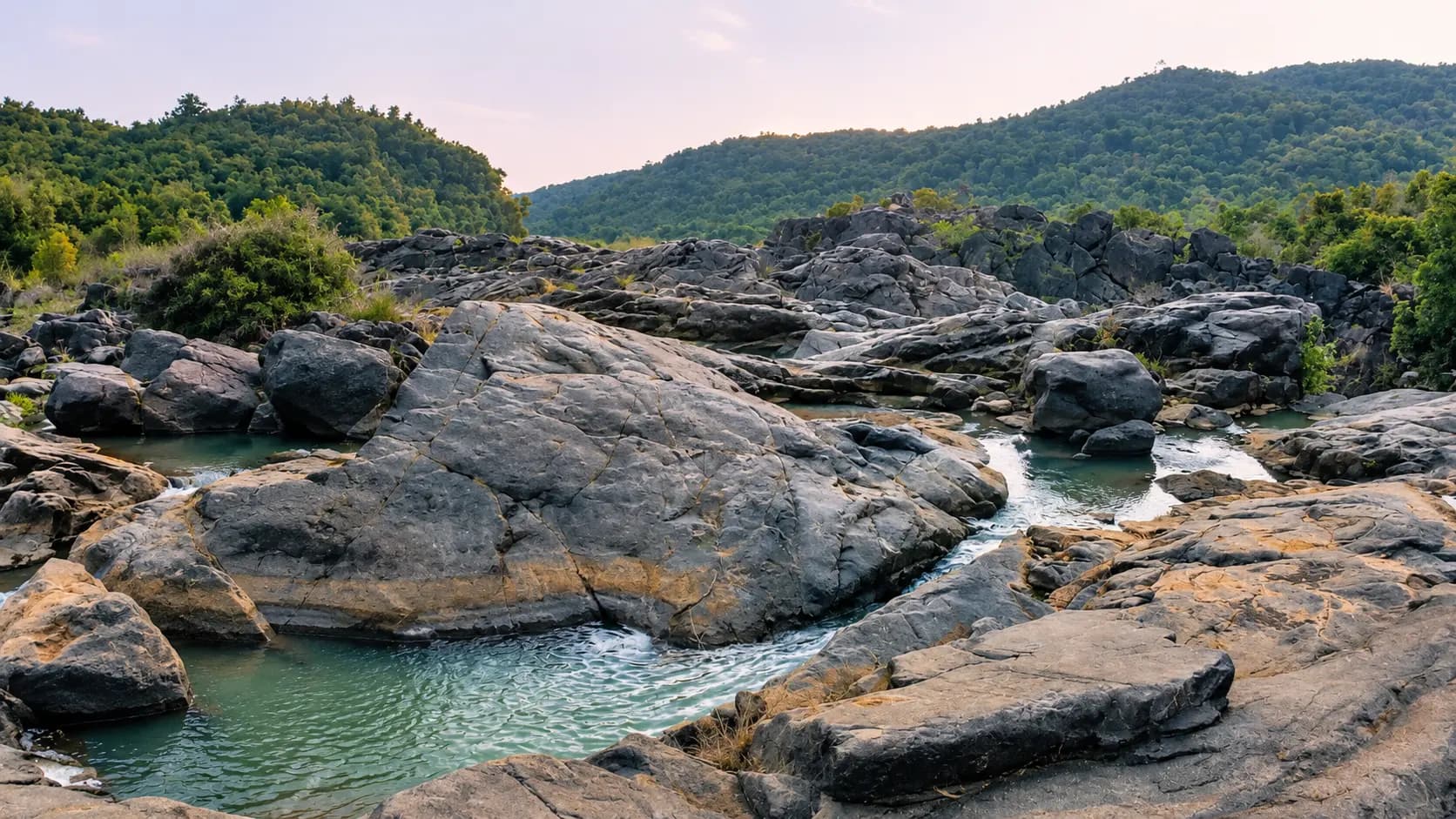
- Summer (April to June) - Arid and Warm: Midday summer temperatures in the deep, rocky canyon can rise above 38°C to 40°C. With reduced water flow through the natural riverbed due to power generation diversions, the gorge appears dry and rocky. Visiting during summer should be restricted to early morning hours.
How to reach
Machkund is situated in the south-western extremity of Koraput district along the Andhra Pradesh border…Explore detailsClose details
Machkund is situated in the south-western extremity of Koraput district along the Andhra Pradesh border, approximately 88 km from Koraput town and 70 km south of Jeypore.
By Road
Road travel by private car, taxi, or chartered jeep is the most efficient way to reach Machkund:
- From Koraput Town (88 km): Head south-west along the paved state highway toward Lamtaput (approx. 50 km). Continue past Sagar and Handiput toward Onukudelli (approx. 35 km), then follow the local approach road for the final 3 km into Machkund. Driving time is approximately 2.5 hours through scenic ghats.
- From Jeypore (70 km): Travel south via Boipariguda or Lamtaput along the well-surfaced district road network. The drive takes roughly 2 hours by private car.
- From Visakhapatnam (approx. 190 km): Approach from the coastal plains of Andhra Pradesh via the Araku Valley or Paderu mountain corridor, crossing the interstate border into the Machkund basin.
- Public Transport: OSRTC and private regional buses run between Koraput, Jeypore, and Onukudelli. From Onukudelli, shared auto-rickshaws or utility jeeps provide frequent short hops to the Machkund colony and Duduma viewpoints. However, hiring a private vehicle for the full round trip ensures seamless transit across multiple scenic viewpoints.
By Rail
- Jeypore Railway Station (JYP, approx. 70 km): The closest active railway station, offering express connections to Visakhapatnam, Rayagada, Jagdalpur, and Rourkela.
- Koraput Junction (KRPU, approx. 88 km): A major railway junction offering wider direct train connections to Bhubaneswar, Kolkata (Howrah), and Raipur. Taxis are easily arranged outside the station.
By Air
- Visakhapatnam International Airport (VTZ, approx. 190 km): The primary commercial airport servicing the region, operating regular non-stop flights to major domestic hubs including Delhi, Mumbai, Hyderabad, Bengaluru, and Chennai.
Entry, timings and permissions
Fees, visiting hours and entry rules may change.Explore detailsClose details
Fees, visiting hours and entry rules may change. Confirm the latest details with the official operator or local authority before travelling.
- Entry Fees: General access to the Machkund valley, public river overlooks, and highway viewpoints is completely free of charge. There are no mandatory entry gates or ticketing booths for public roads.
- Visiting Hours: Visitors are strongly advised to explore the area during daylight hours between 6:00 AM and 6:00 PM. Remote forested mountain roads lack lighting, and night transit is discouraged for safety.
- Hydroelectric Security Guidelines: As a critical interstate power generation installation operated under joint APGENCO and OHPC management:
- Entry into the active powerhouse turbine halls, control centers, high-voltage switchyards, and penstock intake portals is restricted to authorized personnel holding official security permits.
- Riding the industrial winch trolley down the gorge face is strictly forbidden to tourists due to stringent industrial safety laws.
- Photography of security gates, military guards, and critical electrical substations is prohibited; photography of the natural canyon, riverbed, and distant valley panoramas is permitted from public lookouts.
- Tribal Cultural Etiquette: When visiting neighboring villages or the weekly market at Onukudelli, travelers must strictly respect the privacy of local indigenous residents, especially members of the Bonda community. Do not take close-up portrait photographs of indigenous women or elders without explicit, respectful permission, and never offer alcohol or cigarettes.
Nearby places to consider
A visit to Machkund is seamlessly combined with several of south Odisha’s premier natural and tribal…Explore detailsClose details
A visit to Machkund is seamlessly combined with several of south Odisha’s premier natural and tribal destinations:
- Duduma Waterfall (approx. 3 km): The magnificent 175-metre horsetail cataract formed by the Machkund River, ranking among India's highest and most dramatic waterfalls.
- Onukudelli Weekly Tribal Market (approx. 3 km): The world-renowned Thursday tribal gathering where Bonda and Didayi highlanders trade indigenous produce, beads, and handmade craft items.
- Jalaput Dam & Reservoir (approx. 25 km upstream): The colossal 1955 masonry storage dam impounding 34 TMC of the Machkund River at 838 metres elevation, famous for winter migratory waterfowl.
- Gupteswar Cave (approx. 65 km via Boipariguda): An ancient subterranean limestone shrine housing a giant natural Shiva lingam, surrounded by Odisha's 4th Biodiversity Heritage Site along the Sabari River.
- Kolab Hydroelectric Dam & Lake (approx. 70 km): A vast mountain reservoir near Koraput town featuring landscaped botanical gardens, water viewpoints, and boating amenities.
In pictures
The practical bits
Before you go.
Plan ahead
A well-organized excursion to Machkund ensures an enriching and comfortable day trip through the south Koraput…Explore detailsClose details
A well-organized excursion to Machkund ensures an enriching and comfortable day trip through the south Koraput highlands.
Coordinating with Thursday Market
To maximize the cultural value of your trip, schedule your excursion for Thursday morning.Explore detailsClose details
To maximize the cultural value of your trip, schedule your excursion for Thursday morning. Arrive at Onukudelli by 9:00 AM to observe the vibrant weekly tribal market, explore the Machkund gorge viewpoints and historic colony around midday, and proceed to Duduma Falls in the afternoon.
Provisions and Refreshments
Dining infrastructure around Machkund is rudimentary.Explore detailsClose details
Dining infrastructure around Machkund is rudimentary. Onukudelli crossroads has small stalls serving tea, samosas, biscuits, and bottled beverages, but full-service restaurants are absent. Pack substantial lunches, drinking water, and energy snacks from your hotel base in Koraput or Jeypore.
Footwear and Sun Protection
While the primary viewpoints are reached from road turnouts, exploring rocky riverbanks or walking along the…Explore detailsClose details
While the primary viewpoints are reached from road turnouts, exploring rocky riverbanks or walking along the gorge rim involves uneven gravel and loose stones. Wear sturdy walking shoes or sneakers. Carry a hat, sunglasses, and sunscreen, as midday sunlight reflecting off canyon rock faces can be intense.
Cash and Communications
Cellular mobile connectivity (BSNL and Reliance Jio) is spotty and unreliable throughout the Machkund valley and…Explore detailsClose details
Cellular mobile connectivity (BSNL and Reliance Jio) is spotty and unreliable throughout the Machkund valley and drop out completely inside the deep gorge. Carry adequate physical currency for local purchases, snacks, and transport fares, as digital payment gateways rarely function in the area.
A few things you might wonder
Common questions about visiting Machkund. Fees, visiting hours and ceremonies are researched details that may change; confirm current arrangements with the operator before travelling.
What is the historical significance of the name Machkund?
What is the Machkund Hydro Electric Scheme?
Can tourists visit the powerhouse inside the canyon or ride the winch trolley?
How far is Machkund from Koraput and Jeypore?
Is there an entry fee to visit the Machkund valley?
What is the best day of the week to visit Machkund?
Are lodging and dining options available in Machkund?
What tribal communities live around the Machkund valley?
Explore more in Koraput
Discover other destinations around this hub
More Hubs in Odisha
Continue exploring other travel hubs in this state
Planning a trip to Koraput?