Jalaput Dam
Plan your visit to Jalaput Dam in Koraput, Odisha. Sourced travel guide covers the Machkund River reservoir, 1955 hydro heritage, winter birds, and travel tips.
Location
Koraput, Odisha
A closer look
Your visit, at a glance.
Koraput, Odisha
GET TO KNOW THE PLACE
High in the forested tablelands of the Eastern Ghats along the border of Odisha and Andhra Pradesh, Jalaput Dam stands as one of eastern India’s pioneering post-independence…
The story of Jalaput Dam
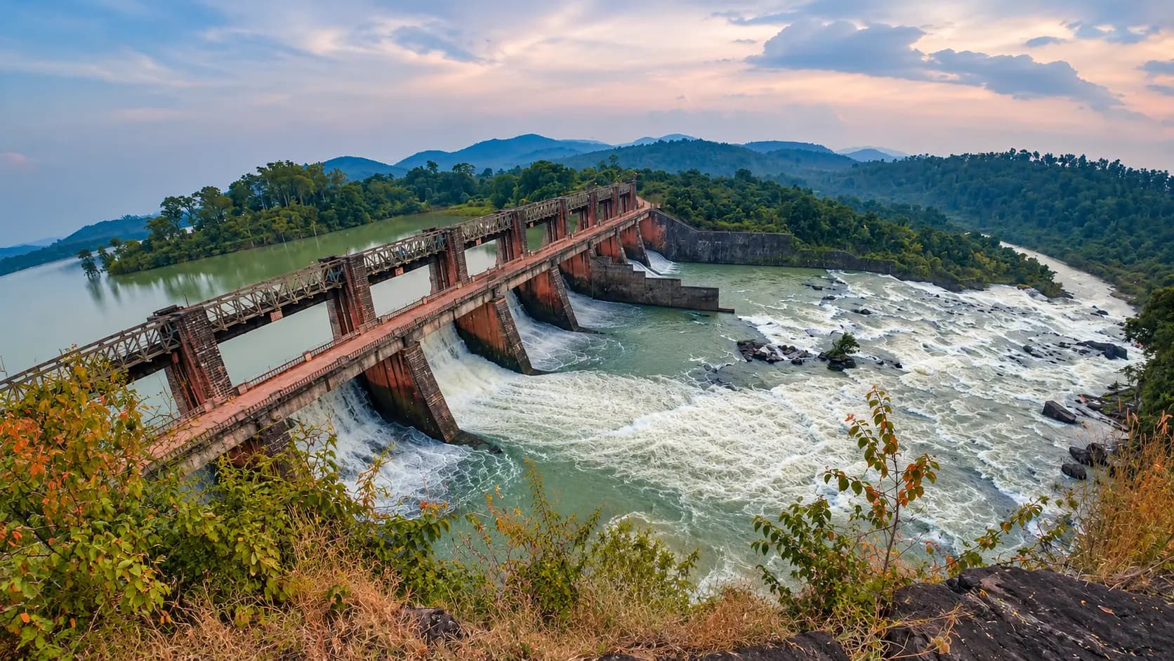
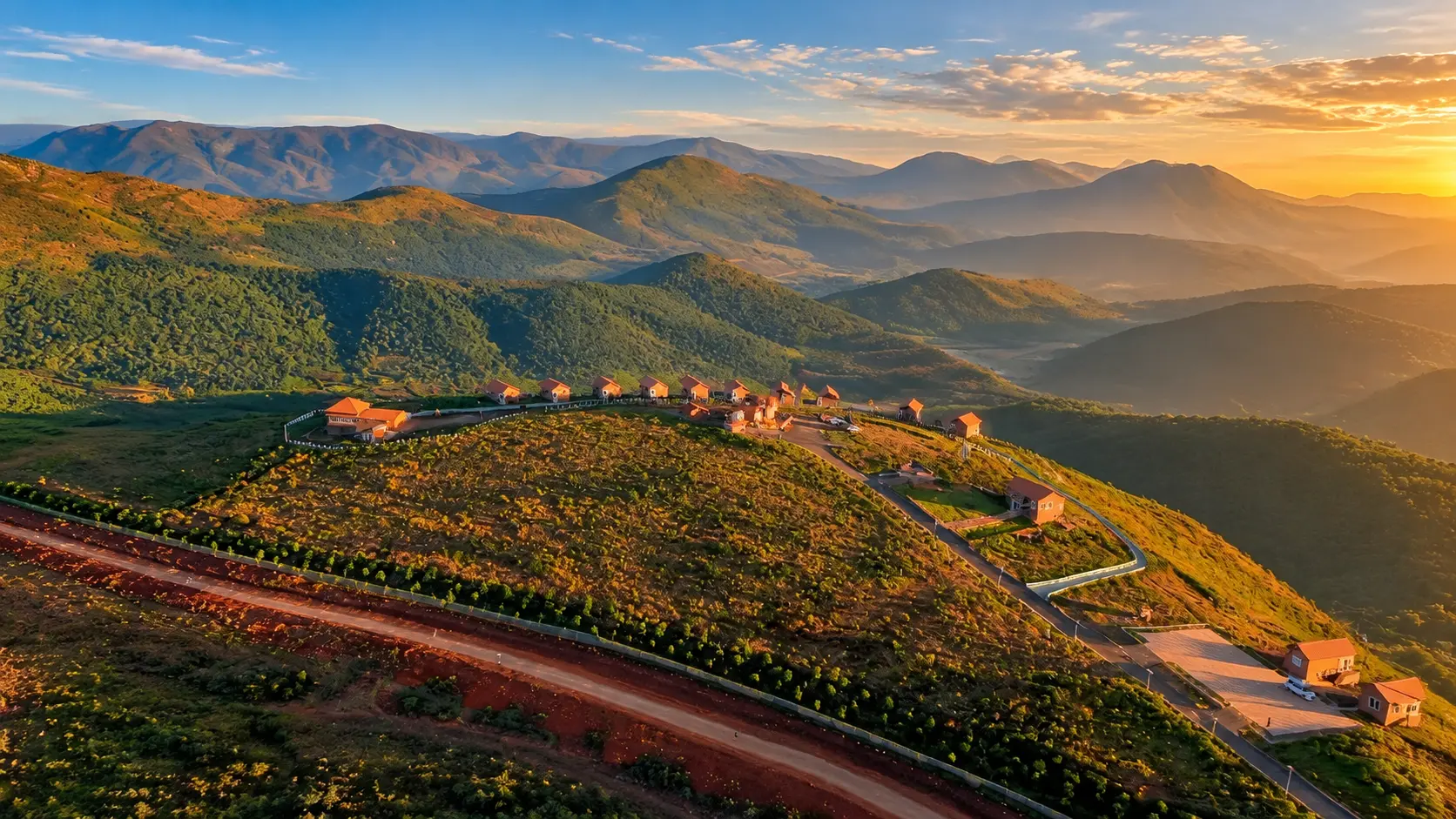
High in the forested tablelands of the Eastern Ghats along the border of Odisha and Andhra Pradesh, Jalaput Dam stands as one of eastern India’s pioneering post-independence engineering achievements. Impounding the swift, boulder-strewn waters of the Machkund River, this colossal masonry barrier forms the primary storage reservoir for the historic Machkund Hydro-Electric Scheme (MHES). The resulting high-altitude reservoir - spreading across thousands of hectares of undulating mountain valleys at an elevation of 838 metres - creates an enchanting panorama of deep blue waters framed by dense sal woodlands and indigenous tribal settlements.
For travelers journeying through the Koraput highlands toward the thundering plunge of Duduma Falls, Jalaput Dam offers a captivating stopover that unites mid-century hydroelectric heritage, untouched montane landscapes, and rich winter birdlife.
Start here. Open a tile for the full details.
Why goRead details
Jalaput Dam combines historical significance with scenic mountain beauty, offering distinct attractions for engineering enthusiasts, nature lovers, and overland explorers.
When to visitRead details
Jalaput Dam can be visited throughout the year, with each season offering a unique visual and climatic character.
Entry & permissionsRead details
Fees, visiting hours and entry rules may change. Confirm the latest details with the official operator or local authority before travelling.
- Entry Fees: General viewing of the Jalaput reservoir from public roads, shoreline viewpoints, and bridge approaches is free of charge. There are no municipal or tourist entry tickets.
- Visiting Hours: Visitors are advised to plan their arrival during daylight hours between 6:00 AM and 6:00 PM. The remote forested roads connecting Lamtaput to Jalaput lack street lighting, making night driving inadvisable.
- Industrial and Powerhouse Security Protocols: As an active, critical interstate hydroelectric asset operated jointly by APGENCO and OHPC:
- Access to the main dam crest, powerhouse control building, switchyards, and intake tunnels is restricted to authorized personnel holding official security passes.
- Photography of sensitive security infrastructure, high-voltage transformers, and surveillance checkpoints is strictly prohibited.
- Photography of the open reservoir waters, natural shorelines, and landscape views from public thoroughfares is freely permitted.
- Water Safety Regulations: Swimming, diving, and unsupervised wading in the reservoir are strictly banned. High-capacity reservoir intakes and sudden changes in water discharge can generate treacherous underwater currents.
Plan your visitRead details
Jalaput Dam is located in the Lamtaput block of Koraput district, approximately 77 km southwest of Koraput town and 48 km south of Jeypore.
Explore the full guide - choose a topic below.
Why visit?
Jalaput Dam combines historical significance with scenic mountain beauty, offering distinct attractions for…Explore detailsClose details
Jalaput Dam combines historical significance with scenic mountain beauty, offering distinct attractions for engineering enthusiasts, nature lovers, and overland explorers.
- A Milestone of Post-Independence Engineering: Conceived in the 1940s and commenced in 1946, the Machkund Hydro-Electric Scheme was one of the earliest large-scale joint interstate river valley projects undertaken in independent India. The first 17 MW turbine was formally commissioned on 19 August 1955 by Dr. Rajendra Prasad, the first President of the Republic of India. The massive masonry dam - constructed using hand-dressed stone rubble and cement mortar rather than modern reinforced concrete - embodies the heroic scale of mid-20th-century nation-building.
- Breathtaking High-Altitude Reservoir Vistas: Because the reservoir's Full Reservoir Level (FRL) sits at an impressive 2,750 feet (838.2 metres) above sea level, the water surface mirrors the changing moods of the highland sky. The jagged shoreline is broken by wooded peninsulas, rocky promontories, and tranquil bays where local tribal fishers paddle traditional wooden dugouts against a backdrop of mist-shrouded peaks.
- Winter Migratory Birding Destination: As officially documented in the Koraput District Gazetteer, the vast, calm waters of the Jalaput reservoir become a critical winter sanctuary for migratory waterfowl between November and February. Flocks of grebes, teals, cormorants, and egrets find sanctuary across its secluded inlets, making the reservoir shoreline an undiscovered haven for birdwatchers and wildlife photographers.
- Natural Gateway to Duduma Falls & Machkund Valley: Situated just 17 kilometres upstream from the Machkund diversion weir and the roaring 175-metre cataract of Duduma Falls, Jalaput Dam is an organic anchor point for an unforgettable one-day circuit through the dramatic canyon country of the Machkund river system.
What to expect
A visit to Jalaput Dam is characterized by wide-open mountain landscapes, cool highland breezes, and quiet rural…Explore detailsClose details
A visit to Jalaput Dam is characterized by wide-open mountain landscapes, cool highland breezes, and quiet rural serenity.
The Dam Structure and Spillway
As you approach from Lamtaput along Major District Road 101 (MDR-101), the road winds through rolling agricultural valleys and tribal hamlets before descending toward the river valley. The main dam structure stretches 1,375 feet (approx. 419 metres) across the river gorge, anchored by a massive 550-foot masonry spillway equipped with eight towering radial crest gates. When the gates are opened during peak monsoon inflows, the discharge of up to 185,000 cusecs creates a thunderous curtain of white water that shakes the bedrock of the valley.
The Expansive Water Sheet
Upstream of the dam crest, the reservoir extends deep into the river basin, holding an enormous gross storage volume of approximately 34.27 TMC (thousand million cubic feet). The water is remarkably clear and deep blue, reflecting the forested hill contours of both Odisha (Koraput district) on the eastern bank and Andhra Pradesh (Alluri Sitharama Raju district) on the western shore. Several unpaved spurs lead down to natural gravel beaches along the shoreline where visitors can sit peacefully and take in the cool breeze.
Village Life and Interstate Character
The small settlement of Jalaput features quiet departmental residential quarters built for engineers of Andhra Pradesh Power Generation Corporation Limited (APGENCO) and Odisha Hydro Power Corporation (OHPC). The atmosphere is bilingual and cosmopolitan, where Odia and Telugu blend naturally with local tribal dialects. Small village shops and tea stalls near the crossroads provide simple refreshments, roasted groundnuts, and hot ginger tea to passing travelers.
Best time to visit
Jalaput Dam can be visited throughout the year, with each season offering a unique visual and climatic character.Explore detailsClose details
Jalaput Dam can be visited throughout the year, with each season offering a unique visual and climatic character.
- Winter (October to March) - Premier Season: The post-monsoon and winter months offer the finest travel conditions. Highland temperatures hover between a brisk 12°C in the early morning and a mild 26°C at midday. The reservoir remains full to its brim, hillslopes are blanketed in lush green vegetation, and migratory waterfowl arrive across the open water. Clear, sunny skies make this period ideal for outdoor exploration and photography.
- Monsoon (July to September) - Dramatic Inflows & Spillway Operation: The southwest monsoon brings heavy rainfall to the catchment of the Eastern Ghats. The Machkund River swells dramatically, filling the reservoir to its Full Reservoir Level (2,750 ft). When excess floodwaters are released through the eight spillway gates, the visual spectacle is breathtaking. However, driving conditions along twisting rural ghat roads require extra caution due to fog, slick surfaces, and occasional minor landslides.
- Summer (April to June) - Arid Horizons & Water Recessions: Summer midday temperatures on the plateau reach 34°C to 38°C. While cooler than the coastal plains due to the 838-metre elevation, the sun is intense, and the reservoir recedes toward its Minimum Draw Down Level (MDDL of 2,685 ft), exposing wide swathes of cracked silt flats and submerged tree stumps. If traveling in summer, plan your arrival for early morning or late afternoon.
How to reach
Jalaput Dam is located in the Lamtaput block of Koraput district, approximately 77 km southwest of Koraput town…Explore detailsClose details
Jalaput Dam is located in the Lamtaput block of Koraput district, approximately 77 km southwest of Koraput town and 48 km south of Jeypore.
By Road
- From Koraput Town (77 km): Travel south along the paved state highway toward Lamtaput (approx. 50 km). From Lamtaput, turn onto Major District Road 101 (MDR-101, Sagar-Jalaput Road) passing through Sagar village for the remaining 27 km to Jalaput. The drive takes approximately 2 to 2.5 hours through scenic forested hills and tribal villages.
- From Jeypore (48 km): Take the direct southern rural highway via Boipariguda or the ghat route connecting through Lamtaput. The drive takes roughly 1.5 hours by private car or taxi.
- From Visakhapatnam (approx. 176 km): Travel northwest via the Araku Valley or Paderu corridor across the Andhra Pradesh border into the Jalaput basin. This route is favored by travelers originating from coastal Andhra Pradesh.
- Public Transport: OSRTC and private regional buses run regularly from Koraput and Jeypore to Lamtaput. From Lamtaput, shared utility jeeps and auto-rickshaws connect to Jalaput village and Sagar, although services become infrequent in the late afternoon. Hiring a private taxi or self-driving vehicle from Koraput or Jeypore is strongly advised for flexibility.
By Rail
- Koraput Junction (KRPU, 77 km): The primary railway gateway for travelers arriving from Bhubaneswar, Visakhapatnam, Kolkata, and Raipur. Taxis can be hired directly from the station forecourt.
- Jeypore Railway Station (JYP, 50 km): A closer rail station on the East Coast Railway line, convenient for passengers arriving on regional express services from Rayagada, Jagdalpur, or Rourkela.
By Air
- Visakhapatnam International Airport (VTZ, approx. 176 km via Paderu / 210 km via Araku): The nearest major commercial airport, operating regular direct flights to all primary Indian metropolitan centers.
Entry, timings and permissions
Fees, visiting hours and entry rules may change.Explore detailsClose details
Fees, visiting hours and entry rules may change. Confirm the latest details with the official operator or local authority before travelling.
- Entry Fees: General viewing of the Jalaput reservoir from public roads, shoreline viewpoints, and bridge approaches is free of charge. There are no municipal or tourist entry tickets.
- Visiting Hours: Visitors are advised to plan their arrival during daylight hours between 6:00 AM and 6:00 PM. The remote forested roads connecting Lamtaput to Jalaput lack street lighting, making night driving inadvisable.
- Industrial and Powerhouse Security Protocols: As an active, critical interstate hydroelectric asset operated jointly by APGENCO and OHPC:
- Access to the main dam crest, powerhouse control building, switchyards, and intake tunnels is restricted to authorized personnel holding official security passes.
- Photography of sensitive security infrastructure, high-voltage transformers, and surveillance checkpoints is strictly prohibited.
- Photography of the open reservoir waters, natural shorelines, and landscape views from public thoroughfares is freely permitted.
- Water Safety Regulations: Swimming, diving, and unsupervised wading in the reservoir are strictly banned. High-capacity reservoir intakes and sudden changes in water discharge can generate treacherous underwater currents.
Nearby places to consider
A visit to Jalaput Dam pairs seamlessly with other premier natural and cultural highlights across southern…Explore detailsClose details
A visit to Jalaput Dam pairs seamlessly with other premier natural and cultural highlights across southern Koraput:
- Duduma Falls (approx. 28 km): The dramatic 175-metre horse-tail waterfall formed by the Machkund River, ranking among the highest and most powerful cataracts in India.
- Machkund Powerhouse Valley (approx. 20 km downstream): The deep forested gorge where the historic powerhouse of the Machkund project is situated beneath sheer granite crags.
- Onukudelli Weekly Tribal Market (approx. 32 km): The world-renowned Thursday tribal market where members of the indigenous Bonda and Didayi communities gather to trade forest produce and traditional crafts.
- Kolab Reservoir (approx. 60 km): Another expansive hydroelectric water body near Koraput town, known for landscaped botanical gardens and boating amenities.
- Deomali Peak (approx. 115 km): The highest mountain peak in Odisha (1,672 m), offering sweeping 360-degree vistas of the Eastern Ghats tablelands.
In pictures
The practical bits
Before you go.
Plan ahead
A well-prepared excursion to Jalaput Dam ensures a safe and comfortable experience in this remote highland region.Explore detailsClose details
A well-prepared excursion to Jalaput Dam ensures a safe and comfortable experience in this remote highland region.
Combining with Duduma Falls
Because Jalaput Dam is situated roughly 25 to 30 kilometres upstream of Duduma Falls, travelers should combine…Explore detailsClose details
Because Jalaput Dam is situated roughly 25 to 30 kilometres upstream of Duduma Falls, travelers should combine both destinations into a single full-day circuit. Start early from Koraput or Jeypore, explore Jalaput Dam during the morning, proceed to Duduma Falls for midday gorge views, and return before darkness settles over the ghat roads.
Food and Provisions
Dining options at Jalaput are limited to small village shacks serving tea, biscuits, boiled eggs, and simple…Explore detailsClose details
Dining options at Jalaput are limited to small village shacks serving tea, biscuits, boiled eggs, and simple regional snacks. There are no tourist restaurants or full-service dhabas near the dam. Pack drinking water, fresh fruit, and substantial snacks or packed meals from Koraput, Jeypore, or Lamtaput.
Mobile Connectivity and Navigation
Cellular networks (BSNL and Reliance Jio) provide intermittent coverage in Jalaput village, but reception is weak…Explore detailsClose details
Cellular networks (BSNL and Reliance Jio) provide intermittent coverage in Jalaput village, but reception is weak or absent along long stretches of the forested access road (MDR-101). Download offline navigation maps before departing your hotel and do not rely entirely on real-time mobile data.
Weather Gear and Sun Protection
At over 838 metres elevation, morning breezes across the water can feel brisk between November and January; carry…Explore detailsClose details
At over 838 metres elevation, morning breezes across the water can feel brisk between November and January; carry a light jacket or windbreaker. During afternoon hours, the open, unshaded shoreline is exposed to strong sunlight, so pack sunglasses, a wide-brimmed hat, and sunscreen.
A few things you might wonder
Common questions about visiting Jalaput Dam. Fees, visiting hours and ceremonies are researched details that may change; confirm current arrangements with the operator before travelling.
What is the primary purpose and history of Jalaput Dam?
Which river is dammed by Jalaput Dam?
Is there an entrance fee to visit Jalaput Dam?
Can tourists walk across the dam crest or tour the powerhouse?
What wildlife can be seen at Jalaput reservoir?
Is swimming or boating permitted in the reservoir?
What is the road condition between Koraput and Jalaput Dam?
Are lodging and restaurant facilities available at Jalaput?
Explore more in Koraput
Discover other destinations around this hub
More Hubs in Odisha
Continue exploring other travel hubs in this state
Planning a trip to Koraput?