Mullayanagiri
Comprehensive visitor guide to Mullayanagiri Peak (1,930 m) in Chikkamagaluru, the highest mountain in Karnataka. Details on the 500-step climb, Sarpadhari trek, and timings.
Location
Coorg & Chikmagalur, Karnataka
A closer look
Your visit, at a glance.
Coorg Chikmagalur, Karnataka
GET TO KNOW THE PLACE
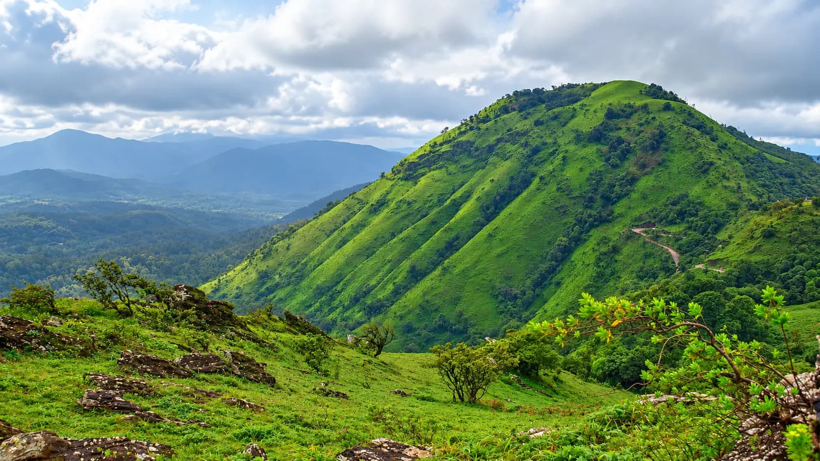
Piercing the southern skies of Karnataka like a sharp granite spire, Mullayanagiri is the undisputed monarch of the state's mountains.
The story of Mullayanagiri
Piercing the southern skies of Karnataka like a sharp granite spire, Mullayanagiri is the undisputed monarch of the state's mountains. Attaining a majestic summit elevation of 1,930 meters (6,332 feet) above mean sea level, it is officially verified as the highest peak in Karnataka. Situated in Chikkamagaluru Taluk of Chikkamagaluru District, approximately 22 kilometers north of the coffee capital of Chikkamagaluru, Mullayanagiri forms the highest crest of the legendary Chandra Drona Parvatha (Baba Budan Range) within the central Western Ghats (Sahyadris). Celebrated for its ancient windswept summit Shiva temple, the challenging Sarpadhari wilderness trekking trail, and an exhilarating 500-step stone staircase rising along a knife-edge ridge, Mullayanagiri is the ultimate high-altitude pilgrimage and trekking destination in South India.
Start here. Open a tile for the full details.
Why goRead details
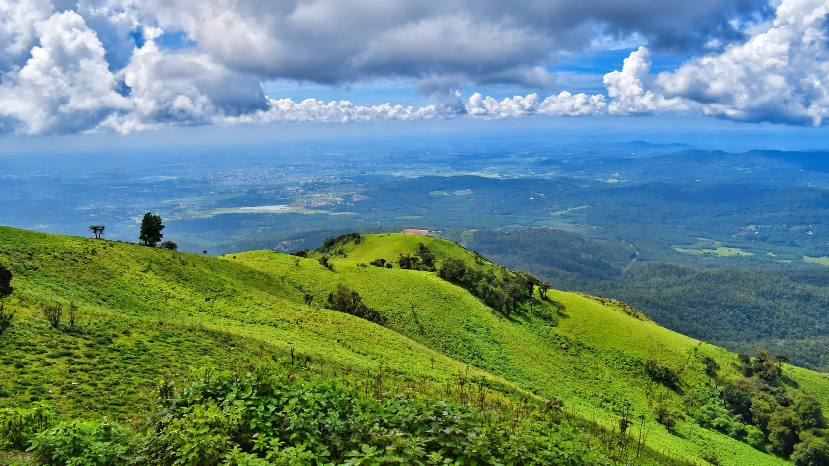
To stand atop Mullayanagiri is to stand upon the geographical roof of Karnataka. Perched nearly two vertical kilometers above the distant coastal and Deccan plains, visitors are treated to an awe-inspiring, unobstructed 360-degree panoramic vista that spans the entire breadth of the Western Ghats. On clear post-monsoon and winter mornings, the sight is nothing short of breathtaking: rolling emerald-green shola grasslands stretch into the distance like velvet waves, deep ravines shelter primeval evergreen rainforests, and far to the west on exceptionally clear days, a faint silver shimmer hints at the distant horizon of the Arabian Sea.
When to visitRead details
Entry & permissionsRead details
Fees, visiting hours and entry rules may change. Confirm the latest details with the official operator or local authority before travelling.
Visitor access, vehicular traffic flow, and environmental conservation at Mullayanagiri are strictly regulated by the District Administration of Chikkamagaluru and the Karnataka Forest Department.
+----------------------------------------------------------------------------------------------------+
|                                    ADMISSION AND TIMINGS SUMMARY                                   |
|                                                                                                    |
|  [OPERATING HOURS]                                                                                 |
|  - Mountain Road Access (Kaimara Gate): Daily 06:00 AM to 18:00 (6:00 PM).                         |
|  - Summit Temple Darshan: Daily 07:00 AM to 17:30 (5:30 PM).                                       |
|  - Descending Curfew: All visitors must begin descending from the summit by 17:30.                 |
|                                                                                                    |
|  [ENTRANCE TARIFFS]                                                                                |
|  - Mountain & Temple Admission: COMPLETELY FREE.                                                   |
|  - Sarpadhari Trekking Access: COMPLETELY FREE.                                                    |
|                                                                                                    |
|  [VEHICULAR PARKING CHARGES]                                                                       |
|  - Four-Wheelers (Cars, Jeeps, SUVs): Approx. ₹50 per vehicle.                                     |
|  - Two-Wheelers (Motorcycles, Scooters): Approx. ₹20 per vehicle.                                  |
|                                                                                                    |
|  [STRICT LEGAL & SAFETY RESTRICTIONS]                                                              |
|  - Camping Ban: Overnight camping, pitching tents, and lighting fires are STRICTLY PROHIBITED.     |
|  - Night Travel Curfew: The road is closed to private vehicles between 18:00 and 06:00 AM.         |
|  - Environmental Protection: Strictly plastic-free and alcohol-free zone; smoking banned.          |
|  - Drones: Flying unauthorized drones over the peak and temple is strictly banned.                 |
+----------------------------------------------------------------------------------------------------+
Traffic Regulation at Kaimara Checkpost
To prevent catastrophic gridlock on the single-lane cliffside road, the Chikkamagaluru District Police and Forest Department enforce strict vehicular quotas:
- On peak weekends and state holidays, when the small parking lot at the base of the steps (capacity approx. 80 - 100 cars) is full, police officers at the Kaimara checkpost or Seethalayyanagiri temporarily halt ascending four-wheelers.
- Vehicles are released in batches as descending vehicles clear the ghat. Visitors who arrive late (after 08:30 AM on a Sunday) may face wait times of one to two hours at the checkpost.
Wilderness Conservation and Zero-Tolerance Rules
The montane shola grasslands surrounding Mullayanagiri are an irreplaceable ecological reserve:
- Strict Ban on Night Camping: Due to past incidents of forest fires, alcohol-fueled misconduct, and littering, the Forest Department strictly bans setting up tents or camping on the peak or along the Sarpadhari trail. Police patrol the summit at 18:00 to ensure all tourists descend.
- Plastic Waste Prohibition: Discarding plastic water bottles, gutka packets, or snack wrappers along the stone steps is heavily penalized. Carry all waste back down in your backpack.
Plan your visitRead details
Mullayanagiri is situated 22 kilometers north of Chikkamagaluru town, accessible via a paved mountain highway and an access-controlled ghat road.
Explore the full guide - choose a topic below.
Why visit?
To stand atop Mullayanagiri is to stand upon the geographical roof of Karnataka.Explore detailsClose details
To stand atop Mullayanagiri is to stand upon the geographical roof of Karnataka. Perched nearly two vertical kilometers above the distant coastal and Deccan plains, visitors are treated to an awe-inspiring, unobstructed 360-degree panoramic vista that spans the entire breadth of the Western Ghats. On clear post-monsoon and winter mornings, the sight is nothing short of breathtaking: rolling emerald-green shola grasslands stretch into the distance like velvet waves, deep ravines shelter primeval evergreen rainforests, and far to the west on exceptionally clear days, a faint silver shimmer hints at the distant horizon of the Arabian Sea.
The mountain possesses a rich spiritual heritage that dates back centuries. The peak is named after the venerated Hindu ascetic Mullappa Swamy (affectionately known as Mullayya), who according to ancient regional folklore retreated to this desolate, cloud-swept crag to practice austere penance (tapasya). Crowned atop the highest monolithic granite boulder at the summit sits the ancient Mullappa Swamy Temple, a small, weather-beaten stone shrine dedicated to Lord Shiva and the samadhi (gadduge) of the sage. Devotees climb the windswept heights to ring the temple's brass bells, offer prayers at the sacred stone Nandi bull, and peer into the dark natural rock fissure where the sage meditated centuries ago.
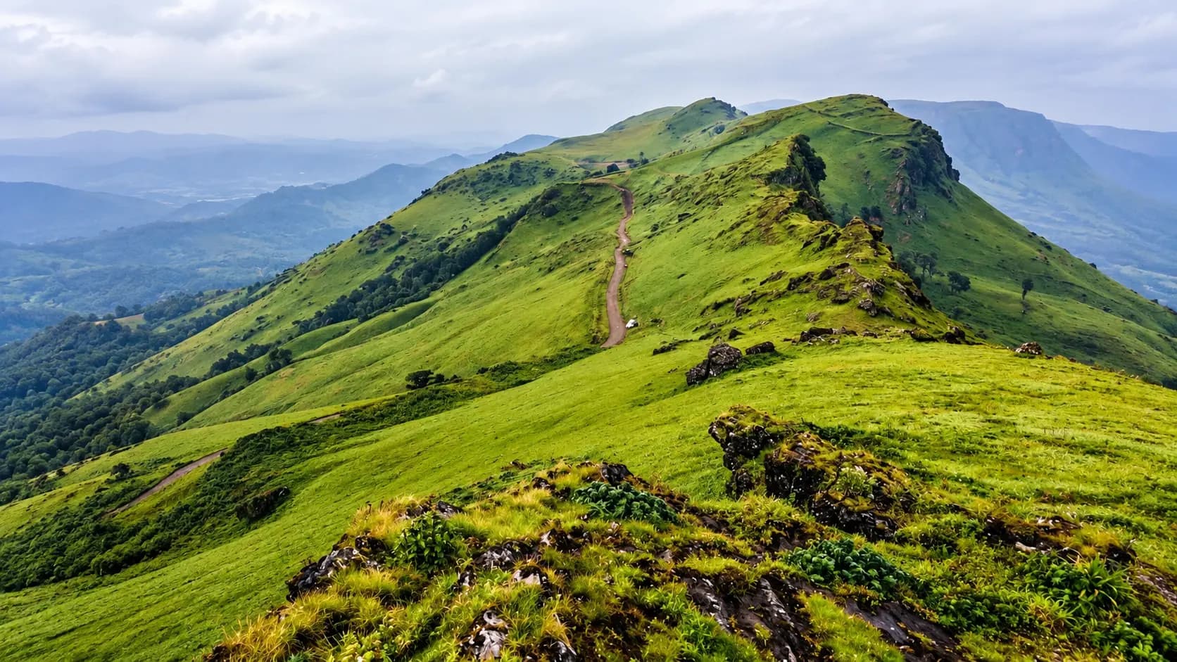
For trekkers and adventure seekers, Mullayanagiri offers two distinct and thrilling ascent options. Adventurous hikers can tackle the famous Sarpadhari Trek ("Serpent's Path"), a steep, rugged 3-kilometer wilderness trail that zig-zags relentlessly up loose volcanic scree, rocky ledges, and dwarf bamboo thickets. Alternatively, travelers driving up to the roadhead parking terminus can test their stamina by climbing the 500-step stone staircase constructed along an exposed, windswept ridge. Buffeted by roaring mountain gales that can exceed 60 to 80 km/h, the climb offers an exhilarating sense of exposure, where clouds swirl across your feet and the entire world falls away below.
Furthermore, Mullayanagiri serves as the southern trailhead for the legendary Chandra Drona Ridge Traverse, an epic 12-kilometer high-altitude hike across the crescent crest of the range connecting Mullayanagiri with Galikere lake and Baba Budangiri. Whether you are drawn by spiritual devotion, trekking ambition, or the sheer spectacle of watching a golden sunrise break over a rolling sea of white clouds, Mullayanagiri is an unforgettable Karnataka landmark.
What to expect
Visiting Mullayanagiri is an intense, high-energy mountain expedition that requires approximately three to four…Explore detailsClose details
Visiting Mullayanagiri is an intense, high-energy mountain expedition that requires approximately three to four hours. The journey combines a nerve-testing drive up an extremely narrow single-lane mountain road, an invigorating physical climb up 500 steep stone steps, and an encounter with extreme, rapidly shifting high-altitude weather.
+----------------------------------------------------------------------------------------------------+
|                                    MULLAYANAGIRI PEAK PRECINCT MAP                                 |
|                                                                                                    |
|  ============================== [MULLAYANAGIRI SUMMIT: 1,930 METERS] ============================== |
|  - HIGHEST PEAK IN KARNATAKA. 360-degree panoramic viewpoints over Western Ghats.                  |
|  - Ancient stone Mullappa Swamy Temple (Shiva Linga, Nandi Bull, Sage's Meditation Cave).          |
|                                                  |                                                 |
|                                                  ^                                                 |
|  ============================== [SUMMIT STAIRCASE (500 STONE STEPS)] ============================== |
|  - Steep concrete and stone staircase rising 150 vertical meters along knife-edge ridge.           |
|  - Fitted with steel handrails; buffeted by fierce, gale-force mountain winds.                     |
|                                                  |                                                 |
|                                                  ^                                                 |
|  ============================== [ROADHEAD PARKING TERMINAL: 1,780 METERS] ========================= |
|  - Pay-and-park apron for private cars, taxis, and motorcycles.                                    |
|  - Small tea stalls, Maggi noodle kiosks, public restrooms, and drinking water.                   |
|                                                  |                                                 |
|                                                  ^                                                 |
|  ============================== [SEETHALAYYANAGIRI TEMPLE: 1,750 METERS] ========================== |
|  - Ancient Shiva shrine with perennial sacred water spring (Kalyani). Intermediate parking.        |
|                                                  |                                                 |
|                                                  ^                                                 |
|  ============================== [SARPADHARI TREKKING TRAILHEAD (3 KM TREK)] ======================= |
|  - Steep zig-zag wilderness trail ascending rocky slopes, scree, and shola grasslands.            |
|                                                  |                                                 |
|                                                  ^                                                 |
|  ============================== [KAIMARA POLICE CHECKPOST & BASE JUNCTION] ======================== |
|Check the current visiting hours and permitted access with the site operator before departure; ceremonies, closures and visitor sessions can affect access.|
+----------------------------------------------------------------------------------------------------+
The Ascent: The Narrow Single-Lane Ghat Road
The journey to Mullayanagiri begins at the Kaimara checkpost, approximately 10 kilometers north of Chikkamagaluru town. Turning left off the main highway, vehicles begin ascending the dedicated Mullayanagiri Ghat Road. The first several kilometers wind gracefully through dense, shaded coffee plantations where massive silver oaks and wild ficus trees tower overhead.
However, once the road passes the intermediate Seethalayyanagiri Temple at an altitude of 1,750 meters, the terrain changes dramatically. The road narrows into an extremely narrow, single-lane asphalt strip carved directly into the sheer, rocky mountain flank with precipitous drop-offs into the valley below:
- In many sections, the road is only wide enough for a single vehicle. When two vehicles meet traveling in opposite directions, one driver must carefully reverse along the edge of the cliff to an unpaved passing turnout.
- Driving this stretch requires exceptional skill, patience, and confidence in reversing on mountain grades. Drivers must maintain low gears, sound their horns around blind rock corners, and strictly yield right-of-way to ascending traffic.
- On busy weekends and public holidays, traffic jams on this single-lane road can freeze vehicles in place for hours. Arriving early (by 06:30 AM to 07:00 AM) is essential to avoid severe congestion.
Seethalayyanagiri Temple (1,750 m)
Located roughly 2 kilometers below the summit parking lot, Seethalayyanagiri is a tranquil, historic shrine dedicated to Lord Shiva in the form of Seethala Mallikarjuna Swamy. Perched on a scenic shoulder of the mountain, the temple features an ancient stone sanctum and a sacred water tank (Kalyani).
Remarkably, despite its extreme altitude on a dry, windswept ridge, the natural spring feeding the Kalyani maintains a perpetual supply of crystal-clear, icy water throughout the year, even during the peak of summer droughts. Pilgrims stop here to wash their hands and face, offer prayers, and acclimatize before tackling the final climb to the summit.
The 500-Step Summit Staircase
From the roadhead parking terminal at 1,780 meters, vehicles can go no further. Reaching the true 1,930-meter summit requires tackling the famous 500-step stone staircase on foot.
The climb covers approximately 150 vertical meters over a horizontal distance of roughly 400 meters, ascending along an exposed, knife-edge grassy ridge. The steps are constructed of concrete and chiseled stone, flanked by sturdy steel handrails. As you climb, the physical exertion is tempered by the exhilarating alpine atmosphere:
- Gale-Force Winds: The wind at Mullayanagiri is legendary. Unobstructed by any higher landmass for hundreds of kilometers, mountain gales sweep up from the valleys with immense force, whistling through the railings and frequently tearing hats, caps, and loose scarves off unsuspecting climbers.
- Swirling Fog and Clouds: One moment you may be climbing under bright, warm sunshine; five minutes later, a dense, swirling cloud can engulf the staircase, plunging visibility to just a few feet and dropping the temperature by several degrees.
- Pacing the Climb: The climb takes between 20 and 35 minutes at a steady, unhurried pace. Shaded resting platforms and wide steps allow climbers to pause, catch their breath, and photograph the rolling shola valleys opening up below.
The Summit and Mullappa Swamy Temple (1,930 m)
Crowning the very highest point of the mountain is the sacred Mullappa Swamy Temple. Built of sturdy dressed granite blocks designed to withstand centuries of torrential monsoon storms and lightning strikes, this humble stone shrine marks the highest architectural point in Karnataka.
Inside the quiet, cave-like sanctum, an oil lamp illuminates the sacred stone Shiva Linga and the gadduge (tomb) of Saint Mullappa Swamy. A small natural rock fissure inside the compound leads into the subterranean meditation cave where the sage is believed to have sat in samadhi. Outside, a stone Nandi bull sits perpetually facing the shrine, adorned with vermilion and flower garlands.
Standing on the rocky viewing platform behind the temple, you are surrounded by an unbroken 360-degree horizon. To the north curves the massive crescent spine of Baba Budangiri; to the east stretch the fertile coffee plantations and blue lakes of Chikkamagaluru; and to the south and west lie the rugged, untamed rainforest ridges of the Kudremukh and Bhadra ranges.
The Sarpadhari Wilderness Trek
For dedicated trekking enthusiasts, ascending by road misses half the adventure. The Sarpadhari Trek is one of the classic day hikes of the Western Ghats:
- Trailhead: The trek begins at a marked milestone along the lower ghat road (near the Sarpadhari bus shelter, approximately 3 km before the summit parking).
- Trail Dynamics: The trail ascends approximately 3 kilometers along a steep, winding ridge. The terrain is demanding, traversing loose volcanic gravel, slippery rock slabs, and dense stands of dwarf montane bamboo (Ochlandra).
- Key Landmarks: Midway along the trail, hikers pass through a natural stone archway and explore a small cave where ascetic hermits once rested. The final 500 meters merges with the stone staircase leading up to the summit temple.
- Duration & Difficulty: The hike requires approximately 2 to 2.5 hours of strenuous uphill climbing, demanding good cardiovascular fitness, sturdy hiking boots with aggressive tread, and adequate hydration.
Best time to visit
Mullayanagiri’s extreme altitude (1,930 m) confers upon it an alpine microclimate unique in Karnataka…Explore detailsClose details
Seasonal Weather Patterns
Mullayanagiri’s extreme altitude (1,930 m) confers upon it an alpine microclimate unique in Karnataka, characterized by cold nights, fierce winds, and rapid meteorological changes:
+----------------------------------------------------------------------------------------------------+
|                                    SEASONAL VISITING CLIMATE & TRAIL GUIDE                         |
|                                                                                                    |
|  [SEPTEMBER TO MARCH: THE IDEAL VISITING WINDOW (RECOMMENDED)]                                     |
|  - Temperatures: 10°C to 22°C. Pre-dawn cold (often 8°C - 10°C); crisp, clear, sunny afternoons.     |
|  - Visibility: Panoramic 360-degree views; clear horizon; stunning sunrise cloud beds.            |
|  - Experience: The absolute best period for climbing the 500 steps and doing the Sarpadhari trek.  |
|  - Tip: Carry a windproof fleece jacket, warm beanie cap, and secure eyewear.                      |
|                                                                                                    |
|  [APRIL TO MAY: WARM SUMMER CLEAR SKIES]                                                           |
|  - Temperatures: 16°C to 28°C. Pleasant morning breezes; warm, intense mid-day mountain sun.       |
|  - Visibility: Clear skies; excellent photography; less intense winds.                            |
|  - Tip: Start your climb early at 06:30 AM to reach the summit before the sun reaches noon peak.   |
|                                                                                                    |
|  [JUNE TO AUGUST: EXTREME MONSOON RAGE]                                                            |
|  - Temperatures: 12°C to 18°C. Violent torrential rains, hurricane-force winds, zero visibility.  |
|  - Experience: Wild, primeval atmosphere; waterfalls roar; mountain is shrouded in driving clouds.|
|  - Hazards: Slippery moss on 500 stone steps; dangerous rockfalls; single-lane road mudslides.     |
|  - Caution: Not recommended for casual tourists; lightning hazards on exposed summit ridge.        |
+----------------------------------------------------------------------------------------------------+
Ideal Time of Day
- Sunrise Assault (06:00 AM to 08:30 AM): Check the current visiting hours and permitted access with the site operator before departure; ceremonies, closures and visitor sessions can affect access. You ascend the ghat road with zero oncoming traffic, reach the base parking lot by 06:30 AM, and climb the steps in the cool morning twilight to witness the sunrise breaking over the sea of clouds from the highest point in Karnataka.
- Avoid Weekend Mid-Days: Between 11:00 AM and 15:30 PM on Saturdays and Sundays, hundreds of vehicles attempt to navigate the narrow single-lane road simultaneously, causing gridlock where vehicles can remain trapped for hours.
How to reach
Mullayanagiri is situated 22 kilometers north of Chikkamagaluru town, accessible via a paved mountain highway and…Explore detailsClose details
Mullayanagiri is situated 22 kilometers north of Chikkamagaluru town, accessible via a paved mountain highway and an access-controlled ghat road.
+----------------------------------------------------------------------------------------------------+
|                                      REGIONAL TRANSIT CONNECTIONS                                  |
|                                                                                                    |
|  [Mangaluru International Airport (IXE): 170 km SW] <--- Charmadi Ghat & NH-73 (approx. 4 hrs)     |
|  [Kempegowda Int'l Airport (BLR): 265 km E]         <--- NH-75 & NH-373 (approx. 5 hrs)           |
|                                                                                                    |
|                                                  |                                                 |
|                                                  v                                                 |
|  ============================== [CHIKKAMAGALURU TOWN / KSRTC DEPOT] =============================== |
|  - Base hill station hub; hotels, homestays, self-drive rentals, and local taxi stands.           |
|  - Direct express buses from Bengaluru (Majestic), Mysuru, and Mangaluru.                          |
|                                                  |                                                 |
|                                                  v                                                 |
|  ============================== [KAIMARA POLICE CHECKPOST (10 KM NORTH)] ========================== |
|  - Base entry checkpoint. Check the current visiting hours and permitted access with the site operator before departure; ceremonies, closures and visitor sessions can affect access. Turn left onto Mullayanagiri Ghat Road.              |
|                                                  |                                                 |
|                                                  v                                                 |
|  ============================== [SEETHALAYYANAGIRI TEMPLE (18 KM NORTH)] ========================== |
|  - Ancient Shiva shrine and spring. Road narrows to single-lane cliffside track.                  |
|                                                  |                                                 |
|                                                  v                                                 |
|  ============================== [MULLAYANAGIRI BASE PARKING (22 KM NORTH)] ======================== |
|  - Roadhead parking apron (1,780 m elevation); base of 500-step summit staircase.                 |
+----------------------------------------------------------------------------------------------------+
By Road: Driving from Chikkamagaluru Town (22 km)
- The Route: Depart northern Chikkamagaluru along the state highway toward Kaimara (10 km). At the Kaimara police checkpost, turn left onto the dedicated mountain road heading toward Mullayanagiri. Climb past coffee estates to the Sarpadhari trailhead (16 km), pass Seethalayyanagiri Temple (18 km), and navigate the final steep single-lane cliffside ascent to the Mullayanagiri base parking lot (22 km). Driving time is approximately 45 to 60 minutes.
- Vehicle Suitability: The entire road is paved with tarmac. Hatchbacks, sedans, SUVs, and motorcycles can make the climb. Confirm the current charge and what it includes with the operator or service provider. Visitor admission, vehicles, parking, activities and accommodation can have separate charges.
By Public Bus (KSRTC)
- Direct KSRTC mountain buses do not run all the way to the summit parking lot due to the narrow single-lane road.
- KSRTC feeder buses operate from the Chikkamagaluru Central Bus Stand to the Kaimara junction and Attigundi. From Kaimara, travelers can hire private auto-rickshaws or shared jeeps to reach the base parking lot or the Sarpadhari trailhead.
Nearest Railway Stations
- Chikkamagaluru Railway Station (CMGR): Located 24 km south, connected by daily regional passenger and express trains to Kadur and Shivamogga.
- Kadur Junction (DRU): Located 62 km east on the national railway trunk line, offering frequent superfast train connections to Bengaluru (approx. 3.5 hours), Hubballi, Belagavi, and Pune. Pre-booked taxis and express buses connect Kadur to Chikkamagaluru around the clock.
Nearest Airports
- Mangaluru International Airport (IXE): Located approximately 170 km southwest. The drive traverses the dramatic Charmadi Ghat, taking roughly 4 to 4.5 hours by taxi.
- Kempegowda International Airport Bengaluru (BLR): Located approximately 265 km east via the 4-lane NH-75 highway (approx. 5 to 5.5 hours).
Entry, timings and permissions
Fees, visiting hours and entry rules may change.Explore detailsClose details
Fees, visiting hours and entry rules may change. Confirm the latest details with the official operator or local authority before travelling.
Visitor access, vehicular traffic flow, and environmental conservation at Mullayanagiri are strictly regulated by the District Administration of Chikkamagaluru and the Karnataka Forest Department.
+----------------------------------------------------------------------------------------------------+
|                                    ADMISSION AND TIMINGS SUMMARY                                   |
|                                                                                                    |
|  [OPERATING HOURS]                                                                                 |
|  - Mountain Road Access (Kaimara Gate): Daily 06:00 AM to 18:00 (6:00 PM).                         |
|  - Summit Temple Darshan: Daily 07:00 AM to 17:30 (5:30 PM).                                       |
|  - Descending Curfew: All visitors must begin descending from the summit by 17:30.                 |
|                                                                                                    |
|  [ENTRANCE TARIFFS]                                                                                |
|  - Mountain & Temple Admission: COMPLETELY FREE.                                                   |
|  - Sarpadhari Trekking Access: COMPLETELY FREE.                                                    |
|                                                                                                    |
|  [VEHICULAR PARKING CHARGES]                                                                       |
|  - Four-Wheelers (Cars, Jeeps, SUVs): Approx. ₹50 per vehicle.                                     |
|  - Two-Wheelers (Motorcycles, Scooters): Approx. ₹20 per vehicle.                                  |
|                                                                                                    |
|  [STRICT LEGAL & SAFETY RESTRICTIONS]                                                              |
|  - Camping Ban: Overnight camping, pitching tents, and lighting fires are STRICTLY PROHIBITED.     |
|  - Night Travel Curfew: The road is closed to private vehicles between 18:00 and 06:00 AM.         |
|  - Environmental Protection: Strictly plastic-free and alcohol-free zone; smoking banned.          |
|  - Drones: Flying unauthorized drones over the peak and temple is strictly banned.                 |
+----------------------------------------------------------------------------------------------------+
Traffic Regulation at Kaimara Checkpost
To prevent catastrophic gridlock on the single-lane cliffside road, the Chikkamagaluru District Police and Forest Department enforce strict vehicular quotas:
- On peak weekends and state holidays, when the small parking lot at the base of the steps (capacity approx. 80 - 100 cars) is full, police officers at the Kaimara checkpost or Seethalayyanagiri temporarily halt ascending four-wheelers.
- Vehicles are released in batches as descending vehicles clear the ghat. Visitors who arrive late (after 08:30 AM on a Sunday) may face wait times of one to two hours at the checkpost.
Wilderness Conservation and Zero-Tolerance Rules
The montane shola grasslands surrounding Mullayanagiri are an irreplaceable ecological reserve:
- Strict Ban on Night Camping: Due to past incidents of forest fires, alcohol-fueled misconduct, and littering, the Forest Department strictly bans setting up tents or camping on the peak or along the Sarpadhari trail. Police patrol the summit at 18:00 to ensure all tourists descend.
- Plastic Waste Prohibition: Discarding plastic water bottles, gutka packets, or snack wrappers along the stone steps is heavily penalized. Carry all waste back down in your backpack.
Nearby places to consider
Mullayanagiri sits at the center of Chikkamagaluru’s high-altitude tourism network, surrounded by dramatic…Explore detailsClose details
Mullayanagiri sits at the center of Chikkamagaluru’s high-altitude tourism network, surrounded by dramatic waterfalls, rival peaks, and historic shrines.
+----------------------------------------------------------------------------------------------------+
|                                    NEARBY DESTINATIONS NETWORK                                     |
|                                                                                                    |
|  [Baba Budangiri: 15 km Northeast]               [Jhari (Buttermilk) Falls: 12 km East]            |
|  (1,895 m Crescent Ridge, 1670 CE Coffee Birth)  (Roaring Milky Cascade, 4x4 Jeep Descent)         |
|         ^                                              ^                                           |
|          \                                            /                                            |
|           \                                          /                                             |
|  ================== [MULLAYANAGIRI: 1,930 M HIGHEST PEAK IN KARNATAKA] ============================ |
|           /                                          \                                             |
|          /                                            \                                            |
|         v                                              v                                           |
|  [Seethalayyanagiri: 2 km Downhill]              [Chikkamagaluru Town: 22 km South]                |
|  (Ancient Shiva Temple, Sacred Cold Spring)      (Coffee Museum, Historic Bazaars, Gateway Hub)    |
+----------------------------------------------------------------------------------------------------+
Seethalayyanagiri Temple (2 km Downhill)
Nestled on a scenic mountain saddle just 2 kilometers below the Mullayanagiri base parking lot, Seethalayyanagiri (elevation 1,750 m) is home to an ancient stone shrine dedicated to Lord Shiva as Seethala Mallikarjuna Swamy. The temple is celebrated for its sacred natural spring (Kalyani), where icy water continuously trickles from beneath subterranean granite fissures, providing a peaceful spiritual pause along the steep ascent.
Jhari (Buttermilk) Falls (12 km East)
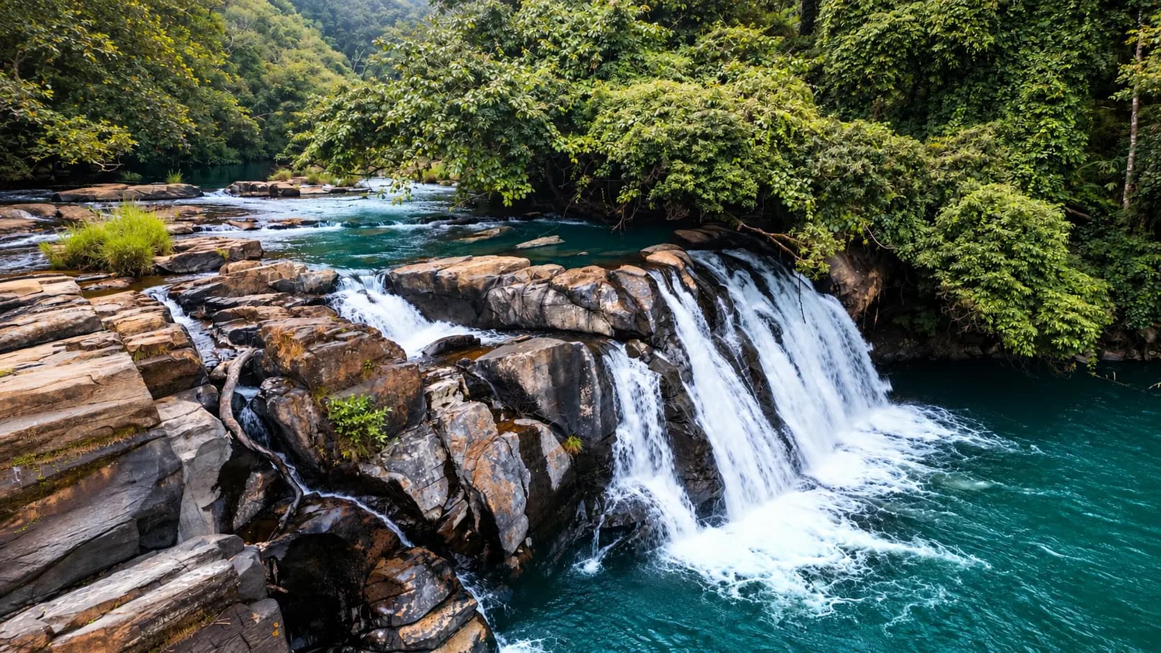
Tucked deep within private coffee and tea plantations near Attigundi, Jhari Falls (also known as Buttermilk Falls) is one of the most picturesque waterfalls in the Western Ghats. Springs originating in the upper Bababudan grasslands plunge over stepped rock tiers, churning the water into a foaming, frothy white cascade resembling buttermilk. Reachable via an exhilarating 4-kilometer ride in local four-wheel-drive jeeps down steep, unpaved plantation tracks, Jhari Falls offers a refreshing natural pool where visitors can wade in the mountain spray.
Baba Budangiri (15 km Northeast)
The sister summit of Mullayanagiri across the Chandra Drona range, Baba Budangiri (1,895 m) is celebrated as the historic cradle where Sufi saint Baba Budan planted the first seven smuggled coffee seeds from Yemen in 1670 CE. The mountain features a sacred, rock-cut cave shrine venerated by both Hindus and Muslims as Sri Guru Dattatreya Bababudan Swamy Peetha, alongside the pearl-like cascades of Manikyadhara Falls and the alpine waters of Galikere lake.
Chikkamagaluru Coffee Museum (24 km South)
Located on the outskirts of Chikkamagaluru town, the Coffee Museum is managed by the Coffee Board of India. It offers an engaging, educational journey through the botany, history, harvesting, roasting, and global trade of coffee, complete with an olfactory coffee-aroma laboratory and video documentaries.
In pictures
The practical bits
Before you go.
Plan ahead
Strategic preparation regarding clothing, timing, and physical conditioning is essential for tackling the…Explore detailsClose details
Strategic preparation regarding clothing, timing, and physical conditioning is essential for tackling the high-altitude winds and physical demands of Karnataka’s highest peak.
Dress in Windproof and Warm Layers
Because of its 1,930-meter altitude and relentless mountain winds, Mullayanagiri can feel intensely cold…Explore detailsClose details
Because of its 1,930-meter altitude and relentless mountain winds, Mullayanagiri can feel intensely cold, particularly in the early morning and late afternoon. Dress in layers - a windproof jacket or fleece, a warm beanie cap that covers your ears (to prevent wind-induced earaches), and comfortable trousers are highly recommended.
Wear Sturdy Hiking Shoes with High-Traction Treads
Whether you are climbing the 500 stone steps or hiking the rugged 3-km Sarpadhari trail, wear closed athletic…Explore detailsClose details
Whether you are climbing the 500 stone steps or hiking the rugged 3-km Sarpadhari trail, wear closed athletic sneakers or trekking shoes with deep rubber treads. Smooth-soled dress shoes, high heels, and loose flip-flops are dangerous on the steep, wind-buffeted stone steps, which can be slick with morning condensation or rain moss.
Secure Eyewear, Caps, and Handheld Valuables
The fierce, sudden gusts of wind at the summit can easily rip baseball caps, lightweight sunglasses, and loose…Explore detailsClose details
The fierce, sudden gusts of wind at the summit can easily rip baseball caps, lightweight sunglasses, and loose scarves from your body and fling them into the abyss. Keep smartphones and cameras secured with wrist straps or neck cords, and ensure loose items are stowed inside zipped pockets.
Carry a Reusable Water Bottle and Light Snacks
Climbing 500 steep stone steps at an elevation of nearly 2,000 meters requires significant cardiovascular exertion.Explore detailsClose details
Climbing 500 steep stone steps at an elevation of nearly 2,000 meters requires significant cardiovascular exertion. Carry a refillable water bottle to stay hydrated, along with energy bars, nuts, or glucose candies to sustain energy during the climb.
Pair with Baba Budangiri and Jhari Waterfalls
A trip to Mullayanagiri takes roughly three to four hours, making it ideal to pair with the nearby Jhari…Explore detailsClose details
A trip to Mullayanagiri takes roughly three to four hours, making it ideal to pair with the nearby Jhari (Buttermilk) Falls (located near Attigundi, reachable by 4x4 jeep) and the historic, syncretic cave shrine of Baba Budangiri (15 km northeast across the mountain ridge) for an extraordinary full-day Malnad mountain circuit.
+----------------------------------------------------------------------------------------------------+
|                                  SUGGESTED COMBINED DAY ITINERARY: ROOF OF KARNATAKA               |
|                                                                                                    |
|  05:45 AM to 06:45 AM  -  Early Morning Drive from Chikkamagaluru                                    |
|Check the current visiting hours and permitted access with the site operator before departure; ceremonies, closures and visitor sessions can affect access.|
|  - Navigate the thrilling single-lane cliffside road up to the Mullayanagiri base parking lot.     |
|                                                                                                    |
|  06:45 AM to 08:30 AM  -  The 500-Step Summit Ascent & Mullappa Swamy Temple                         |
|  - Ascend the 500 stone steps along the knife-edge ridge in the crisp morning mountain air.        |
|  - Reach the 1,930 m summit of Karnataka; ring the bells at the stone Shiva temple; explore cave.  |
|  - Marvel at the 360-degree panoramic vista and watch the golden sunrise illuminate the clouds.   |
|                                                                                                    |
|  08:30 AM to 09:15 AM  -  Descent & Seethalayyanagiri Visit                                          |
|  - Walk down the stone steps; stop at Seethalayyanagiri Temple to view the sacred cold spring.     |
|                                                                                                    |
|  09:30 AM to 10:30 AM  -  Attigundi Village Coffee & Breakfast                                       |
|  - Drive across to Attigundi village; savor piping-hot South Indian breakfast and estate coffee.   |
|                                                                                                    |
|  11:00 AM to 01:00 PM  -  Jhari (Buttermilk) Falls Excursion                                         |
|  - Board a local 4x4 jeep to descend the rugged dirt track through private tea and coffee estates. |
|  - Stand before the roaring, milky white cascade of Jhari Falls; enjoy refreshing mountain spray.  |
|                                                                                                    |
|  01:30 PM to 02:45 PM  -  Traditional Malnad Lunch                                                   |
|  - Savor authentic local Malnad cuisine at a scenic plantation restaurant near Kaimara.            |
|                                                                                                    |
|  03:15 PM to 05:30 PM  -  Baba Budangiri Cave Shrine & Manikyadhara                                  |
|  - Explore the historic 1670 CE birthplace of Indian coffee; visit the rock-cut Dattatreya shrine. |
|  - Drive to Manikyadhara Falls; view the pearl-like water cascade before heading down the mountain.|
+----------------------------------------------------------------------------------------------------+
A few things you might wonder
Common questions about visiting Mullayanagiri. Fees, visiting hours and ceremonies are researched details that may change; confirm current arrangements with the operator before travelling.
What is the elevation of Mullayanagiri and why is it significant?
How many steps must visitors climb to reach the top of Mullayanagiri?
Can regular private cars drive all the way to the Mullayanagiri base parking?
What is the Sarpadhari Trek?
Are there entry fees or permits required to visit Mullayanagiri?
Is night camping allowed on Mullayanagiri?
What is the best time of day to visit Mullayanagiri?
What weather conditions should visitors prepare for at the summit?
Explore more in Coorg Chikmagalur
Discover other destinations around this hub
More Hubs in Karnataka
Continue exploring other travel hubs in this state
Planning a trip to Coorg Chikmagalur?