Galikonda View Point
Visit Galikonda View Point, the highest roadside peak on the Visakhapatnam-Araku highway. Panoramic views at 1,317m, morning cloud sea, and tribal roadside stalls.
Location
Araku Valley, Andhra Pradesh
A closer look
Your visit, at a glance.
Araku Valley, Andhra Pradesh
GET TO KNOW THE PLACE
High above the undulating green folds of the northern Eastern Ghats in Andhra Pradesh, Galikonda View Point stands as the crowning scenic overlook along the mountain highway…
The story of Galikonda View Point
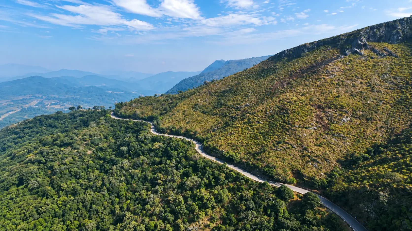
High above the undulating green folds of the northern Eastern Ghats in Andhra Pradesh, Galikonda View Point stands as the crowning scenic overlook along the mountain highway connecting the coastal city of Visakhapatnam to the elevated basin of Araku Valley. Situated in Ananthagiri Mandal, Alluri Sitharama Raju (ASR) District, at an elevation of approximately 1,317 metres (4,320 feet) above mean sea level - with the broader Galikonda mountain ridge soaring to nearly 1,500 metres (5,000 feet) - this breath-taking roadside promontory holds the distinction of being the highest geographical vantage point along State Highway 39.
The name Galikonda is derived from the Telugu words Gali (meaning "wind") and Konda (meaning "hill" or "mountain"), an apt descriptor for the bracing, high-velocity montane drafts that continually sweep across this exposed saddle. From the paved viewing platform, travelers are treated to an astonishing 360-degree amphitheater of wilderness: sweeping vistas of the emerald Araku Valley floor, dense subtropical rainforests, terraced tribal settlements, and the dramatic ribbon of the ghat road tracing hairpin turns far below. Whether catching the mystical winter "sea of clouds" at dawn, watching the sun dip into the misty blue horizons at dusk, or savoring hot, charcoal-roasted sweet corn from local tribal vendors, a pause at Galikonda is an essential rite of passage for every Eastern Ghats traveler.
Start here. Open a tile for the full details.
Why goRead details
- The Highest Roadside Vantage Point: Stand at 1,317 metres (4,320 feet) above sea level, the highest elevation reached by the Visakhapatnam - Araku highway, offering unparalleled alpine air and cool temperatures.
- Sweeping 360-Degree Mountain Panoramas: Look out over hundreds of square kilometres of layered Eastern Ghats ridges, deep forested ravines, and the distant patchwork of tribal agricultural terraces.
- The Ethereal "Sea of Clouds" Spectacle: Witness the magical temperature inversion of winter mornings, when the entire Araku Valley is blanketed in a sea of dense white fog while the peaks rise like islands in the dawn sun.
- Stunning Bird’s-Eye View of the Ghat Road: Marvel at the engineering mastery of the Ananthagiri Ghat Road as it twists through sweeping hairpin bends and clings to sheer mountainsides beneath you.
- Authentic Wayside Tribal Gastronomy: Taste fresh local sweet corn roasted on charcoal braziers, seasoned with lime and chili, alongside wild forest honey and seasonal mountain pineapples.
- Effortless Roadside Access: Enjoy world-class panoramic vistas without requiring rigorous trekking, making it completely accessible for elderly travelers, families, and road-trippers of all ages.
When to visitRead details
Galikonda's exposed high-altitude position means atmospheric conditions change dynamically with the seasons:
Entry & permissionsRead details
Fees, visiting hours and entry rules may change. Confirm the latest details with the official operator or local authority before travelling.
- Admission Charges:
- Entry Fee: Completely Free of charge. The viewpoint is an open public wayside overlook developed by the state government.
- Parking Charges: Free roadside parking on the paved shoulder and designated layby bays.
- Snacks & Produce: Roasted sweet corn is typically ₹20 to ₹30 per cob; fresh pineapples are ₹40 to ₹60; pure wild honey ranges from ₹250 to ₹400 per bottle.
- Operating Hours:
- The roadside pavilion is open 24 hours a day, 7 days a week.
- Daylight visiting hours between 6:00 AM and 6:00 PM are strongly advised. Stopping late at night is discouraged due to thick nocturnal fog, lack of streetlighting, and fast-moving highway traffic.
- Permissions & Safety Protocols:
- No permits or clearances are required for any visitors.
- Highway Safety: Because the viewpoint sits directly alongside a mountain highway with blind curves, travelers must exercise caution when crossing the road and parking vehicles. Always pull completely off the active driving lane into the designated parking layby.
- Climbing Restrictions: Visitors must remain behind the concrete parapet wall and safety railings. Do not attempt to climb down the steep, unstable shale slopes below the viewpoint.
- Wind Precautions: Due to strong, sudden gusts of wind, secure lightweight hats, caps, loose shawls, and sunglasses when approaching the railing.
Plan your visitRead details
Galikonda View Point is located directly on the primary transport artery linking coastal Andhra Pradesh to the Araku highlands:
Dressing for High-Altitude Wind Chill
At 1,317 metres elevation, the ambient temperature at Galikonda is typically 6°C to 10°C colder than the coastal plains of Visakhapatnam, and the relentless mountain wind magnifies the chill. Even on sunny days, pack a light windbreaker, fleece jacket, or wool shawl, especially if visiting during the early morning or evening hours between November and February.
Explore the full guide - choose a topic below.
Why visit?
The Highest Roadside Vantage Point: Stand at 1,317 metres (4,320 feet) above sea level, the highest elevation…Explore detailsClose details
- The Highest Roadside Vantage Point: Stand at 1,317 metres (4,320 feet) above sea level, the highest elevation reached by the Visakhapatnam - Araku highway, offering unparalleled alpine air and cool temperatures.
- Sweeping 360-Degree Mountain Panoramas: Look out over hundreds of square kilometres of layered Eastern Ghats ridges, deep forested ravines, and the distant patchwork of tribal agricultural terraces.
- The Ethereal "Sea of Clouds" Spectacle: Witness the magical temperature inversion of winter mornings, when the entire Araku Valley is blanketed in a sea of dense white fog while the peaks rise like islands in the dawn sun.
- Stunning Bird’s-Eye View of the Ghat Road: Marvel at the engineering mastery of the Ananthagiri Ghat Road as it twists through sweeping hairpin bends and clings to sheer mountainsides beneath you.
- Authentic Wayside Tribal Gastronomy: Taste fresh local sweet corn roasted on charcoal braziers, seasoned with lime and chili, alongside wild forest honey and seasonal mountain pineapples.
- Effortless Roadside Access: Enjoy world-class panoramic vistas without requiring rigorous trekking, making it completely accessible for elderly travelers, families, and road-trippers of all ages.
What to expect
Stopping at Galikonda View Point is a revitalizing highland experience that offers a distinct sensory change from…Explore detailsClose details
Stopping at Galikonda View Point is a revitalizing highland experience that offers a distinct sensory change from the warmer coastal plains below:
[Visakhapatnam (95 km) via SH-39 Ghats] ====> [Galikonda View Point Ridge (1,317 m)] ====> [Araku Town (18 km)]
                                                            |
                           +--------------------------------+-------------------------------+
                           |                                                                |
                           v                                                                v
              [Paved Viewing Pavilion & Parapet]                               [Wayside Tribal Micro-Market]
              - 360-Degree Valley Panorama                                     - Charcoal-Roasted Sweet Corn
              - Morning Cloud Inversion ("Sea of Clouds")                      - Mountain Pineapples & Forest Honey
              - Distant K-K Railway Tunnels & Viaducts                         - Pure Araku Arabica Coffee Powder
1. The High-Altitude Mountain Saddle
As your vehicle navigates the final climbing bends of State Highway 39 past Ananthagiri, the road crests a narrow mountain saddle. Instantly, the dense roadside forest gives way to expansive open sky, and a brisk, invigorating mountain wind buffets the vehicle. A wide paved roadside viewing platform, equipped with sturdy concrete parapet walls and iron safety railings, provides a secure perch overlooking the steep eastern and western drops.
2. The Vast Eastern Ghats Panorama
Looking northwest, the panoramic vista stretches across the entire Araku Valley bowl, bordered in the far distance by the cloud-capped ranges of the Odisha border. To the southeast, the forested ravines of Ananthagiri tumble away toward the coastal plains. On exceptionally clear winter mornings, patient observers with binoculars can spot the silver tracks, high viaducts, and dark tunnel openings of the legendary Kottavalasa - Kirandul (K-K) mountain railway etched into distant cliff faces.
3. The Morning "Sea of Clouds"
Between late October and early February, visitors arriving at Galikonda between 06:00 AM and 07:30 AM are frequently treated to the breathtaking "cloud bed" phenomenon. Because cold, dense mountain air sinks into the valley overnight, a thick layer of stratus clouds forms over the valley basin, completely concealing the ground beneath a white, billowy ocean. The jagged upper peaks of Galikonda and neighboring ridges rise above the clouds like islands in an ethereal sea, bathed in soft pink, amber, and gold dawn sunlight.
4. Roadside Tribal Vendors and Refreshments
The shoulder of the viewpoint is lined with modest stalls managed by indigenous tribal families from nearby Ananthagiri Agency hamlets. The cool mountain air carries the appetizing scent of sweet corn roasting over wood coals:
- Roasted Corn (Mokkajonna Kankulu): Plump cobs freshly plucked from highland terraces, roasted over glowing embers, and coated with tangy lemon juice, sea salt, and red chili powder.
- Fresh Mountain Fruits: Sliced pineapples, wild papayas, sweet custard apples (sitaphal), and seasonal berries sold in eco-friendly leaf wraps.
- Agency Forest Produce: Jars of golden, wild forest honey harvested from cliff faces, raw mountain ginger, and fresh bags of roasted Araku Arabica coffee powder.
Best time to visit
Galikonda's exposed high-altitude position means atmospheric conditions change dynamically with the seasons…Explore detailsClose details
Galikonda's exposed high-altitude position means atmospheric conditions change dynamically with the seasons:
Season | Months | Weather & Thermal Conditions | Visual & Travel Experience |
|---|---|---|---|
Peak Winter | November to February | Bracing mountain cold; dawn temps drop to 8°C - 12°C; afternoon highs around 20°C - 23°C; brisk gusts. | Supreme Visiting Window: Highest probability of witnessing the "Sea of Clouds"; crystal-clear afternoon skies; pleasant sunny walks along the ridge. |
Spring | March to April | Mild mornings (16°C); warm, breezy afternoons (27°C - 31°C); golden dry-grass hillsides. | Excellent Visibility: Unobstructed long-distance views across the valley; less crowded; excellent for photographing mountain contours. |
Summer | May to mid-June | Warm days (28°C to 34°C), but pleasantly cooler than the scorching plains (40°C+); strong thermal winds. | Refreshing Highway Respite: An essential stopping point to catch cool montane breezes while ascending from Visakhapatnam to Araku. |
Monsoon | July to October | Heavy mist, driving rain, and swirling fog; lush emerald greenery; dramatic cloudscapes. | Moody & Dramatic: The hills turn deep green and mountain streams roar below, though thick fog can temporarily reduce visibility to a few metres. |
Recommended Time of Day: The most magical times to stop at Galikonda are early morning between 06:00 AM and 08:30 AM (for the morning cloud inversion and soft dawn photography) and late afternoon between 04:30 PM and 06:00 PM (to watch the sunset cast deep golden light across the Eastern Ghats).
How to reach
Galikonda View Point is located directly on the primary transport artery linking coastal Andhra Pradesh to the…Explore detailsClose details
Galikonda View Point is located directly on the primary transport artery linking coastal Andhra Pradesh to the Araku highlands:
[Visakhapatnam (95 km)] ====(SH-39 Ananthagiri Ghat)====> [GALIKONDA VIEW POINT (1,317 m)] ====(18 km)====> [Araku Town Center]
                                                                        |
                                                               (5 km spur off SH-39)
                                                                        v
                                                               [Borra Caves & Katiki Falls]
By Road (Private Car, Taxi, or Bus)
- Direct Highway Location: The viewpoint requires no detours; it sits right on State Highway 39 (Visakhapatnam - Araku Ghat Road) at the summit pass between Ananthagiri village and Araku town.
- From Visakhapatnam (95 km, 2.5 to 3 hours): Take SH-39 through Pendurthi and S. Kota. Ascend the scenic Ananthagiri Ghat road. Galikonda View Point appears on your left as you reach the highest crest of the pass, approximately 10 km past Ananthagiri village.
- From Araku Town (18 km, 25 to 30 minutes): Drive southeast along SH-39 toward Visakhapatnam. The viewpoint is on your right just before the highway begins its descent into the Ananthagiri hills.
- Public Buses: All APSRTC express and deluxe buses operating between Visakhapatnam and Araku pass directly by Galikonda View Point. Passengers on private tourist buses or organized APTDC sight-seeing coaches are given a scheduled 20 to 30-minute stop here.
By Rail
- Shimiliguda Railway Station (approx. 8 km): One of the highest broad-gauge railway stations in India, located nearby on the Kothavalasa - Kirandul (K-K) line.
- Borra Guhalu (approx. 12 km) & Araku (approx. 18 km): Major passenger stops with frequent road connections to the viewpoint.
By Air
- Visakhapatnam International Airport (VTZ, ~90 km): Well-connected by domestic flights. Taxis can be hired directly from the airport terminal.
Entry, timings and permissions
Fees, visiting hours and entry rules may change.Explore detailsClose details
Fees, visiting hours and entry rules may change. Confirm the latest details with the official operator or local authority before travelling.
- Admission Charges:
- Entry Fee: Completely Free of charge. The viewpoint is an open public wayside overlook developed by the state government.
- Parking Charges: Free roadside parking on the paved shoulder and designated layby bays.
- Snacks & Produce: Roasted sweet corn is typically ₹20 to ₹30 per cob; fresh pineapples are ₹40 to ₹60; pure wild honey ranges from ₹250 to ₹400 per bottle.
- Operating Hours:
- The roadside pavilion is open 24 hours a day, 7 days a week.
- Daylight visiting hours between 6:00 AM and 6:00 PM are strongly advised. Stopping late at night is discouraged due to thick nocturnal fog, lack of streetlighting, and fast-moving highway traffic.
- Permissions & Safety Protocols:
- No permits or clearances are required for any visitors.
- Highway Safety: Because the viewpoint sits directly alongside a mountain highway with blind curves, travelers must exercise caution when crossing the road and parking vehicles. Always pull completely off the active driving lane into the designated parking layby.
- Climbing Restrictions: Visitors must remain behind the concrete parapet wall and safety railings. Do not attempt to climb down the steep, unstable shale slopes below the viewpoint.
- Wind Precautions: Due to strong, sudden gusts of wind, secure lightweight hats, caps, loose shawls, and sunglasses when approaching the railing.
Nearby places to consider
Galikonda’s central position along State Highway 39 makes it the perfect gateway to surrounding natural and…Explore detailsClose details
Galikonda’s central position along State Highway 39 makes it the perfect gateway to surrounding natural and cultural highlights:
[Araku Town / Tribal Museum] (18 km northwest)
                 ^
                 |
     [GALIKONDA VIEW POINT (1,317 m)]
                 |
          (10 km southeast)
                 v
[Ananthagiri Coffee Plantations] ====(12 km east)====> [Borra Caves & Katiki Falls]- Ananthagiri Coffee Plantations (10 km southeast): Extensive shade-grown organic coffee estates bordering the highway, celebrated for historic 1898 plantings beneath towering silver oaks.
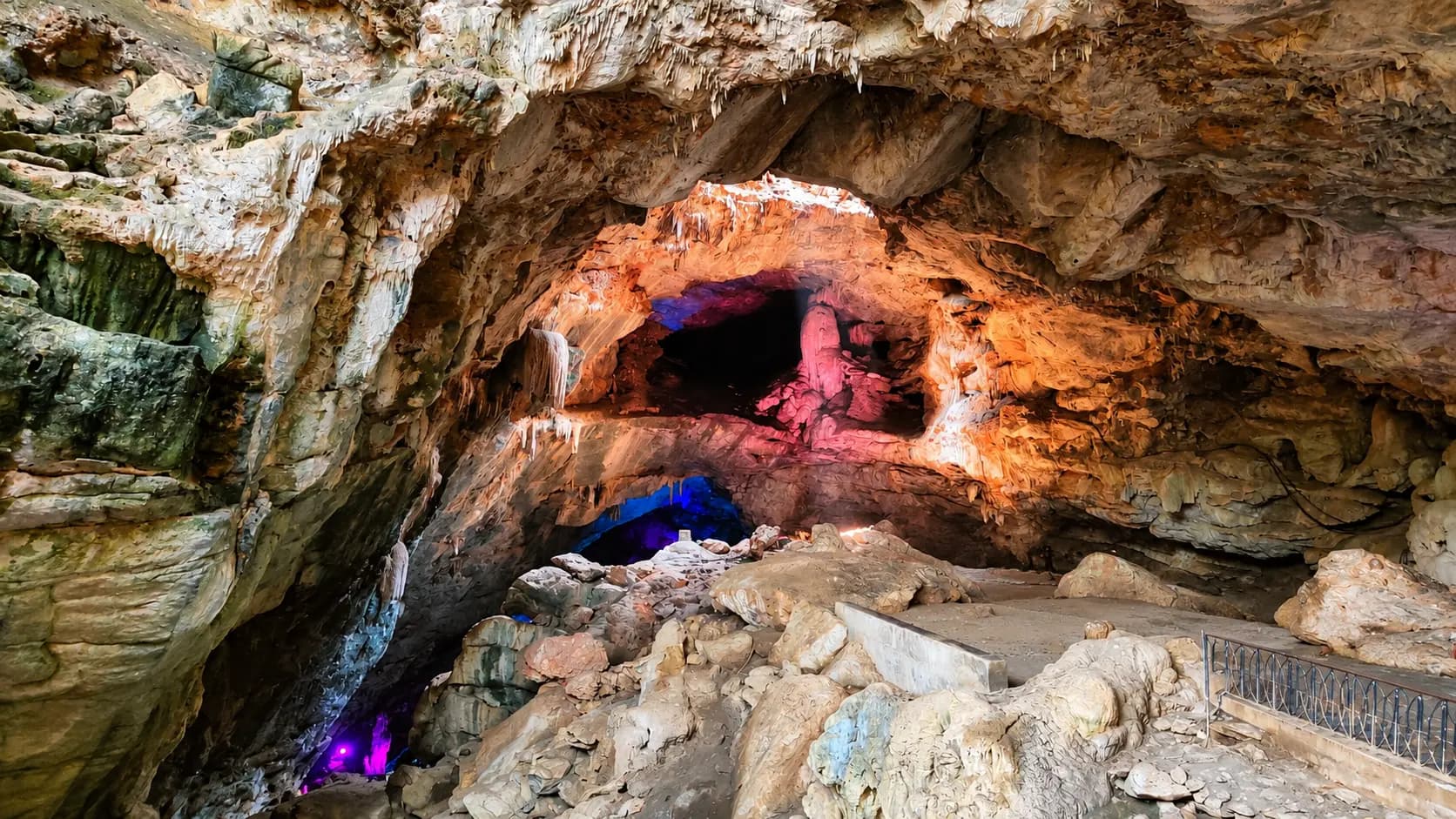
- Borra Caves (18 km southeast via SH-39 & spur): Over 150-million-year-old subterranean limestone caves featuring illuminated stalactite and stalagmite formations extending 80 metres deep.
- Katiki Waterfalls (26 km southeast): A breathtaking 50-foot waterfall tumbling through dense rainforest, reached via an adventurous four-wheel-drive jeep track near Borra Caves.
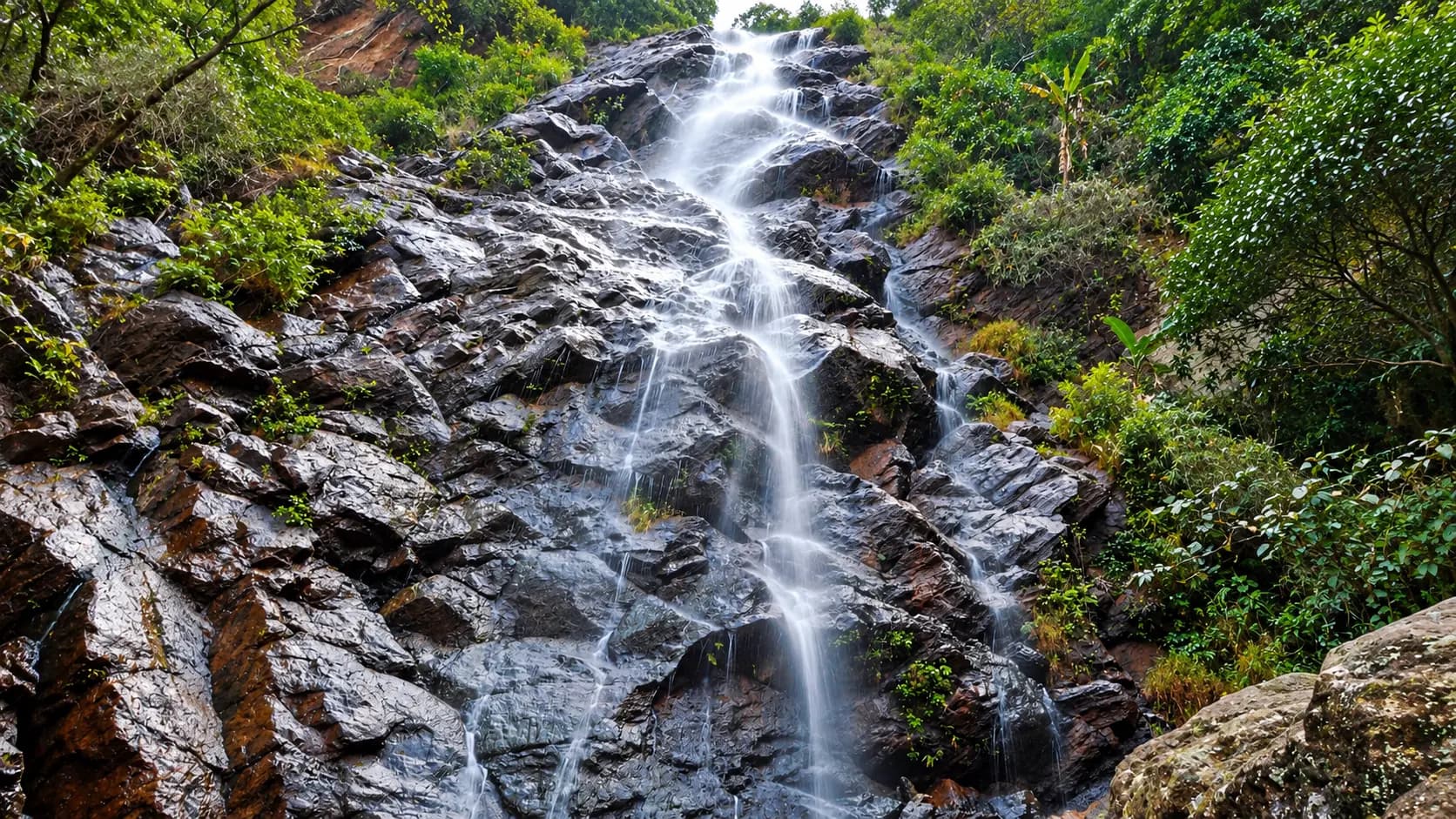
- Tatiguda Waterfalls (14 km southeast): A tiered 100-foot waterfall cascading over rock shelves in the lush forested hills near Ananthagiri village.
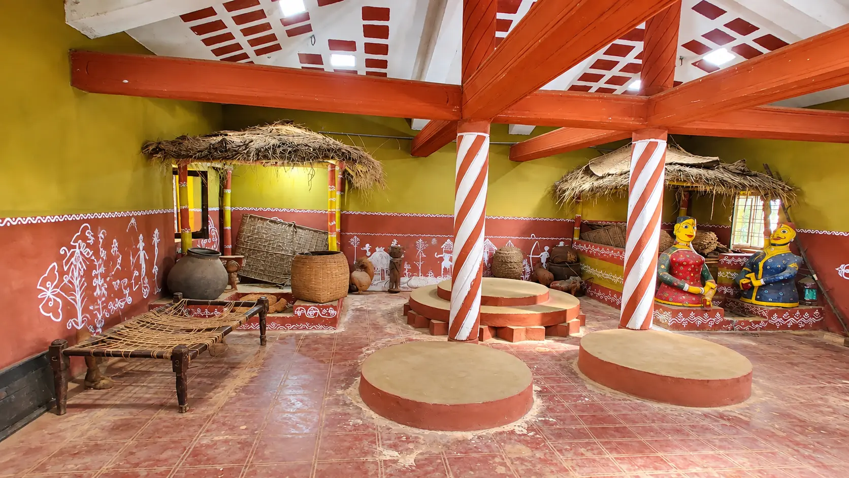
- Araku Tribal Museum & Padmapuram Gardens (18 km northwest): Located in central Araku town, featuring authentic mud-and-thatch tribal hamlets, live Dhimsa chain dances, and hanging tree-top cottages.
In pictures
The practical bits
Before you go.
Plan ahead
Make the most of your stop at Galikonda View Point by incorporating these four practical planning blocks:Explore detailsClose details
Make the most of your stop at Galikonda View Point by incorporating these four practical planning blocks:
Coordinating Your Highway Travel Schedule
Because Galikonda View Point lies directly on the route between Visakhapatnam and Araku, it is best visited as a…Explore detailsClose details
Because Galikonda View Point lies directly on the route between Visakhapatnam and Araku, it is best visited as a scenic transit pause rather than a standalone excursion. If driving up from Visakhapatnam in the morning, schedule your departure around 05:30 AM to reach Galikonda between 07:30 and 08:00 AM, capturing the morning mist and cloud beds before proceeding into Araku town for brunch. Alternatively, on your return drive, plan a sunset pause around 05:00 PM.
Dressing for High-Altitude Wind Chill
At 1,317 metres elevation, the ambient temperature at Galikonda is typically 6°C to 10°C colder than the coastal…Explore detailsClose details
At 1,317 metres elevation, the ambient temperature at Galikonda is typically 6°C to 10°C colder than the coastal plains of Visakhapatnam, and the relentless mountain wind magnifies the chill. Even on sunny days, pack a light windbreaker, fleece jacket, or wool shawl, especially if visiting during the early morning or evening hours between November and February.
Photography and Exposure Optimization
The vast dynamic range between bright sky and deep valley shadows can trick camera sensors.Explore detailsClose details
The vast dynamic range between bright sky and deep valley shadows can trick camera sensors. Use high dynamic range (HDR) mode on your smartphone or a polarizing filter on your DSLR to cut atmospheric haze and saturate the lush green hues of the distant ridges. For sunrise and cloud-bed photography, arriving fifteen minutes before official sunrise allows you to capture the pre-dawn alpine glow across the horizon.
Wayside Etiquette and Cash Preparedness
The tribal women and youth operating the fruit and corn stalls rely on visitor patronage for their seasonal…Explore detailsClose details
The tribal women and youth operating the fruit and corn stalls rely on visitor patronage for their seasonal livelihoods. While prices are very modest, digital UPI payments can fail due to patchy cellular data signals along the mountain ridge. Confirm the current charge and what it includes with the operator or service provider. Visitor admission, vehicles, parking, activities and accommodation can have separate charges.
A few things you might wonder
Common questions about visiting Galikonda View Point. Fees, visiting hours and ceremonies are researched details that may change; confirm current arrangements with the operator before travelling.
Where is Galikonda View Point located, and what is its altitude?
What does the name "Galikonda" mean?
Is there an entry fee to visit Galikonda View Point?
What is the "Sea of Clouds" phenomenon at Galikonda?
What snacks and local products can you buy at the viewpoint?
How far is Galikonda View Point from Visakhapatnam and Araku town?
Is the viewpoint suitable for elderly visitors and young children?
Can you visit Galikonda View Point during the monsoon season?
Explore more in Araku Valley
Discover other destinations around this hub
More Hubs in Andhra Pradesh
Continue exploring other travel hubs in this state
Planning a trip to Araku Valley?